TopoQuest Logo
Do you find TopoQuest useful?
Help keep TopoQuest running and adding new maps/features by donating!
Bitcoin:  19c7KJd3qBynnjoSw5npx9KScwjBe4ifkT
Litecoin:  LXs6TkuXGGXo1vDsWCkWVdjQX94eUKd6ui
Home View Maps Find Maps Find Places Resources & Links


Sandy Hook NW, Mississippi Topographic Map

USGS Map Title: Sandy Hook NW, MS
USGS Map MRC: 31089B8
DRG (GeoTIFF) Download: o31089b8.tif


Neighboring USGS Topographic Map Quads:


  Darbun, MS  
31090C1
 

  Morgantown, MS  
31089C8
 

  Columbia North, MS  
31089C7
 

  Kokomo, MS  
31090B1
 

  Sandy Hook NW, MS  
31089B8
 

  Columbia South, MS  
31089B7
 

  Tylertown SE, MS  
31090A1
 

  Dexter, MS  
31089A8
 

  Sandy Hook, MS  
31089A7


Map MRC Location:

N32°
W90°
N32°
W89°
H8 H7 H6 H5 H4 H3 H2 H1
G8 G7 G6 G5 G4 G3 G2 G1
F8 F7 F6 F5 F4 F3 F2 F1
E8 E7 E6 E5 E4 E3 E2 E1
D8 D7 D6 D5 D4 D3 D2 D1
C8 C7 C6 C5 C4 C3 C2 C1
B8 B7 B6 B5 B4 B3 B2 B1
A8 A7 A6 A5 A4 A3 A2 A1
N31°
W90°
N31°
W89°

Sandy Hook NW, MS USGS 1:24K Topographic Map Preview:
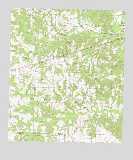
Sandy Hook NW, MS USGS Topographic Map
Click on map above to begin viewing in our Map Viewer.

This topographic map contains these locations and features:
Feature Name Type Latitude Longitude GNIS ID View Map
Antioch Baptist ChurchChurchN31.2349°W89.9226°2596813View Map
Attam MinistriesChurchN31.2078°W89.9162°2596704View Map
Browns LandingAirportN31.1981°W89.9529°2676405View Map
Christian Hill ChurchChurchN31.2273°W89.8966°2596403View Map
Foxworth CemeteryCemeteryN31.2279°W89.8881°670152View Map
Foxworth Census Designated PlaceCensusN31.2386°W89.8828°2586593View Map
Grace Point Worship CenterChurchN31.2312°W89.9060°2596705View Map
HamagePopulated PlaceN31.2257°W89.9442°691915View Map
Indian CreekStreamN31.2177°W89.9618°671682View Map
Knoxo Oil FieldOilfieldN31.1474°W89.9723°689681View Map
Little Rock CemeteryCemeteryN31.2493°W89.9640°710556View Map
Little Rock ChurchChurchN31.2491°W89.9654°672661View Map
Lott Memorial CemeteryCemeteryN31.1593°W89.8967°672890View Map
Mays Creek ChurchChurchN31.1771°W89.9248°673281View Map
New HopePopulated PlaceN31.1577°W89.9134°710562View Map
New Hope ChurchChurchN31.1535°W89.9112°674678View Map
New Jerusalem Church of GodChurchN31.2447°W89.9763°2596532View Map
Pine Grove School (historical)SchoolN31.2488°W89.9640°710568View Map
Pleasant Hill CemeteryCemeteryN31.2193°W89.8923°710570View Map
Pleasant Hill ChurchChurchN31.2196°W89.8926°676058View Map
Pleasant Valley ChurchChurchN31.2280°W89.8792°676134View Map
Prisk Poultry FarmsLocaleN31.1936°W89.9667°2664466View Map
Richland CreekStreamN31.2302°W89.9190°676642View Map
Shady Grove ChurchChurchN31.1760°W89.9367°677555View Map
Shiloh Baptist ChurchChurchN31.1624°W89.9679°677677View Map
Southwest Marion Fire Department FoxworthBuildingN31.1515°W89.9107°2667741View Map
SumbaxPopulated PlaceN31.2355°W89.9231°692249View Map
Terrys ChapelChurchN31.2471°W89.8779°678652View Map
Turnage ChapelChurchN31.1432°W89.9465°678966View Map
Turnage Chapel CemeteryCemeteryN31.1432°W89.9484°710577View Map
West Marion High SchoolSchoolN31.2366°W89.8767°711677View Map

Note: Coordinates in the location and feature list above are referenced to NAD83 datum.


Copyright (C) 2008-2025 Ryan Niemi / Sunset Dynamics ... All Rights Reserved