TopoQuest Logo
Do you find TopoQuest useful?
Help keep TopoQuest running and adding new maps/features by donating!
Bitcoin:  19c7KJd3qBynnjoSw5npx9KScwjBe4ifkT
Litecoin:  LXs6TkuXGGXo1vDsWCkWVdjQX94eUKd6ui
Home View Maps Find Maps Find Places Resources & Links


Jayess, Mississippi Topographic Map

USGS Map Title: Jayess, MS
USGS Map MRC: 31090C2
DRG (GeoTIFF) Download: o31090c2.tif


Neighboring USGS Topographic Map Quads:


  Ruth, MS  
31090D3
 

  Topeka, MS  
31090D2
 

  Tilton, MS  
31090D1
 

  Pricedale, MS  
31090C3
 

  Jayess, MS  
31090C2
 

  Darbun, MS  
31090C1
 

  Holmesville, MS  
31090B3
 

  Mesa, MS  
31090B2
 

  Kokomo, MS  
31090B1


Map MRC Location:

N32°
W91°
N32°
W90°
H8 H7 H6 H5 H4 H3 H2 H1
G8 G7 G6 G5 G4 G3 G2 G1
F8 F7 F6 F5 F4 F3 F2 F1
E8 E7 E6 E5 E4 E3 E2 E1
D8 D7 D6 D5 D4 D3 D2 D1
C8 C7 C6 C5 C4 C3 C2 C1
B8 B7 B6 B5 B4 B3 B2 B1
A8 A7 A6 A5 A4 A3 A2 A1
N31°
W91°
N31°
W90°

Jayess, MS USGS 1:24K Topographic Map Preview:
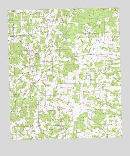
Jayess, MS USGS Topographic Map
Click on map above to begin viewing in our Map Viewer.

This topographic map contains these locations and features:
Feature Name Type Latitude Longitude GNIS ID View Map
Bethel ChurchChurchN31.2930°W90.1987°666899View Map
Carters Precinct (historical)LocaleN31.3113°W90.1715°687114View Map
East Sunny Hill ChurchChurchN31.2582°W90.1676°669612View Map
EnonPopulated PlaceN31.3038°W90.2231°669783View Map
Enon Baptist ChurchChurchN31.3049°W90.2204°687120View Map
Enon CemeteryCemeteryN31.2999°W90.2237°669784View Map
Enon Fire DepartmentBuildingN31.3035°W90.2224°2667945View Map
Galilee ChurchChurchN31.3363°W90.2273°670289View Map
Garner CemeteryCemeteryN31.3338°W90.2281°670322View Map
Greer CemeteryCemeteryN31.3493°W90.2254°670730View Map
Hope HillSummitN31.3685°W90.2354°687139View Map
Hope SchoolSchoolN31.3035°W90.1470°671400View Map
JayessPopulated PlaceN31.3649°W90.2059°671818View Map
Jayess Baptist ChurchChurchN31.3624°W90.2054°687140View Map
Jayess Post OfficePost OfficeN31.3638°W90.1974°2768604View Map
New Bethel CemeteryCemeteryN31.2938°W90.2104°709252View Map
New Bethel Jesus Name ChurchChurchN31.2929°W90.2099°709253View Map
New Bethel SchoolSchoolN31.2927°W90.2109°674593View Map
New Home ChurchChurchN31.3027°W90.1493°674646View Map
New Hope ChurchChurchN31.3660°W90.2451°674680View Map
Supervisor District 4CivilN31.2633°W90.1287°712118View Map
VernaPopulated PlaceN31.3732°W90.2426°692292View Map
West Holy Hill ChurchChurchN31.3296°W90.1737°679502View Map
West Sunny Hill Missionary Baptist ChurchChurchN31.2513°W90.2034°679529View Map

Note: Coordinates in the location and feature list above are referenced to NAD83 datum.


Copyright (C) 2008-2025 Ryan Niemi / Sunset Dynamics ... All Rights Reserved