TopoQuest Logo
Do you find TopoQuest useful?
Help keep TopoQuest running and adding new maps/features by donating!
Bitcoin:  19c7KJd3qBynnjoSw5npx9KScwjBe4ifkT
Litecoin:  LXs6TkuXGGXo1vDsWCkWVdjQX94eUKd6ui
Home View Maps Find Maps Find Places Resources & Links


Mesa, Mississippi Topographic Map

USGS Map Title: Mesa, MS
USGS Map MRC: 31090B2
DRG (GeoTIFF) Download: o31090b2.tif


Neighboring USGS Topographic Map Quads:


  Pricedale, MS  
31090C3
 

  Jayess, MS  
31090C2
 

  Darbun, MS  
31090C1
 

  Holmesville, MS  
31090B3
 

  Mesa, MS  
31090B2
 

  Kokomo, MS  
31090B1
 

  Progress, MS  
31090A3
 

  Tylertown, MS  
31090A2
 

  Tylertown SE, MS  
31090A1


Map MRC Location:

N32°
W91°
N32°
W90°
H8 H7 H6 H5 H4 H3 H2 H1
G8 G7 G6 G5 G4 G3 G2 G1
F8 F7 F6 F5 F4 F3 F2 F1
E8 E7 E6 E5 E4 E3 E2 E1
D8 D7 D6 D5 D4 D3 D2 D1
C8 C7 C6 C5 C4 C3 C2 C1
B8 B7 B6 B5 B4 B3 B2 B1
A8 A7 A6 A5 A4 A3 A2 A1
N31°
W91°
N31°
W90°

Mesa, MS USGS 1:24K Topographic Map Preview:
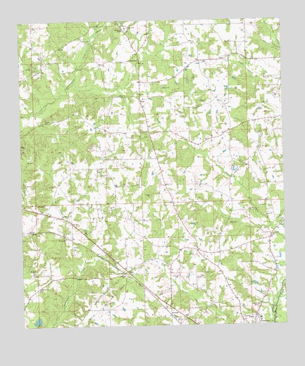
Mesa, MS USGS Topographic Map
Click on map above to begin viewing in our Map Viewer.

This topographic map contains these locations and features:
Feature Name Type Latitude Longitude GNIS ID View Map
Bridges CemeteryCemeteryN31.2091°W90.2384°667566View Map
Charlie Duncan CemeteryCemeteryN31.2338°W90.1543°709237View Map
DinanPopulated PlaceN31.2174°W90.1926°691815View Map
Dinan Baptist ChurchChurchN31.2183°W90.1912°687118View Map
Duncan CemeteryCemeteryN31.2349°W90.1937°669503View Map
Elisha Thornhill CemeteryCemeteryN31.1574°W90.1804°709244View Map
Foil CemeteryCemeteryN31.2143°W90.1826°709245View Map
Holmes CemeteryCemeteryN31.1785°W90.1887°671346View Map
Isaac Duncan CemeteryCemeteryN31.2349°W90.1520°709247View Map
KiotoPopulated PlaceN31.1641°W90.2456°691983View Map
MesaPopulated PlaceN31.1474°W90.2004°673501View Map
Mesa Baptist ChurchChurchN31.1456°W90.2018°673502View Map
Mesa Mount Olive Baptist ChurchChurchN31.1607°W90.2295°674121View Map
New Bethel ChurchChurchN31.1699°W90.2315°674572View Map
Oak Grove ChurchChurchN31.1874°W90.2087°675020View Map
Oak Grove Volunteer Fire DepartmentBuildingN31.1823°W90.2305°2667876View Map
Obed Magee CemeteryCemeteryN31.1574°W90.2251°709255View Map
Paul Pittman Memorial AirportAirportN31.1434°W90.1668°680309View Map
Roy Atchinson Lake DamDamN31.1252°W90.2418°680583View Map
RushingPopulated PlaceN31.1307°W90.1770°676959View Map
Rushing CemeteryCemeteryN31.1452°W90.1762°676961View Map
Saint Paul Missionary Baptist ChurchChurchN31.1730°W90.2074°677182View Map
Supervisor District 5CivilN31.2388°W90.2037°712119View Map
Tylertown Primary SchoolSchoolN31.1260°W90.1369°2132762View Map
Union Baptist ChurchChurchN31.1618°W90.1308°679046View Map
Union CemeteryCemeteryN31.1616°W90.1304°709267View Map
West Mount Olive Missionary Baptist ChurchChurchN31.1757°W90.2486°679513View Map
WTYL-AM (Tylertown)TowerN31.1307°W90.1370°680070View Map
WTYL-FM (Tylertown)TowerN31.1307°W90.1370°680182View Map

Note: Coordinates in the location and feature list above are referenced to NAD83 datum.


Copyright (C) 2008-2024 Ryan Niemi / Sunset Dynamics ... All Rights Reserved