TopoQuest Logo
Do you find TopoQuest useful?
Help keep TopoQuest running and adding new maps/features by donating!
Bitcoin:  19c7KJd3qBynnjoSw5npx9KScwjBe4ifkT
Litecoin:  LXs6TkuXGGXo1vDsWCkWVdjQX94eUKd6ui
Home View Maps Find Maps Find Places Resources & Links


Berryman, Missouri Topographic Map

USGS Map Title: Berryman, MO
USGS Map MRC: 37091H1
DRG (GeoTIFF) Download: o37091h1.tif


Neighboring USGS Topographic Map Quads:


  Onondaga Cave, MO  
38091A2
 

  Anthonies Mill, MO  
38091A1
 

  Ebo, MO  
38090A8
 

  Huzzah, MO  
37091H2
 

  Berryman, MO  
37091H1
 

  Shirley, MO  
37090H8
 

  Davisville, MO  
37091G2
 

  Courtois, MO  
37091G1
 

  Palmer, MO  
37090G8


Map MRC Location:

N38°
W92°
N38°
W91°
H8 H7 H6 H5 H4 H3 H2 H1
G8 G7 G6 G5 G4 G3 G2 G1
F8 F7 F6 F5 F4 F3 F2 F1
E8 E7 E6 E5 E4 E3 E2 E1
D8 D7 D6 D5 D4 D3 D2 D1
C8 C7 C6 C5 C4 C3 C2 C1
B8 B7 B6 B5 B4 B3 B2 B1
A8 A7 A6 A5 A4 A3 A2 A1
N37°
W92°
N37°
W91°

Berryman, MO USGS 1:24K Topographic Map Preview:
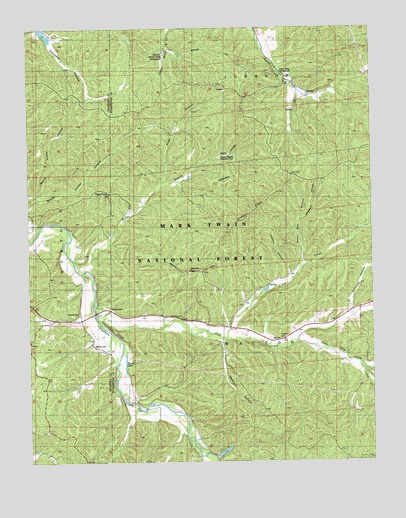
Berryman, MO USGS Topographic Map
Click on map above to begin viewing in our Map Viewer.

This topographic map contains these locations and features:
Feature Name Type Latitude Longitude GNIS ID View Map
Bass Ranch (historical)LocaleN37.9703°W91.0710°753392View Map
BerrymanPopulated PlaceN37.9188°W91.0964°748796View Map
Berryman CampgroundLocaleN37.9303°W91.0632°754213View Map
Berryman School (historical)SchoolN37.9275°W91.1065°753391View Map
Berryman TrailTrailN37.9309°W91.0712°748798View Map
Billys BranchStreamN37.9334°W91.1090°748864View Map
Brazil Creek CampgroundLocaleN37.9870°W91.0324°754214View Map
C D Smiths SawmillLocaleN37.8989°W91.0274°736754View Map
Cedar RidgeRidgeN37.9128°W91.0937°749310View Map
Clear CreekStreamN37.9103°W91.0540°749379View Map
Coffman HollowValleyN37.9192°W91.0079°749402View Map
Courtois CemeteryCemeteryN37.9184°W91.1068°749498View Map
Courtois Church (historical)ChurchN37.9178°W91.1090°753390View Map
Cresswell CemeteryCemeteryN37.9106°W91.0340°749520View Map
Dans BranchStreamN37.9437°W91.1129°736550View Map
Davis SawmillLocaleN37.9506°W91.0337°736753View Map
Dobkins CemeteryCemeteryN37.9092°W91.1021°749670View Map
Edward Beecher Recreation AreaLocaleN37.9637°W91.0521°754217View Map
Flagg BranchStreamN37.9559°W91.0749°749931View Map
Four PointsPopulated PlaceN37.9528°W91.0957°749964View Map
Harmon Spring CampgroundLocaleN37.9920°W91.0754°754218View Map
Harveys Sawmill (historical)LocaleN37.9189°W91.0076°736752View Map
Henpeck Hollow DamDamN37.9817°W91.0935°765058View Map
Johns CreekStreamN37.9035°W91.0048°750521View Map
Kemlin HollowValleyN37.9289°W91.0301°750585View Map
Levey School (historical)LocaleN37.9195°W91.0046°753389View Map
Little Lost CreekStreamN37.9095°W91.0279°750782View Map
Lost CreekStreamN37.9173°W91.1011°750865View Map
Machell HollowValleyN37.9098°W91.0551°750901View Map
Matthews Lead MineMineN37.9339°W91.1057°736549View Map
Oak Grove ChurchChurchN37.9170°W91.0696°754042View Map
Picayune Lead DiggingsMineN37.8770°W91.0215°736751View Map
Pine Forest School (historical)SchoolN37.9028°W91.0690°736755View Map
Shirley RidgeRidgeN37.9470°W91.0440°752130View Map
Smith Mill HollowValleyN37.9328°W91.0257°752221View Map
Thunder Valley Farm DamDamN37.9984°W91.1201°764417View Map
Thunder Valley Farm LakeReservoirN37.9985°W91.1188°764418View Map
Timberlane LakeReservoirN37.8780°W91.0544°758407View Map
Timberlane Lake DamDamN37.8784°W91.0585°763883View Map
Usury Lead MineMineN37.9237°W91.1101°736548View Map
Wheelings Lead Mines and FurnaceMineN37.9195°W91.0971°736547View Map
Whitby-Ellis CemeteryCemeteryN37.9164°W91.0696°1759791View Map
Woods LakeLakeN37.9039°W91.0902°752976View Map

Note: Coordinates in the location and feature list above are referenced to NAD83 datum.


Copyright (C) 2008-2025 Ryan Niemi / Sunset Dynamics ... All Rights Reserved