TopoQuest Logo
Do you find TopoQuest useful?
Help keep TopoQuest running and adding new maps/features by donating!
Bitcoin:  19c7KJd3qBynnjoSw5npx9KScwjBe4ifkT
Litecoin:  LXs6TkuXGGXo1vDsWCkWVdjQX94eUKd6ui
Home View Maps Find Maps Find Places Resources & Links


Dodson Butte, Oregon Topographic Map

USGS Map Title: Dodson Butte, OR
USGS Map MRC: 43123A2
DRG (GeoTIFF) Download: o43123a2.tif


Neighboring USGS Topographic Map Quads:


  Roseburg East, OR  
43123B3
 

  Dixonville, OR  
43123B2
 

  Lane Mountain, OR  
43123B1
 

  Myrtle Creek, OR  
43123A3
 

  Dodson Butte, OR  
43123A2
 

  White Rock, OR  
43123A1
 

  Canyonville, OR  
42123H3
 

  Days Creek, OR  
42123H2
 

  Milo, OR  
42123H1


Map MRC Location:

N44°
W124°
N44°
W123°
H8 H7 H6 H5 H4 H3 H2 H1
G8 G7 G6 G5 G4 G3 G2 G1
F8 F7 F6 F5 F4 F3 F2 F1
E8 E7 E6 E5 E4 E3 E2 E1
D8 D7 D6 D5 D4 D3 D2 D1
C8 C7 C6 C5 C4 C3 C2 C1
B8 B7 B6 B5 B4 B3 B2 B1
A8 A7 A6 A5 A4 A3 A2 A1
N43°
W124°
N43°
W123°

Dodson Butte, OR USGS 1:24K Topographic Map Preview:
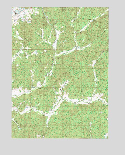
Dodson Butte, OR USGS Topographic Map
Click on map above to begin viewing in our Map Viewer.

This topographic map contains these locations and features:
Feature Name Type Latitude Longitude GNIS ID View Map
Ben BranchStreamN43.0354°W123.1595°1117506View Map
Big LickStreamN43.0604°W123.2034°1117641View Map
Bryant CemeteryCemeteryN43.0379°W123.1750°1156896View Map
Buck Fork (historical)Populated PlaceN43.1123°W123.1470°1132887View Map
Buckfork Post Office (historical)Post OfficeN43.1123°W123.1470°1164240View Map
Carson CreekStreamN43.0304°W123.2248°1132892View Map
Cavitt FallsFallsN43.0207°W123.2040°1155250View Map
Cedar Grove ChurchChurchN43.0740°W123.1970°1158161View Map
Cox GulchValleyN43.1207°W123.1290°1132886View Map
Dodson ButteSummitN43.1187°W123.2440°1119993View Map
Eleanor ReservoirReservoirN43.0818°W123.2199°1132889View Map
Fisher GulchValleyN43.1123°W123.1456°1155210View Map
Frozen CreekStreamN43.1248°W123.2012°1121011View Map
Frozen Creek MineMineN43.1148°W123.2076°1135709View Map
Hamline CreekStreamN43.1137°W123.1428°1132884View Map
Heath CreekStreamN43.0582°W123.1428°1155212View Map
Lee CreekStreamN43.1001°W123.1690°1123018View Map
Left Fork Frozen CreekStreamN43.0860°W123.1970°1132888View Map
Lehnherr ParkParkN43.0660°W123.1451°2058295View Map
Little LickStreamN43.0460°W123.2228°1123224View Map
Louis CreekStreamN43.0346°W123.1501°1145574View Map
Myrtle Creek-Riddle DivisionCivilN43.0212°W123.2490°1938069View Map
North Myrtle ParkParkN43.0760°W123.1934°1124830View Map
Riser CreekStreamN43.1046°W123.1312°1148483View Map
Roseburg CreekStreamN43.1110°W123.1498°1132882View Map
Sanderson GulchValleyN43.0318°W123.1928°1132893View Map
School HollowValleyN43.0398°W123.1856°1126651View Map
Slide CreekStreamN43.0846°W123.1692°1149708View Map
Stewart GulchValleyN43.1123°W123.1456°1132883View Map
Stone CreekStreamN43.0651°W123.1442°1132891View Map
Weaver CreekStreamN43.1165°W123.1373°1132885View Map

Note: Coordinates in the location and feature list above are referenced to NAD83 datum.


Copyright (C) 2008-2025 Ryan Niemi / Sunset Dynamics ... All Rights Reserved