TopoQuest Logo
Do you find TopoQuest useful?
Help keep TopoQuest running and adding new maps/features by donating!
Bitcoin:  19c7KJd3qBynnjoSw5npx9KScwjBe4ifkT
Litecoin:  LXs6TkuXGGXo1vDsWCkWVdjQX94eUKd6ui
Home View Maps Find Maps Find Places Resources & Links


Canyonville, Oregon Topographic Map

USGS Map Title: Canyonville, OR
USGS Map MRC: 42123H3
DRG (GeoTIFF) Download: o42123h3.tif


Neighboring USGS Topographic Map Quads:


  Winston, OR  
43123A4
 

  Myrtle Creek, OR  
43123A3
 

  Dodson Butte, OR  
43123A2
 

  Nickel Mountain, OR  
42123H4
 

  Canyonville, OR  
42123H3
 

  Days Creek, OR  
42123H2
 

  McCullough Creek, OR  
42123G4
 

  Quines Creek, OR  
42123G3
 

  Starvout Creek, OR  
42123G2


Map MRC Location:

N43°
W124°
N43°
W123°
H8 H7 H6 H5 H4 H3 H2 H1
G8 G7 G6 G5 G4 G3 G2 G1
F8 F7 F6 F5 F4 F3 F2 F1
E8 E7 E6 E5 E4 E3 E2 E1
D8 D7 D6 D5 D4 D3 D2 D1
C8 C7 C6 C5 C4 C3 C2 C1
B8 B7 B6 B5 B4 B3 B2 B1
A8 A7 A6 A5 A4 A3 A2 A1
N42°
W124°
N42°
W123°

Canyonville, OR USGS 1:24K Topographic Map Preview:
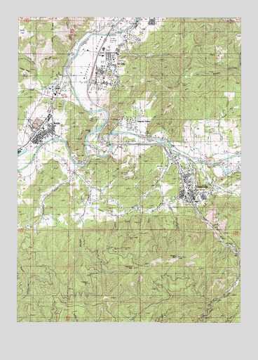
Canyonville, OR USGS Topographic Map
Click on map above to begin viewing in our Map Viewer.

This topographic map contains these locations and features:
Feature Name Type Latitude Longitude GNIS ID View Map
Alder CreekStreamN42.9318°W123.2970°1116811View Map
Baker FlatFlatN42.9935°W123.3723°1117156View Map
Canyon CreekStreamN42.9423°W123.2809°1118579View Map
Canyon MountainSummitN42.9018°W123.2865°1118583View Map
CanyonvillePopulated PlaceN42.9273°W123.2812°1118589View Map
Canyonville - South Umpqua Fire DepartmentBuildingN42.9319°W123.2815°2576496View Map
Canyonville Branch LibraryBuildingN42.9300°W123.2815°2661415View Map
Canyonville CemeteryCemeteryN42.9365°W123.2817°1157162View Map
Canyonville Christian AcademySchoolN42.9288°W123.2784°2417811View Map
Canyonville City HallBuildingN42.9300°W123.2815°2661414View Map
Canyonville County ParkParkN42.9401°W123.2651°1157164View Map
Canyonville County Park Boat RampLocaleN42.9408°W123.2619°2668595View Map
Canyonville Justice CourtBuildingN42.9301°W123.2804°2661253View Map
Canyonville Municipal CourtBuildingN42.9302°W123.2804°2661254View Map
Canyonville Post OfficePost OfficeN42.9276°W123.2782°1165010View Map
Canyonville Public WorksBuildingN42.9300°W123.2815°2661542View Map
Canyonville SchoolSchoolN42.9281°W123.2804°2417812View Map
Canyonville Wastewater Treatment PlantLocaleN42.9416°W123.2808°2660681View Map
Canyonville Water Treatment PlantLocaleN42.9252°W123.2752°2660784View Map
Chadwick CanyonValleyN42.9904°W123.3426°1118795View Map
Charles V Stanton ParkParkN42.9471°W123.2928°1157157View Map
City of CanyonvilleCivilN42.9274°W123.2781°2409980View Map
City of RiddleCivilN42.9542°W123.3645°2410943View Map
Comer BrookStreamN42.9304°W123.2790°1132254View Map
Copper CreekStreamN42.9054°W123.3401°1132255View Map
Corder Log PondReservoirN42.9720°W123.3553°1131425View Map
Corder Log Pond DikeDamN42.9715°W123.3528°1131424View Map
Cow CreekStreamN42.9471°W123.3378°1140278View Map
Cow Creek Gaming Center Wastewater Treatment PlantLocaleN42.9393°W123.2826°2660728View Map
Cow Creek ReservationCivilN42.9374°W123.3079°2418898View Map
Department of Motor Vehicles CanyonvilleBuildingN42.9300°W123.2800°2697255View Map
Douglas County Sheriff's Office Riddle SubstationBuildingN42.9521°W123.3571°2737846View Map
Douglas Forest Protective Association South UnitBuildingN42.9492°W123.3140°2577068View Map
Fords BridgeBridgeN42.9482°W123.3242°1638138View Map
Gold Bluff MineMineN42.9043°W123.3178°1121190View Map
Herbert Log PondReservoirN42.9372°W123.2584°1157152View Map
Herberts Pond ParkParkN42.9373°W123.2581°1157163View Map
Hiles ReservoirReservoirN42.9165°W123.3620°1157153View Map
Hillman ReservoirReservoirN42.9549°W123.2689°1157151View Map
Hilp CreekStreamN42.9846°W123.3442°1132257View Map
Huckleberry MineMineN42.8910°W123.3365°1122099View Map
Johnson DR Lumber Cogen Natural GasLocaleN42.9591°W123.3589°2697263View Map
Jordan CreekStreamN42.9446°W123.2898°1122523View Map
Judd CreekStreamN42.9707°W123.3603°1122547View Map
Keystone Log PondReservoirN42.9512°W123.3087°1157150View Map
KROR-AMTowerN42.9823°W123.3184°1131237View Map
Lane CreekStreamN42.9726°W123.3448°1122940View Map
Lawson BarBarN42.9526°W123.3359°1157165View Map
Levens Ledge MineMineN42.9101°W123.3126°1123052View Map
Missouri BottomFlatN42.9960°W123.3212°1161445View Map
Mitchell CreekStreamN42.9362°W123.3428°1124265View Map
Mount RamblerSummitN42.9830°W123.3574°1136671View Map
Myrtle Creek Municipal AirportAirportN42.9983°W123.3164°1131728View Map
O'Shea CreekStreamN42.9401°W123.2734°1124894View Map
Open Bible Christian CenterChurchN42.9558°W123.3592°2508126View Map
Pearson Log PondReservoirN42.9599°W123.2611°1157149View Map
Pine SpringSpringN42.9758°W123.3741°1157156View Map
Pioneer CemeteryCemeteryN42.9259°W123.2817°1157158View Map
Red RidgeRidgeN42.9965°W123.3556°1125896View Map
RiddlePopulated PlaceN42.9510°W123.3642°1166702View Map
Riddle Branch LibraryBuildingN42.9522°W123.3573°2661181View Map
Riddle City HallBuildingN42.9520°W123.3570°2661619View Map
Riddle Elementary SchoolSchoolN42.9542°W123.3618°2417825View Map
Riddle First Church of GodChurchN42.9528°W123.3614°2508125View Map
Riddle High SchoolSchoolN42.9494°W123.3632°2417826View Map
Riddle Post OfficePost OfficeN42.9509°W123.3664°1165856View Map
Riddle Public WorksBuildingN42.9512°W123.3561°2661527View Map
Riddle Volunteer Fire DepartmentBuildingN42.9502°W123.3665°2576624View Map
Riddle Wastewater Treatment PlantLocaleN42.9509°W123.3566°2660661View Map
Riddle Water Treatment PlantLocaleN42.9512°W123.3561°2660811View Map
Rock Canyon CreekStreamN42.9943°W123.3317°1133018View Map
Scott PondReservoirN42.9569°W123.3179°1157154View Map
Seventh Day Adventist ChurchChurchN42.9319°W123.2847°2508115View Map
Shoestring CreekStreamN42.9393°W123.3426°1126902View Map
Small CreekStreamN42.9429°W123.2609°1132251View Map
South Umpqua High SchoolSchoolN42.9869°W123.3283°2417827View Map
South Umpqua Historical Society Pioneer - Indian MuseumBuildingN42.9236°W123.2794°2661561View Map
Surprise ValleyPopulated PlaceN42.9540°W123.3095°1132252View Map
Sweetbriar MineMineN42.8960°W123.3259°1127835View Map
Tellurium PeakSummitN42.8977°W123.3112°1127921View Map
Tri - City Rural Fire DepartmentBuildingN42.9865°W123.3202°2576567View Map
Tri CityPopulated PlaceN42.9807°W123.3231°1128221View Map
Tri City Elementary SchoolSchoolN42.9840°W123.3285°2417829View Map
Tri-CityPopulated PlaceN42.9846°W123.3117°1867482View Map
Tri-City Census Designated PlaceCensusN42.9893°W123.3000°2409349View Map
Veatch CreekStreamN42.9221°W123.3373°1132253View Map
West Fork Canyon CreekStreamN42.8985°W123.2503°1128840View Map
William D Bradley CemeteryCemeteryN42.9493°W123.3124°1157155View Map
Yokum BridgeBridgeN42.9429°W123.3365°1638137View Map

Note: Coordinates in the location and feature list above are referenced to NAD83 datum.


Copyright (C) 2008-2024 Ryan Niemi / Sunset Dynamics ... All Rights Reserved