TopoQuest Logo
Do you find TopoQuest useful?
Help keep TopoQuest running and adding new maps/features by donating!
Bitcoin:  19c7KJd3qBynnjoSw5npx9KScwjBe4ifkT
Litecoin:  LXs6TkuXGGXo1vDsWCkWVdjQX94eUKd6ui
Home View Maps Find Maps Find Places Resources & Links


Dayton, Pennsylvania Topographic Map

USGS Map Title: Dayton, PA
USGS Map MRC: 40079H2
DRG (GeoTIFF) Download: o40079h2.tif


Neighboring USGS Topographic Map Quads:


  New Bethlehem, PA  
41079A3
 

  Summerville, PA  
41079A2
 

  Coolspring, PA  
41079A1
 

  Distant, PA  
40079H3
 

  Dayton, PA  
40079H2
 

  Valier, PA  
40079H1
 

  Rural Valley, PA  
40079G3
 

  Plumville, PA  
40079G2
 

  Marion Center, PA  
40079G1


Map MRC Location:

N41°
W80°
N41°
W79°
H8 H7 H6 H5 H4 H3 H2 H1
G8 G7 G6 G5 G4 G3 G2 G1
F8 F7 F6 F5 F4 F3 F2 F1
E8 E7 E6 E5 E4 E3 E2 E1
D8 D7 D6 D5 D4 D3 D2 D1
C8 C7 C6 C5 C4 C3 C2 C1
B8 B7 B6 B5 B4 B3 B2 B1
A8 A7 A6 A5 A4 A3 A2 A1
N40°
W80°
N40°
W79°

Dayton, PA USGS 1:24K Topographic Map Preview:
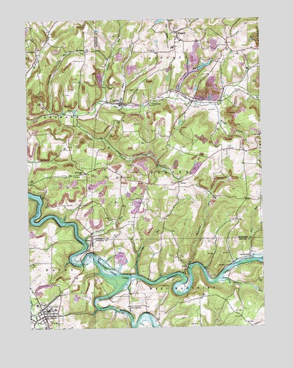
Dayton, PA USGS Topographic Map
Click on map above to begin viewing in our Map Viewer.

This topographic map contains these locations and features:
Feature Name Type Latitude Longitude GNIS ID View Map
Borough of DaytonCivilN40.8812°W79.2411°1214847View Map
Borough of TimblinCivilN40.9673°W79.1991°1215305View Map
Carr RunStreamN40.8945°W79.1486°1171255View Map
Caylor RunStreamN40.9681°W79.1706°1171355View Map
Copenhaver Crossroads CemeteryCemeteryN40.9379°W79.2206°2775894View Map
CorbettownPopulated PlaceN40.9670°W79.1820°1203336View Map
DaytonPopulated PlaceN40.8803°W79.2420°1173006View Map
Dayton District Volunteer Fire Company Station 30BuildingN40.8786°W79.2431°2645656View Map
Dayton Elementary SchoolSchoolN40.8823°W79.2364°1211752View Map
Dayton High SchoolSchoolN40.8823°W79.2398°1205550View Map
Dayton Post OfficePost OfficeN40.8800°W79.2423°2779682View Map
DoraPopulated PlaceN40.9667°W79.1603°1173390View Map
Doverspike Number Two DamDamN40.9801°W79.1598°1195184View Map
Dry Ridge School (historical)SchoolN40.9773°W79.2198°1200794View Map
Eagle RunStreamN40.9648°W79.2000°1173697View Map
Eagle ValleyLocaleN40.9745°W79.1734°1200792View Map
Emory Chapel Memorial ParkCemeteryN40.8885°W79.2372°2775909View Map
Fairview SchoolSchoolN40.9273°W79.1889°1200796View Map
Foundry RunStreamN40.9103°W79.2209°1175046View Map
GoodvilleLocaleN40.8876°W79.1973°1212086View Map
Hamilton RunStreamN40.8995°W79.1631°1176424View Map
Independence (historical)LocaleN40.9017°W79.2231°1202335View Map
Little Mahoning CreekStreamN40.8959°W79.1961°1192806View Map
LoopPopulated PlaceN40.8998°W79.1656°1204061View Map
Mahoning Creek LakeReservoirN40.9178°W79.2288°1180224View Map
Mc GregorPopulated PlaceN40.9381°W79.2203°1209245View Map
Middle Branch Pine RunStreamN40.9651°W79.1492°1181010View Map
MiltonPopulated PlaceN40.9098°W79.2167°1181297View Map
Milton CemeteryCemeteryN40.9086°W79.2176°2775935View Map
Mount TaborPopulated PlaceN40.9876°W79.2175°1204231View Map
Mount Tabor CemeteryCemeteryN40.9865°W79.2172°2775901View Map
New SalemPopulated PlaceN40.9881°W79.2442°1182366View Map
New Salem CemeteryCemeteryN40.9887°W79.2431°2775945View Map
North PointPopulated PlaceN40.9037°W79.1314°1199234View Map
Nye BranchStreamN40.9626°W79.2214°1182719View Map
Painter RunStreamN40.9667°W79.2109°1183206View Map
PorterPopulated PlaceN40.9340°W79.1686°1204439View Map
Reitz SchoolSchoolN40.9859°W79.1381°1200791View Map
RinggoldPopulated PlaceN40.9948°W79.1678°1185092View Map
Ringgold Area Volunteer Fire Company Station 9BuildingN40.9913°W79.1674°2645892View Map
Saint James ChurchChurchN40.9867°W79.1800°1186022View Map
Schrauger School (historical)SchoolN40.9512°W79.1875°1200795View Map
Smicksburg StationLocaleN40.8884°W79.1959°1200797View Map
Steer RunStreamN40.9045°W79.1303°1188592View Map
Sugarcamp RunStreamN40.9620°W79.2370°1209332View Map
Sugarcamp RunStreamN40.8959°W79.1923°1188986View Map
SunrisePopulated PlaceN40.9715°W79.1681°1200793View Map
TimblinPopulated PlaceN40.9665°W79.1981°1189575View Map
Timblin Post OfficePost OfficeN40.9664°W79.1984°2779712View Map
Township of PorterCivilN40.9382°W79.1692°1216569View Map
Township of RinggoldCivilN40.9999°W79.1703°1216570View Map
Travis AirportAirportN40.8837°W79.1925°1209368View Map
Zion ChurchChurchN40.9473°W79.1423°1192008View Map

Note: Coordinates in the location and feature list above are referenced to NAD83 datum.


Copyright (C) 2008-2024 Ryan Niemi / Sunset Dynamics ... All Rights Reserved