TopoQuest Logo
Do you find TopoQuest useful?
Help keep TopoQuest running and adding new maps/features by donating!
Bitcoin:  19c7KJd3qBynnjoSw5npx9KScwjBe4ifkT
Litecoin:  LXs6TkuXGGXo1vDsWCkWVdjQX94eUKd6ui
Home View Maps Find Maps Find Places Resources & Links


New Bethlehem, Pennsylvania Topographic Map

USGS Map Title: New Bethlehem, PA
USGS Map MRC: 41079A3
DRG (GeoTIFF) Download: o41079a3.tif


Neighboring USGS Topographic Map Quads:


  Clarion, PA  
41079B4
 

  Strattanville, PA  
41079B3
 

  Corsica, PA  
41079B2
 

  Sligo, PA  
41079A4
 

  New Bethlehem, PA  
41079A3
 

  Summerville, PA  
41079A2
 

  Templeton, PA  
40079H4
 

  Distant, PA  
40079H3
 

  Dayton, PA  
40079H2


Map MRC Location:

N42°
W80°
N42°
W79°
H8 H7 H6 H5 H4 H3 H2 H1
G8 G7 G6 G5 G4 G3 G2 G1
F8 F7 F6 F5 F4 F3 F2 F1
E8 E7 E6 E5 E4 E3 E2 E1
D8 D7 D6 D5 D4 D3 D2 D1
C8 C7 C6 C5 C4 C3 C2 C1
B8 B7 B6 B5 B4 B3 B2 B1
A8 A7 A6 A5 A4 A3 A2 A1
N41°
W80°
N41°
W79°

New Bethlehem, PA USGS 1:24K Topographic Map Preview:
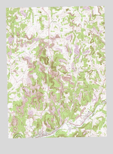
New Bethlehem, PA USGS Topographic Map
Click on map above to begin viewing in our Map Viewer.

This topographic map contains these locations and features:
Feature Name Type Latitude Longitude GNIS ID View Map
AlcolaPopulated PlaceN41.0123°W79.2889°1212168View Map
Borough of HawthornCivilN41.0210°W79.2782°1215085View Map
Borough of New BethlehemCivilN41.0043°W79.3283°1215087View Map
BrinkertonPopulated PlaceN41.0773°W79.3595°1205028View Map
Brinkerton Post Office (historical)Post OfficeN41.0773°W79.3595°1214344View Map
Citizens Water Company DamDamN41.0017°W79.3348°1195195View Map
Cottage HillPopulated PlaceN41.0103°W79.3473°1192301View Map
CratesPopulated PlaceN41.1106°W79.2698°1192309View Map
Emmanuel Evangelical Lutheran CemeteryCemeteryN41.0177°W79.2715°2775910View Map
Fairmont CityPopulated PlaceN41.0081°W79.3131°1192441View Map
Fairmount City Post OfficePost OfficeN41.0072°W79.3144°2772697View Map
Frazier SchoolSchoolN41.0798°W79.2781°1201063View Map
FrogtownPopulated PlaceN41.1109°W79.3162°1192495View Map
HawthornPopulated PlaceN41.0201°W79.2745°1192593View Map
Hawthorn Area Volunteer Fire Department Station 560BuildingN41.0193°W79.2762°2645638View Map
Hawthorn Post OfficePost OfficeN41.0192°W79.2738°2779896View Map
Jack SchoolSchoolN41.0567°W79.3556°1201064View Map
Leatherwood ChurchChurchN41.0623°W79.3534°1192756View Map
Leatherwood ChurchChurchN41.0698°W79.3725°1192757View Map
Leisure RunStreamN41.0009°W79.3273°1202123View Map
Long RunStreamN41.0001°W79.3537°1192844View Map
MayportPopulated PlaceN41.0337°W79.2514°1180582View Map
Mayport Airport (historical)AirportN41.0128°W79.2523°1194156View Map
Mayport Post OfficePost OfficeN41.0343°W79.2555°2779897View Map
Middle RunStreamN41.0106°W79.3073°1192929View Map
MillvillePopulated PlaceN41.0170°W79.3006°1201960View Map
Nevin ChurchChurchN41.1065°W79.3223°1193010View Map
New BethlehemPopulated PlaceN41.0017°W79.3314°1193013View Map
New Bethlehem Fire Company Station 600BuildingN41.0029°W79.3301°2644854View Map
New Bethlehem Police DepartmentBuildingN41.0013°W79.3341°2781043View Map
New Bethlehem Post OfficePost OfficeN41.0019°W79.3299°2779678View Map
New Mayville Post Office (historical)Post OfficeN41.0503°W79.2556°1214203View Map
Oak Hill SchoolSchoolN41.1145°W79.3412°1201066View Map
Oak RidgePopulated PlaceN41.0076°W79.2959°1193058View Map
Oak Ridge Post OfficePost OfficeN41.0095°W79.2964°2777418View Map
Paradise CemeteryCemeteryN41.0843°W79.2576°1193088View Map
Parsons RunStreamN41.1228°W79.3445°1193089View Map
Pine CreekStreamN41.0278°W79.2628°1193126View Map
Saint Nicholas CemeteryCemeteryN41.1083°W79.2671°1193266View Map
Sloan GapGapN41.0953°W79.3317°1193378View Map
Spaces CornersPopulated PlaceN41.0667°W79.3212°1193415View Map
Town RunStreamN41.0137°W79.3009°1193544View Map
Township of RedbankCivilN41.0652°W79.2715°1216217View Map
TruittsburgPopulated PlaceN41.0623°W79.2839°1193558View Map

Note: Coordinates in the location and feature list above are referenced to NAD83 datum.


Copyright (C) 2008-2025 Ryan Niemi / Sunset Dynamics ... All Rights Reserved