TopoQuest Logo
Do you find TopoQuest useful?
Help keep TopoQuest running and adding new maps/features by donating!
Bitcoin:  19c7KJd3qBynnjoSw5npx9KScwjBe4ifkT
Litecoin:  LXs6TkuXGGXo1vDsWCkWVdjQX94eUKd6ui
Home View Maps Find Maps Find Places Resources & Links


Coolspring, Pennsylvania Topographic Map

USGS Map Title: Coolspring, PA
USGS Map MRC: 41079A1
DRG (GeoTIFF) Download: o41079a1.tif


Neighboring USGS Topographic Map Quads:


  Corsica, PA  
41079B2
 

  Brookville, PA  
41079B1
 

  Hazen, PA  
41078B8
 

  Summerville, PA  
41079A2
 

  Coolspring, PA  
41079A1
 

  Reynoldsville, PA  
41078A8
 

  Dayton, PA  
40079H2
 

  Valier, PA  
40079H1
 

  Punxsutawney, PA  
40078H8


Map MRC Location:

N42°
W80°
N42°
W79°
H8 H7 H6 H5 H4 H3 H2 H1
G8 G7 G6 G5 G4 G3 G2 G1
F8 F7 F6 F5 F4 F3 F2 F1
E8 E7 E6 E5 E4 E3 E2 E1
D8 D7 D6 D5 D4 D3 D2 D1
C8 C7 C6 C5 C4 C3 C2 C1
B8 B7 B6 B5 B4 B3 B2 B1
A8 A7 A6 A5 A4 A3 A2 A1
N41°
W80°
N41°
W79°

Coolspring, PA USGS 1:24K Topographic Map Preview:
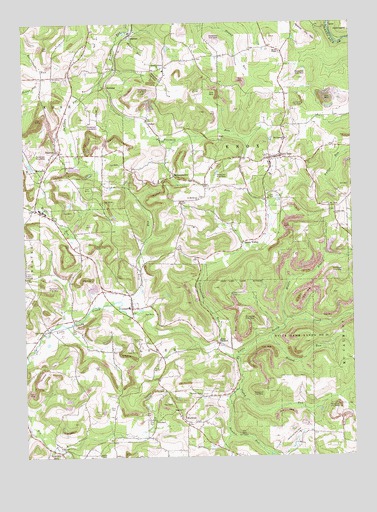
Coolspring, PA USGS Topographic Map
Click on map above to begin viewing in our Map Viewer.

This topographic map contains these locations and features:
Feature Name Type Latitude Longitude GNIS ID View Map
BarnesPopulated PlaceN41.1215°W79.0828°1168735View Map
Barton ChapelChurchN41.0006°W79.0973°1168781View Map
Beech Hollow SchoolSchoolN41.0848°W79.0703°1201052View Map
Burkett Hollow ChurchChurchN41.0176°W79.0573°1170720View Map
Burkett Hollow SchoolSchoolN41.0226°W79.0439°1201049View Map
Center Hill ChurchChurchN41.0698°W79.0064°1171438View Map
Center Hill SchoolSchoolN41.0637°W79.0084°1201112View Map
Cliff ChurchChurchN41.0517°W79.1242°1171997View Map
Clutch RunStreamN41.0281°W79.0445°1172039View Map
ColonPopulated PlaceN41.0959°W79.0764°1203312View Map
CoolspringPopulated PlaceN41.0431°W79.0836°1172400View Map
Coolspring CemeteryCemeteryN41.0339°W79.0845°1172401View Map
CoulterPopulated PlaceN41.0106°W79.0753°1203351View Map
East BranchPopulated PlaceN41.0331°W79.0509°1209134View Map
Green ValleyPopulated PlaceN41.0615°W79.0411°1176123View Map
Hadden RunStreamN41.0195°W79.0439°1176351View Map
Hickok RunStreamN41.0345°W79.0317°1176947View Map
Hunters Grove ChurchChurchN41.1117°W79.0717°1177613View Map
Hunts RunStreamN41.1223°W79.0842°1177633View Map
Indiancamp RunStreamN41.0323°W79.0503°1177799View Map
IowaPopulated PlaceN41.1240°W79.0075°1209130View Map
Knox DalePopulated PlaceN41.0862°W79.0264°1178622View Map
Knox Dale Post OfficePost OfficeN41.0860°W79.0269°2773170View Map
Knox Township Volunteer Fire Department Station 13BuildingN41.0859°W79.0321°2645541View Map
Laurel Ridge School (historical)SchoolN41.0217°W79.0806°1201050View Map
Lick RunStreamN41.0451°W79.0895°1179298View Map
MarktonPopulated PlaceN41.0106°W79.0642°1180430View Map
McAninch SchoolSchoolN41.1142°W79.0617°1201047View Map
McGareyPopulated PlaceN41.0820°W79.1164°1180712View Map
Meade ChapelChurchN41.1165°W79.0259°1180814View Map
Middle Branch Little Sandy CreekStreamN41.0390°W79.0250°1181009View Map
Millen SchoolSchoolN41.0640°W79.1050°1201113View Map
Mount Pleasant ChurchChurchN41.0915°W79.0242°1181822View Map
NormanPopulated PlaceN41.1073°W79.0925°1204295View Map
Oliver Township Volunteer Fire Company Station 5BuildingN41.0129°W79.0658°2645904View Map
Pawner SchoolSchoolN41.1112°W79.0884°1201053View Map
Pine Valley ChurchChurchN41.0367°W79.1161°1183919View Map
Pleasant Hill SchoolSchoolN41.1056°W79.0256°1201048View Map
RamsaytownPopulated PlaceN41.0806°W79.0667°1184629View Map
Saint Johns CemeteryCemeteryN41.1092°W79.1131°1186077View Map
Saint Matthews ChurchChurchN41.0742°W79.0573°1186458View Map
Smathers RunStreamN41.1073°W79.0942°1187843View Map
Smith School (historical)SchoolN41.0326°W79.0923°1201051View Map
Sprankle MillsPopulated PlaceN41.0020°W79.1136°1188202View Map
StantonPopulated PlaceN41.0884°W79.1120°1188397View Map
State Game Lands Number 31ParkN41.0356°W79.0173°1188510View Map
TaitPopulated PlaceN41.0912°W79.0492°1204794View Map
Township of KnoxCivilN41.0947°W79.0342°1216563View Map
Township of OliverCivilN41.0212°W79.0731°1216565View Map
WMKX-FM (Brookville)TowerN41.1237°W79.0589°1200280View Map

Note: Coordinates in the location and feature list above are referenced to NAD83 datum.


Copyright (C) 2008-2025 Ryan Niemi / Sunset Dynamics ... All Rights Reserved