TopoQuest Logo
Do you find TopoQuest useful?
Help keep TopoQuest running and adding new maps/features by donating!
Bitcoin:  19c7KJd3qBynnjoSw5npx9KScwjBe4ifkT
Litecoin:  LXs6TkuXGGXo1vDsWCkWVdjQX94eUKd6ui
Home View Maps Find Maps Find Places Resources & Links


Deerfield, Michigan Topographic Map

USGS Map Title: Deerfield, MI
USGS Map MRC: 41083H7
DRG (GeoTIFF) Download: o41083h7.tif


Neighboring USGS Topographic Map Quads:


  Tecumseh North, MI  
42083A8
 

  Macon, MI  
42083A7
 

  Milan, MI  
42083A6
 

  Tecumseh South, MI  
41083H8
 

  Deerfield, MI  
41083H7
 

  Dundee, MI  
41083H6
 

  Palmyra, MI  
41083G8
 

  Blissfield, MI  
41083G7
 

  Lambertville West, MI  
41083G6


Map MRC Location:

N42°
W84°
N42°
W83°
H8 H7 H6 H5 H4 H3 H2 H1
G8 G7 G6 G5 G4 G3 G2 G1
F8 F7 F6 F5 F4 F3 F2 F1
E8 E7 E6 E5 E4 E3 E2 E1
D8 D7 D6 D5 D4 D3 D2 D1
C8 C7 C6 C5 C4 C3 C2 C1
B8 B7 B6 B5 B4 B3 B2 B1
A8 A7 A6 A5 A4 A3 A2 A1
N41°
W84°
N41°
W83°

Deerfield, MI USGS 1:24K Topographic Map Preview:
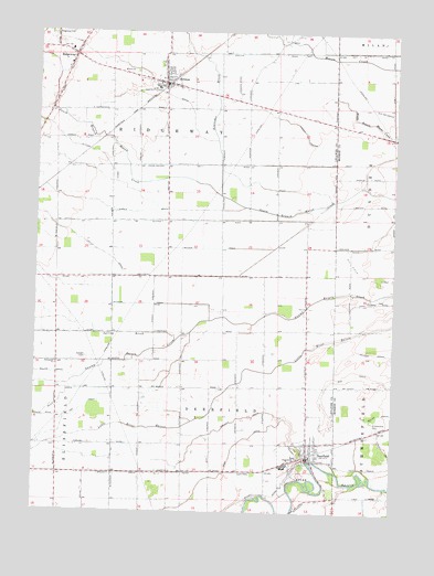
Deerfield, MI USGS Topographic Map
Click on map above to begin viewing in our Map Viewer.

This topographic map contains these locations and features:
Feature Name Type Latitude Longitude GNIS ID View Map
Brablec Farms AirportAirportN41.9834°W83.8058°1623813View Map
Bragg CemeteryCemeteryN41.9303°W83.7547°2439402View Map
Brenott DrainStreamN41.8989°W83.7886°621923View Map
BrittonPopulated PlaceN41.9867°W83.8311°622012View Map
Britton Bethel Baptist ChurchChurchN41.9842°W83.8311°2465612View Map
Britton Fire DepartmentBuildingN41.9867°W83.8308°2465611View Map
Britton LibraryBuildingN41.9861°W83.8314°2465610View Map
Britton Post OfficePost OfficeN41.9867°W83.8283°2465609View Map
Britton StationLocaleN41.9872°W83.8292°2465604View Map
Camp DrainStreamN41.8878°W83.7794°622565View Map
Coats DrainStreamN41.9720°W83.8127°623515View Map
Congregational Christian ChurchChurchN41.9856°W83.8258°2465613View Map
DeerfieldPopulated PlaceN41.8889°W83.7788°624496View Map
Deerfield Post OfficePost OfficeN41.8886°W83.7800°2465572View Map
Deerfield Public SchoolSchoolN41.8894°W83.7836°2465575View Map
Deerfield Station (historical)LocaleN41.8903°W83.7772°2465573View Map
Deerfield Township Fire DepartmentBuildingN41.8941°W83.7798°2465580View Map
Deerfield United Methodist ChurchChurchN41.8883°W83.7825°2465579View Map
Deerfield Village CemeteryCemeteryN41.8917°W83.7847°2465716View Map
Dibble DrainStreamN41.9545°W83.8024°624647View Map
Free Methodist ChurchChurchN41.8883°W83.7706°2465576View Map
Fry DrainStreamN41.9137°W83.8477°626542View Map
Grace ChurchChurchN41.9898°W83.8455°627051View Map
Immanuels ChurchChurchN41.9134°W83.8677°628946View Map
Isley DrainStreamN41.9064°W83.8474°629140View Map
Kelly DrainStreamN41.9439°W83.7922°629546View Map
Miller DrainStreamN41.9087°W83.8622°632375View Map
Pentecostal Church of GodChurchN41.8928°W83.7828°2465577View Map
RidgewayPopulated PlaceN41.9939°W83.8627°635909View Map
Ridgeway Baptist ChurchChurchN41.9958°W83.8744°2465607View Map
Ridgeway Church of the NazareneChurchN41.9917°W83.8642°2465608View Map
Ridgeway Post OfficePost OfficeN41.9939°W83.8628°2435601View Map
Ridgeway Station (historical)LocaleN41.9939°W83.8622°2435551View Map
Ridgeway Township Fire DepartmentBuildingN41.9865°W83.8312°2465605View Map
Ridgeway Township HallBuildingN41.9864°W83.8300°2465606View Map
Roberts Ingold LibraryBuildingN41.8894°W83.7789°2465574View Map
Saint Alphonse CemeteryCemeteryN41.8973°W83.7552°636518View Map
Saint Alphonsus ChurchChurchN41.8908°W83.7797°2465578View Map
Schreeder BrookStreamN41.9562°W83.7722°637433View Map
Schwab DrainStreamN41.9248°W83.8144°637447View Map
Speigel CemeteryCemeteryN41.9150°W83.8572°638491View Map
Spring BrookStreamN41.9195°W83.8258°638547View Map
Springbrook DrainStreamN41.9845°W83.8363°638617View Map
Sutton DrainStreamN41.9534°W83.8319°639131View Map
Township of DeerfieldCivilN41.8873°W83.8024°1626170View Map
Township of RidgewayCivilN41.9661°W83.8311°1626979View Map
Village of BrittonCivilN41.9876°W83.8305°2397458View Map
Village of DeerfieldCivilN41.8901°W83.7790°2398706View Map
Woodruff BrookStreamN41.9212°W83.8544°1616780View Map

Note: Coordinates in the location and feature list above are referenced to NAD83 datum.


Copyright (C) 2008-2024 Ryan Niemi / Sunset Dynamics ... All Rights Reserved