TopoQuest Logo
Do you find TopoQuest useful?
Help keep TopoQuest running and adding new maps/features by donating!
Bitcoin:  19c7KJd3qBynnjoSw5npx9KScwjBe4ifkT
Litecoin:  LXs6TkuXGGXo1vDsWCkWVdjQX94eUKd6ui
Home View Maps Find Maps Find Places Resources & Links


Blissfield, Michigan Topographic Map

USGS Map Title: Blissfield, MI
USGS Map MRC: 41083G7
DRG (GeoTIFF) Download: o41083g7.tif


Neighboring USGS Topographic Map Quads:


  Tecumseh South, MI  
41083H8
 

  Deerfield, MI  
41083H7
 

  Dundee, MI  
41083H6
 

  Palmyra, MI  
41083G8
 

  Blissfield, MI  
41083G7
 

  Lambertville West, MI  
41083G6
 

  Assumption, OH  
41083F8
 

  Berkey, OH  
41083F7
 

  Sylvania, OH  
41083F6


Map MRC Location:

N42°
W84°
N42°
W83°
H8 H7 H6 H5 H4 H3 H2 H1
G8 G7 G6 G5 G4 G3 G2 G1
F8 F7 F6 F5 F4 F3 F2 F1
E8 E7 E6 E5 E4 E3 E2 E1
D8 D7 D6 D5 D4 D3 D2 D1
C8 C7 C6 C5 C4 C3 C2 C1
B8 B7 B6 B5 B4 B3 B2 B1
A8 A7 A6 A5 A4 A3 A2 A1
N41°
W84°
N41°
W83°

Blissfield, MI USGS 1:24K Topographic Map Preview:
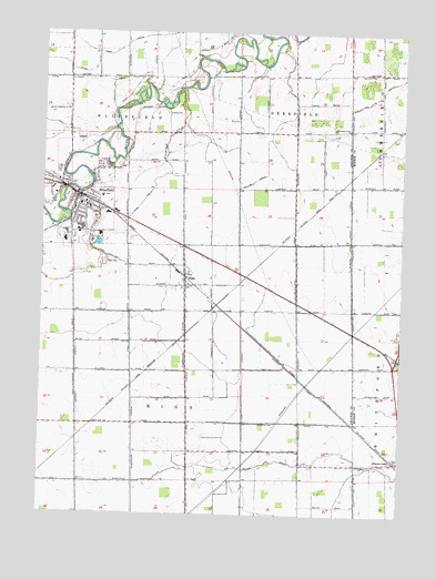
Blissfield, MI USGS Topographic Map
Click on map above to begin viewing in our Map Viewer.

This topographic map contains these locations and features:
Feature Name Type Latitude Longitude GNIS ID View Map
Bachmayer Little League ParkParkN41.8242°W83.8639°2465675View Map
Bachmayer ParkParkN41.8322°W83.8689°2465673View Map
Betz AirportAirportN41.8550°W83.8677°1623807View Map
BlissfieldPopulated PlaceN41.8325°W83.8624°621593View Map
Blissfield Baptist ChurchChurchN41.8422°W83.8664°2465658View Map
Blissfield Bible Holiness ChurchChurchN41.8378°W83.8578°2465661View Map
Blissfield Elementary SchoolSchoolN41.8211°W83.8669°2465669View Map
Blissfield Hotel Historical MarkerParkN41.8328°W83.8631°2465753View Map
Blissfield Junior HighSchoolN41.8217°W83.8694°2465668View Map
Blissfield Police DepartmentBuildingN41.8294°W83.8544°2465667View Map
Blissfield Post OfficePost OfficeN41.8303°W83.8644°2465672View Map
Blissfield Senior High SchoolSchoolN41.8228°W83.8667°2465670View Map
Blissfield StationLocaleN41.8306°W83.8564°2465665View Map
Blissfield Township Fire DepartmentBuildingN41.8314°W83.8584°2465666View Map
Carpenter House Historical MarkerParkN41.8353°W83.8714°2465754View Map
Christian Union ChurchChurchN41.8503°W83.7688°623261View Map
Crane CemeteryCemeteryN41.8542°W83.8324°624005View Map
Eddy Extension DrainCanalN41.7881°W83.8627°625345View Map
Ellis ParkParkN41.8325°W83.8667°2465674View Map
Erie and Kalamazoo Railroad Historical MarkerParkN41.8353°W83.8714°2465755View Map
Farver Little League ParkParkN41.8214°W83.8619°2465676View Map
First Presbyterian ChurchChurchN41.8358°W83.8669°2465664View Map
First Presbyterian Church Historical MarkerParkN41.8358°W83.8672°2465756View Map
First United Brethren ChurchChurchN41.8294°W83.8592°2465663View Map
First United Methodist ChurchChurchN41.8331°W83.8633°2465659View Map
Floodwood CreekStreamN41.8609°W83.8266°626178View Map
Hill DrainCanalN41.8495°W83.8636°628278View Map
Hiram D Ellis House Historical MarkerParkN41.8353°W83.8714°2465757View Map
Kellar and Riga DrainCanalN41.8153°W83.7869°629512View Map
Kellar DrainCanalN41.8367°W83.8022°629513View Map
Logan CemeteryCemeteryN41.8650°W83.7591°630878View Map
Ottawa Lake Station (historical)LocaleN41.7639°W83.7506°2438815View Map
Pease DrainCanalN41.8631°W83.8674°634537View Map
Pleasant View CemeteryCemeteryN41.7914°W83.7506°2439409View Map
Ravine DrainCanalN41.7639°W83.7930°635671View Map
RigaPopulated PlaceN41.8092°W83.8249°635922View Map
Riga CemeteryCemeteryN41.8159°W83.8530°635923View Map
Riga DrainCanalN41.7978°W83.8441°635924View Map
Riga Post OfficePost OfficeN41.8092°W83.8250°2436130View Map
Riga StationLocaleN41.8125°W83.8272°2436129View Map
Riga Township Fire Department and Emergency Medical ServicesBuildingN41.8063°W83.8244°2436133View Map
Saint Johns Evangelical Lutheran ChurchChurchN41.8092°W83.8258°2436132View Map
Saint Paul Evangelical Lutheran ChurchChurchN41.8297°W83.8600°2465662View Map
Saint Peter the Apostle ChurchChurchN41.8292°W83.8642°2465660View Map
Schultz-Holmes Memorial LibraryBuildingN41.8286°W83.8642°2465671View Map
Township of BlissfieldCivilN41.8618°W83.8531°1625948View Map
Township of RigaCivilN41.7708°W83.8239°1626980View Map
Trinity Lutheran ChurchChurchN41.8092°W83.8247°2436131View Map
Village of BlissfieldCivilN41.8311°W83.8634°2398133View Map
Wiley DrainCanalN41.8642°W83.8563°1616474View Map

Note: Coordinates in the location and feature list above are referenced to NAD83 datum.


Copyright (C) 2008-2025 Ryan Niemi / Sunset Dynamics ... All Rights Reserved