TopoQuest Logo
Do you find TopoQuest useful?
Help keep TopoQuest running and adding new maps/features by donating!
Bitcoin:  19c7KJd3qBynnjoSw5npx9KScwjBe4ifkT
Litecoin:  LXs6TkuXGGXo1vDsWCkWVdjQX94eUKd6ui
Home View Maps Find Maps Find Places Resources & Links


Palmyra, Michigan Topographic Map

USGS Map Title: Palmyra, MI
USGS Map MRC: 41083G8
DRG (GeoTIFF) Download: o41083g8.tif


Neighboring USGS Topographic Map Quads:


  Adrian, MI  
41084H1
 

  Tecumseh South, MI  
41083H8
 

  Deerfield, MI  
41083H7
 

  Jasper, MI  
41084G1
 

  Palmyra, MI  
41083G8
 

  Blissfield, MI  
41083G7
 

  Lyons, OH  
41084F1
 

  Assumption, OH  
41083F8
 

  Berkey, OH  
41083F7


Map MRC Location:

N42°
W84°
N42°
W83°
H8 H7 H6 H5 H4 H3 H2 H1
G8 G7 G6 G5 G4 G3 G2 G1
F8 F7 F6 F5 F4 F3 F2 F1
E8 E7 E6 E5 E4 E3 E2 E1
D8 D7 D6 D5 D4 D3 D2 D1
C8 C7 C6 C5 C4 C3 C2 C1
B8 B7 B6 B5 B4 B3 B2 B1
A8 A7 A6 A5 A4 A3 A2 A1
N41°
W84°
N41°
W83°

Palmyra, MI USGS 1:24K Topographic Map Preview:
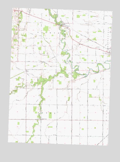
Palmyra, MI USGS Topographic Map
Click on map above to begin viewing in our Map Viewer.

This topographic map contains these locations and features:
Feature Name Type Latitude Longitude GNIS ID View Map
Bay DrainCanalN41.8037°W83.9113°620782View Map
Bear CreekStreamN41.8081°W83.9538°620824View Map
Bell DrainCanalN41.7598°W83.9597°621032View Map
Big Meadow DrainStreamN41.8178°W83.9358°621337View Map
Bixby DrainCanalN41.8367°W83.9649°621469View Map
Black CreekStreamN41.8162°W83.9152°621486View Map
Blessed Savior Lutheran ChurchChurchN41.7870°W83.8824°621209View Map
Blissfield Health CenterHospitalN41.8350°W83.8847°2465653View Map
Clement DrainCanalN41.7659°W83.8819°623444View Map
Coach Light Estates Mobile Home ParkPopulated PlaceN41.8367°W83.8789°2465654View Map
Colvin DrainCanalN41.8700°W83.9019°623650View Map
Corbin DrainCanalN41.7720°W83.9427°623821View Map
Cornerstone Baptist ChurchChurchN41.8181°W83.9811°2465657View Map
Crane CemeteryCemeteryN41.8714°W83.9902°624006View Map
Foot DrainStreamN41.8031°W83.9797°626215View Map
Gleason BrookStreamN41.8100°W83.9586°626867View Map
Goff CemeteryCemeteryN41.8264°W83.8944°2465690View Map
Goodrich DrainCanalN41.8414°W83.8838°626950View Map
Grinnell DrainCanalN41.8231°W83.9524°627444View Map
Grosvenor Post Office (historical)Post OfficeN41.8428°W83.9097°2435683View Map
Hahn DrainCanalN41.7595°W83.9211°627601View Map
Luke Farm CemeteryCemeteryN41.7569°W83.9694°2465720View Map
Malburg DrainCanalN41.7626°W83.9397°631347View Map
Mulberry StationLocaleN41.7547°W83.8817°2435672View Map
OgdenPopulated PlaceN41.8178°W83.9799°633948View Map
Ogden CenterPopulated PlaceN41.7720°W83.9597°633949View Map
Ogden Center ChurchChurchN41.7578°W83.9397°633950View Map
Ogden Center Post Office (historical)Post OfficeN41.7719°W83.9597°2435609View Map
Ogden Post Office (historical)Post OfficeN41.8178°W83.9800°2435610View Map
Ogden Station (historical)LocaleN41.8167°W83.9806°2435556View Map
Ogden Town HallBuildingN41.7719°W83.9722°2465656View Map
PalmyraPopulated PlaceN41.8598°W83.9358°634331View Map
Palmyra Community ChurchChurchN41.8625°W83.9350°2436137View Map
Palmyra Post OfficePost OfficeN41.8619°W83.9347°2436134View Map
Palmyra Presbyterian Church Historical MarkerParkN41.8594°W83.9319°2465774View Map
Palmyra SchoolSchoolN41.8603°W83.9325°2436136View Map
Palmyra StationLocaleN41.8625°W83.9294°2436135View Map
Palmyra Township Fire DepartmentBuildingN41.8598°W83.9363°2436138View Map
Palmyra Village CemeteryCemeteryN41.8617°W83.9444°2465689View Map
Pleasant View CemeteryCemeteryN41.8359°W83.8794°635125View Map
Rockwood DrainCanalN41.7867°W83.9019°636096View Map
Scovell CemeteryCemeteryN41.8417°W83.9250°2465688View Map
Township of OgdenCivilN41.7684°W83.9416°1626838View Map
Township of PalmyraCivilN41.8618°W83.9443°1626878View Map
Underwood CemeteryCemeteryN41.8617°W83.9913°1615324View Map
Victorsville Post Office (historical)Post OfficeN41.8014°W83.9222°2435593View Map
Walker BrookStreamN41.8028°W83.9694°1615690View Map
West Ogden Post Office (historical)Post OfficeN41.8006°W83.9653°2435592View Map
Zion ChurchChurchN41.8017°W83.9272°1616947View Map
Zion United Brethren CemeteryCemeteryN41.8028°W83.9272°2465721View Map
Zion United Brethren ChurchChurchN41.7722°W83.9619°2465655View Map

Note: Coordinates in the location and feature list above are referenced to NAD83 datum.


Copyright (C) 2008-2025 Ryan Niemi / Sunset Dynamics ... All Rights Reserved