TopoQuest Logo
Do you find TopoQuest useful?
Help keep TopoQuest running and adding new maps/features by donating!
Bitcoin:  19c7KJd3qBynnjoSw5npx9KScwjBe4ifkT
Litecoin:  LXs6TkuXGGXo1vDsWCkWVdjQX94eUKd6ui
Home View Maps Find Maps Find Places Resources & Links


Dekoven, Kentucky Topographic Map

USGS Map Title: Dekoven, KY
USGS Map MRC: 37088E1
DRG (GeoTIFF) Download: o37088e1.tif


Neighboring USGS Topographic Map Quads:


  Shawneetown, IL  
37088F2
 

  Grove Center, KY  
37088F1
 

  Morganfield, KY  
37087F8
 

  Saline Mines, IL  
37088E2
 

  Dekoven, KY  
37088E1
 

  Sturgis, KY  
37087E8
 

  Cave-in-Rock, IL  
37088D2
 

  Repton, KY  
37088D1
 

  Blackford, KY  
37087D8


Map MRC Location:

N38°
W89°
N38°
W88°
H8 H7 H6 H5 H4 H3 H2 H1
G8 G7 G6 G5 G4 G3 G2 G1
F8 F7 F6 F5 F4 F3 F2 F1
E8 E7 E6 E5 E4 E3 E2 E1
D8 D7 D6 D5 D4 D3 D2 D1
C8 C7 C6 C5 C4 C3 C2 C1
B8 B7 B6 B5 B4 B3 B2 B1
A8 A7 A6 A5 A4 A3 A2 A1
N37°
W89°
N37°
W88°

Dekoven, KY USGS 1:24K Topographic Map Preview:
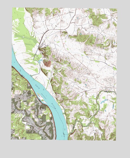
Dekoven, KY USGS Topographic Map
Click on map above to begin viewing in our Map Viewer.

This topographic map contains these locations and features:
Feature Name Type Latitude Longitude GNIS ID View Map
Ace Perry PointSummitN37.5056°W88.1045°403333View Map
Anvil RockPillarN37.5862°W88.0928°486006View Map
Battery RockCliffN37.5306°W88.0798°403966View Map
Battery Rock School (historical)SchoolN37.5234°W88.0964°1808754View Map
Bells Mine (historical)Populated PlaceN37.5097°W88.0222°2743661View Map
Bells Mines ChurchChurchN37.5095°W88.0234°486823View Map
Brokaw HillSummitN37.5403°W88.1059°404900View Map
Brown CemeteryCemeteryN37.5217°W88.0775°404936View Map
Brown HillSummitN37.5114°W88.1003°404949View Map
Buckhart HollowValleyN37.5514°W88.1229°405122View Map
Cane CreekStreamN37.5617°W88.1148°424707View Map
Caney BranchStreamN37.5175°W88.0300°511199View Map
CaseyvillePopulated PlaceN37.5378°W88.0642°489053View Map
Caseyville CemeteryCemeteryN37.5411°W88.0667°499771View Map
Cattail Pond (historical)LakeN37.5859°W88.0621°2743570View Map
Chapel HillsRangeN37.6173°W88.0234°489340View Map
Crow HillSummitN37.5337°W88.1089°406846View Map
CurlewPopulated PlaceN37.5778°W88.0867°507799View Map
Curlew LakesReservoirN37.5758°W88.0894°2743571View Map
DekovenPopulated PlaceN37.5748°W88.0723°490789View Map
Dekoven Census Designated PlaceCensusN37.5792°W88.0750°2629602View Map
Dennis O'Nan DitchCanalN37.5900°W88.0923°490816View Map
Dodge HillsRangeN37.5917°W88.0231°490958View Map
FinneyvillePopulated PlaceN37.5445°W88.1053°422698View Map
Gentry LandingLocaleN37.5195°W88.0742°1808765View Map
Graham HillSummitN37.6023°W88.0617°493083View Map
GrangertownPopulated PlaceN37.5509°W88.0067°493105View Map
Green Chapel HollowValleyN37.5056°W88.0261°512432View Map
Hamilton HillSummitN37.5306°W88.1164°409693View Map
HenshawPopulated PlaceN37.6217°W88.0556°494065View Map
Henshaw Volunteer Fire DepartmentBuildingN37.6203°W88.0578°2637055View Map
Hobbs CemeteryCemeteryN37.5414°W88.1211°410328View Map
Indian HillSummitN37.5628°W88.0836°494959View Map
LambPopulated PlaceN37.5317°W88.1248°425093View Map
Lizard PointSummitN37.5734°W88.0575°496915View Map
Locust Lick CreekStreamN37.5287°W88.0209°2743585View Map
Michael CemeteryCemeteryN37.6231°W88.0345°498093View Map
Mount Olive CemeteryCemeteryN37.6220°W88.0934°498786View Map
MulfordtownPopulated PlaceN37.5437°W88.0725°499080View Map
Old Bethel ChurchChurchN37.5917°W88.0181°499799View Map
Panther HollowValleyN37.5497°W88.1211°415365View Map
Paris HillsRangeN37.5962°W88.0448°500176View Map
Saint Ambrose ChurchChurchN37.6100°W88.0306°502567View Map
Sellers LandingLocaleN37.5489°W88.1000°1808788View Map
Sturgeon HillSummitN37.5303°W88.0856°419244View Map
Sturgeon IslandIslandN37.5395°W88.0889°504613View Map
Tradewater RiverStreamN37.5053°W88.0570°505460View Map
Wardens SloughStreamN37.5828°W88.1236°516229View Map

Note: Coordinates in the location and feature list above are referenced to NAD83 datum.


Copyright (C) 2008-2024 Ryan Niemi / Sunset Dynamics ... All Rights Reserved