TopoQuest Logo
Do you find TopoQuest useful?
Help keep TopoQuest running and adding new maps/features by donating!
Bitcoin:  19c7KJd3qBynnjoSw5npx9KScwjBe4ifkT
Litecoin:  LXs6TkuXGGXo1vDsWCkWVdjQX94eUKd6ui
Home View Maps Find Maps Find Places Resources & Links


Morganfield, Kentucky Topographic Map

USGS Map Title: Morganfield, KY
USGS Map MRC: 37087F8
DRG (GeoTIFF) Download: o37087f8.tif


Neighboring USGS Topographic Map Quads:


  Wabash Island, KY  
37088G1
 

  Uniontown, KY  
37087G8
 

  Smith Mills, KY  
37087G7
 

  Grove Center, KY  
37088F1
 

  Morganfield, KY  
37087F8
 

  Waverly, KY  
37087F7
 

  Dekoven, KY  
37088E1
 

  Sturgis, KY  
37087E8
 

  Bordley, KY  
37087E7


Map MRC Location:

N38°
W88°
N38°
W87°
H8 H7 H6 H5 H4 H3 H2 H1
G8 G7 G6 G5 G4 G3 G2 G1
F8 F7 F6 F5 F4 F3 F2 F1
E8 E7 E6 E5 E4 E3 E2 E1
D8 D7 D6 D5 D4 D3 D2 D1
C8 C7 C6 C5 C4 C3 C2 C1
B8 B7 B6 B5 B4 B3 B2 B1
A8 A7 A6 A5 A4 A3 A2 A1
N37°
W88°
N37°
W87°

Morganfield, KY USGS 1:24K Topographic Map Preview:
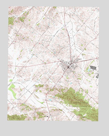
Morganfield, KY USGS Topographic Map
Click on map above to begin viewing in our Map Viewer.

This topographic map contains these locations and features:
Feature Name Type Latitude Longitude GNIS ID View Map
Antioch ChurchChurchN37.6970°W87.9647°485989View Map
Chalybeate HillsRangeN37.6492°W87.9095°489316View Map
ChapmanPopulated PlaceN37.7162°W87.9153°507686View Map
Chatman CemeteryCemeteryN37.6364°W87.9686°489375View Map
City of MorganfieldCivilN37.6868°W87.8797°2404302View Map
Cypress FlatsFlatN37.6670°W87.9834°490529View Map
Davenport CemeteryCemeteryN37.7373°W87.9864°490617View Map
Dyer HillsRangeN37.6273°W87.9881°491393View Map
Eagle CreekStreamN37.6653°W87.9964°491406View Map
Givens CemeteryCemeteryN37.7270°W87.9440°492870View Map
HamnerPopulated PlaceN37.6478°W87.9470°508170View Map
HardingPopulated PlaceN37.6481°W87.9856°508183View Map
Higginson DitchCanalN37.7003°W87.8945°494174View Map
Higginson-Henry Wildlife Management AreaParkN37.6434°W87.8978°494175View Map
Line DitchCanalN37.7062°W87.9128°496584View Map
Methodist Hospital Union CountyHospitalN37.6284°W87.9479°2660381View Map
MorganfieldPopulated PlaceN37.6834°W87.9167°498597View Map
Morganfield DivisionCivilN37.6738°W87.9498°1937153View Map
Morganfield Fire DepartmentBuildingN37.6832°W87.9163°2636548View Map
Morganfield Police DepartmentBuildingN37.6831°W87.9162°2767547View Map
Mortons LakeReservoirN37.6535°W87.9049°498646View Map
Rayburn CemeteryCemeteryN37.7200°W87.9906°501621View Map
Saint Ann SchoolSchoolN37.6823°W87.9214°502574View Map
Sugg CemeteryCemeteryN37.7250°W87.9911°504711View Map
Sugg CreekStreamN37.6650°W87.9964°504712View Map
Sulphur Spring HillsRangeN37.6312°W87.8800°504762View Map
Union CountyCivilN37.6584°W87.9454°516959View Map
Union County Sheriff's OfficeBuildingN37.6838°W87.9174°2767476View Map
Waller CemeteryCemeteryN37.7131°W87.9492°506150View Map
Wathen DitchCanalN37.7259°W87.9275°506271View Map
Willett DitchCanalN37.7239°W87.9139°506777View Map
Williams CemeteryCemeteryN37.7095°W87.9909°506805View Map
Williams CemeteryCemeteryN37.7117°W87.9428°506806View Map
WMSK-AM (Morganfield)TowerN37.6667°W87.9278°517639View Map
WMSK-FM (Morganfield)TowerN37.6667°W87.9278°517724View Map

Note: Coordinates in the location and feature list above are referenced to NAD83 datum.


Copyright (C) 2008-2024 Ryan Niemi / Sunset Dynamics ... All Rights Reserved