TopoQuest Logo
Do you find TopoQuest useful?
Help keep TopoQuest running and adding new maps/features by donating!
Bitcoin:  19c7KJd3qBynnjoSw5npx9KScwjBe4ifkT
Litecoin:  LXs6TkuXGGXo1vDsWCkWVdjQX94eUKd6ui
Home View Maps Find Maps Find Places Resources & Links


Denmark, Tennessee Topographic Map

USGS Map Title: Denmark, TN
USGS Map MRC: 35089E1
DRG (GeoTIFF) Download: o35089e1.tif


Neighboring USGS Topographic Map Quads:


  Jones, TN  
35089F2
 

  Bells, TN  
35089F1
 

  Adair, TN  
35088F8
 

  Sunnyhill, TN  
35089E2
 

  Denmark, TN  
35089E1
 

  Westover, TN  
35088E8
 

  Hillville, TN  
35089D2
 

  Mercer, TN  
35089D1
 

  Teague, TN  
35088D8


Map MRC Location:

N36°
W90°
N36°
W89°
H8 H7 H6 H5 H4 H3 H2 H1
G8 G7 G6 G5 G4 G3 G2 G1
F8 F7 F6 F5 F4 F3 F2 F1
E8 E7 E6 E5 E4 E3 E2 E1
D8 D7 D6 D5 D4 D3 D2 D1
C8 C7 C6 C5 C4 C3 C2 C1
B8 B7 B6 B5 B4 B3 B2 B1
A8 A7 A6 A5 A4 A3 A2 A1
N35°
W90°
N35°
W89°

Denmark, TN USGS 1:24K Topographic Map Preview:
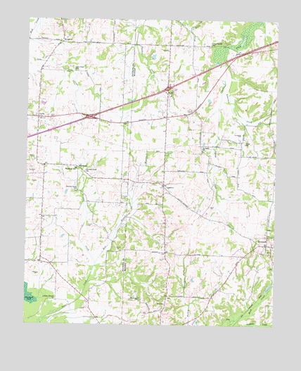
Denmark, TN USGS Topographic Map
Click on map above to begin viewing in our Map Viewer.

This topographic map contains these locations and features:
Feature Name Type Latitude Longitude GNIS ID View Map
Bond CemeteryCemeteryN35.5484°W89.0331°1277930View Map
Brickyard PondSwampN35.5126°W89.1248°1278335View Map
Brown Creek CemeteryCemeteryN35.5628°W89.0956°1318958View Map
Browns CreekStreamN35.5254°W89.0898°1278621View Map
Browns Creek ChurchChurchN35.5631°W89.0953°1278625View Map
Browns Creek SchoolSchoolN35.5548°W89.1006°1305465View Map
Cane Creek Church (historical)ChurchN35.6042°W89.1009°1318962View Map
Cane Creek SchoolSchoolN35.6042°W89.1012°1279529View Map
Currie CemeteryCemeteryN35.5523°W89.1081°1281887View Map
Currie CemeteryCemeteryN35.5584°W89.1201°1281888View Map
DenmarkPopulated PlaceN35.5329°W89.0040°1282335View Map
Denmark Female Institute (historical)SchoolN35.5320°W89.0006°1321006View Map
Denmark Male Academy (historical)SchoolN35.5337°W89.0037°1321007View Map
Denmark Post OfficePost OfficeN35.5331°W89.0006°1651639View Map
Denmark Presbyterian ChurchChurchN35.5326°W89.0006°1321008View Map
Drake CemeteryCemeteryN35.5848°W89.1134°1282772View Map
Ebenezer ChurchChurchN35.5106°W89.0676°1283470View Map
Forrest CemeteryCemeteryN35.5315°W89.0792°1284646View Map
Forrest CemeteryCemeteryN35.5515°W89.0753°1284647View Map
Greer SchoolSchoolN35.5748°W89.0159°1286226View Map
Hawkins CemeteryCemeteryN35.5951°W89.0551°1287178View Map
Hill SchoolSchoolN35.5087°W89.0551°1287803View Map
Interchange 66CrossingN35.5848°W89.0937°1311326View Map
Interchange 68CrossingN35.5970°W89.0548°1312106View Map
LeightonPopulated PlaceN35.5570°W89.0565°1291006View Map
London Branch ChurchChurchN35.5106°W89.1098°1291832View Map
Lower Ingram SchoolSchoolN35.6154°W89.0328°1292220View Map
Madison County Fire Department Station 3BuildingN35.5511°W89.0568°2654029View Map
Mud Creek Dam Number 15m-28-1DamN35.6234°W89.0934°1301974View Map
Mud Creek LakeReservoirN35.6234°W89.0934°1301975View Map
Norvell CemeteryCemeteryN35.5406°W89.0939°1295991View Map
Powell CemeteryCemeteryN35.6248°W89.1084°1298405View Map
Rice BranchStreamN35.5240°W89.0903°1299292View Map
Robertson CreekStreamN35.6076°W89.0265°1299667View Map
Saint Johns ChurchChurchN35.5726°W89.0373°1300448View Map
Springfield CemeteryCemeteryN35.5781°W89.0178°1271142View Map
Tyson LakeReservoirN35.6100°W89.0621°1301959View Map
Tyson Lake DamDamN35.6101°W89.0634°1301958View Map
UnionPopulated PlaceN35.5848°W89.1195°1304221View Map
Union CemeteryCemeteryN35.5687°W89.1212°1273184View Map
Walker CemeteryCemeteryN35.5209°W89.1184°1273588View Map
WellwoodPopulated PlaceN35.6159°W89.1078°1274118View Map
Wellwood School (historical)SchoolN35.6156°W89.1026°1319031View Map
WoodlandPopulated PlaceN35.5645°W89.0990°1314532View Map
Woodland Baptist ChurchChurchN35.5640°W89.1006°1319032View Map
Woodland SchoolSchoolN35.5640°W89.1001°1275046View Map

Note: Coordinates in the location and feature list above are referenced to NAD83 datum.


Copyright (C) 2008-2025 Ryan Niemi / Sunset Dynamics ... All Rights Reserved