TopoQuest Logo
Do you find TopoQuest useful?
Help keep TopoQuest running and adding new maps/features by donating!
Bitcoin:  19c7KJd3qBynnjoSw5npx9KScwjBe4ifkT
Litecoin:  LXs6TkuXGGXo1vDsWCkWVdjQX94eUKd6ui
Home View Maps Find Maps Find Places Resources & Links


Adair, Tennessee Topographic Map

USGS Map Title: Adair, TN
USGS Map MRC: 35088F8
DRG (GeoTIFF) Download: o35088f8.tif


Neighboring USGS Topographic Map Quads:


  Alamo, TN  
35089G1
 

  Humboldt, TN  
35088G8
 

  Medina, TN  
35088G7
 

  Bells, TN  
35089F1
 

  Adair, TN  
35088F8
 

  Jackson North, TN  
35088F7
 

  Denmark, TN  
35089E1
 

  Westover, TN  
35088E8
 

  Jackson South, TN  
35088E7


Map MRC Location:

N36°
W89°
N36°
W88°
H8 H7 H6 H5 H4 H3 H2 H1
G8 G7 G6 G5 G4 G3 G2 G1
F8 F7 F6 F5 F4 F3 F2 F1
E8 E7 E6 E5 E4 E3 E2 E1
D8 D7 D6 D5 D4 D3 D2 D1
C8 C7 C6 C5 C4 C3 C2 C1
B8 B7 B6 B5 B4 B3 B2 B1
A8 A7 A6 A5 A4 A3 A2 A1
N35°
W89°
N35°
W88°

Adair, TN USGS 1:24K Topographic Map Preview:
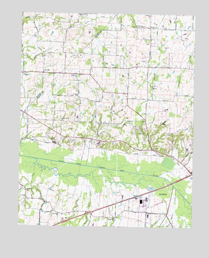
Adair, TN USGS Topographic Map
Click on map above to begin viewing in our Map Viewer.

This topographic map contains these locations and features:
Feature Name Type Latitude Longitude GNIS ID View Map
AdairPopulated PlaceN35.7142°W88.9609°1275447View Map
Adair BranchStreamN35.6606°W88.9520°1275448View Map
Bascom CemeteryCemeteryN35.6867°W88.9123°1276418View Map
Bascom ChurchChurchN35.7062°W88.9048°1304984View Map
Bethlehem CemeteryCemeteryN35.6426°W88.9951°1277157View Map
Bethlehem ChurchChurchN35.6462°W88.9942°1305166View Map
Center Point SchoolSchoolN35.6326°W88.9712°1280144View Map
Commissioner District 3CivilN35.6689°W88.8934°2464174View Map
Commissioner District 9CivilN35.7332°W88.8867°2464734View Map
Cross Road School (historical)SchoolN35.7217°W88.9981°1317645View Map
Cub CreekStreamN35.6592°W88.9412°1281794View Map
Cypress CreekStreamN35.6606°W88.9884°1281930View Map
De Loach CemeteryCemeteryN35.7303°W88.8962°1282231View Map
Gregory ChurchChurchN35.7484°W88.9070°1286244View Map
Gum FlatPopulated PlaceN35.7151°W88.9840°1286404View Map
Harris CemeteryCemeteryN35.7420°W88.9176°1286965View Map
Harris Grove ChurchChurchN35.7423°W88.9117°1286983View Map
Hart CemeteryCemeteryN35.7440°W88.9037°1287039View Map
Hicks CemeteryCemeteryN35.7417°W88.8970°1287650View Map
Interchange 74CrossingN35.6331°W88.9492°1312112View Map
Jewette CemeteryCemeteryN35.7223°W88.9101°1289427View Map
Johnson CreekStreamN35.6481°W88.8870°1289601View Map
Lacy CemeteryCemeteryN35.6770°W88.9892°1290445View Map
Lawrence CemeteryCemeteryN35.6765°W88.9778°1290780View Map
Madison County Fire Department Station 10BuildingN35.6788°W88.9079°2654024View Map
Madison West Industrial ParkLocaleN35.6376°W88.9078°1321043View Map
Mason Grove SchoolSchoolN35.7495°W88.9581°1292887View Map
Matthews CemeteryCemeteryN35.6915°W88.9092°1292955View Map
McClellan CemeteryCemeteryN35.6862°W88.9445°1293155View Map
McLemore CemeteryCemeteryN35.6820°W88.9639°1293405View Map
Meriweather BranchStreamN35.6498°W88.9478°1293623View Map
MidwayPopulated PlaceN35.7145°W88.9987°1315505View Map
Midway Baptist ChurchChurchN35.7153°W88.9934°1643429View Map
Pope Division (historical)CensusN35.7184°W88.9076°1648857View Map
Poplar Corner ChurchChurchN35.6870°W88.9698°1298174View Map
Randolph Family CemeteryCemeteryN35.6914°W88.9767°2557709View Map
RobertsPopulated PlaceN35.6762°W88.9953°1315818View Map
Saint John Baptist ChurchChurchN35.7006°W88.9584°1321063View Map
Saint Johns SchoolSchoolN35.7023°W88.9587°1300455View Map
Walnut Grove Baptist ChurchChurchN35.6301°W88.9312°1321076View Map
Walnut Grove SchoolSchoolN35.6301°W88.9306°1273732View Map
Windy CityPopulated PlaceN35.7417°W88.9067°1274866View Map
Wirt Seminary (historical)SchoolN35.7326°W88.9717°1317658View Map

Note: Coordinates in the location and feature list above are referenced to NAD83 datum.


Copyright (C) 2008-2024 Ryan Niemi / Sunset Dynamics ... All Rights Reserved