TopoQuest Logo
Do you find TopoQuest useful?
Help keep TopoQuest running and adding new maps/features by donating!
Bitcoin:  19c7KJd3qBynnjoSw5npx9KScwjBe4ifkT
Litecoin:  LXs6TkuXGGXo1vDsWCkWVdjQX94eUKd6ui
Home View Maps Find Maps Find Places Resources & Links


Dennis, Kentucky Topographic Map

USGS Map Title: Dennis, KY
USGS Map MRC: 36086G7
DRG (GeoTIFF) Download: o36086g7.tif


Neighboring USGS Topographic Map Quads:


  Lewisburg, KY  
36086H8
 

  Homer, KY  
36086H7
 

  South Union, KY  
36086H6
 

  Russellville, KY  
36086G8
 

  Dennis, KY  
36086G7
 

  Auburn, KY  
36086G6
 

  Dot, KY  
36086F8
 

  Adairville, KY  
36086F7
 

  Prices Mill, KY  
36086F6


Map MRC Location:

N37°
W87°
N37°
W86°
H8 H7 H6 H5 H4 H3 H2 H1
G8 G7 G6 G5 G4 G3 G2 G1
F8 F7 F6 F5 F4 F3 F2 F1
E8 E7 E6 E5 E4 E3 E2 E1
D8 D7 D6 D5 D4 D3 D2 D1
C8 C7 C6 C5 C4 C3 C2 C1
B8 B7 B6 B5 B4 B3 B2 B1
A8 A7 A6 A5 A4 A3 A2 A1
N36°
W87°
N36°
W86°

Dennis, KY USGS 1:24K Topographic Map Preview:
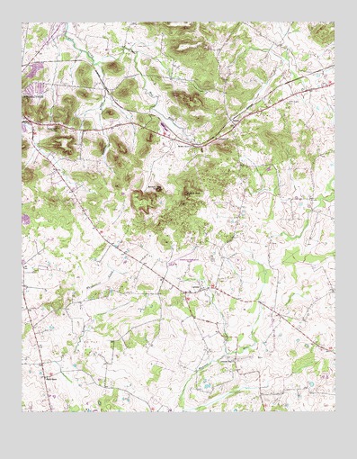
Dennis, KY USGS Topographic Map
Click on map above to begin viewing in our Map Viewer.

This topographic map contains these locations and features:
Feature Name Type Latitude Longitude GNIS ID View Map
Bibbs Chapel CemeteryCemeteryN36.8489°W86.7686°487069View Map
Butlers (historical)Populated PlaceN36.7825°W86.8722°2743068View Map
Buzzard KnobSummitN36.8200°W86.8089°488535View Map
Cook CemeteryCemeteryN36.8673°W86.8278°489998View Map
CorinthPopulated PlaceN36.7889°W86.8039°507760View Map
DennisPopulated PlaceN36.8428°W86.7872°507846View Map
Duncans Shed (historical)Populated PlaceN36.8574°W86.8161°2743074View Map
Halls StoreLocaleN36.7609°W86.8658°493605View Map
Mud River Valley SchoolSchoolN36.8675°W86.8325°499014View Map
Muddy River ChurchChurchN36.8350°W86.8058°499049View Map
Pillow CemeteryCemeteryN36.8656°W86.8308°500636View Map
Pleasant Run (historical)Populated PlaceN36.7662°W86.7901°2743092View Map
Pleasant Run ChurchChurchN36.7667°W86.7900°500908View Map
Poindexter BranchStreamN36.8614°W86.8450°500991View Map
Rainbow Rock KnobSummitN36.8212°W86.8200°501533View Map
Rockcastle ChurchChurchN36.8376°W86.7974°490815View Map
Russellville-Logan County AirportAirportN36.7999°W86.8102°517484View Map
Sugarloaf KnobSummitN36.8409°W86.8603°504702View Map

Note: Coordinates in the location and feature list above are referenced to NAD83 datum.


Copyright (C) 2008-2024 Ryan Niemi / Sunset Dynamics ... All Rights Reserved