TopoQuest Logo
Do you find TopoQuest useful?
Help keep TopoQuest running and adding new maps/features by donating!
Bitcoin:  19c7KJd3qBynnjoSw5npx9KScwjBe4ifkT
Litecoin:  LXs6TkuXGGXo1vDsWCkWVdjQX94eUKd6ui
Home View Maps Find Maps Find Places Resources & Links


Prices Mill, Kentucky Topographic Map

USGS Map Title: Prices Mill, KY
USGS Map MRC: 36086F6
DRG (GeoTIFF) Download: o36086f6.tif


Neighboring USGS Topographic Map Quads:


  Dennis, KY  
36086G7
 

  Auburn, KY  
36086G6
 

  Woodburn, KY  
36086G5
 

  Adairville, KY  
36086F7
 

  Prices Mill, KY  
36086F6
 

  Franklin, KY  
36086F5
 

  Youngville, TN  
36086E7
 

  Orlinda, TN  
36086E6
 

  Portland, TN  
36086E5


Map MRC Location:

N37°
W87°
N37°
W86°
H8 H7 H6 H5 H4 H3 H2 H1
G8 G7 G6 G5 G4 G3 G2 G1
F8 F7 F6 F5 F4 F3 F2 F1
E8 E7 E6 E5 E4 E3 E2 E1
D8 D7 D6 D5 D4 D3 D2 D1
C8 C7 C6 C5 C4 C3 C2 C1
B8 B7 B6 B5 B4 B3 B2 B1
A8 A7 A6 A5 A4 A3 A2 A1
N36°
W87°
N36°
W86°

Prices Mill, KY USGS 1:24K Topographic Map Preview:
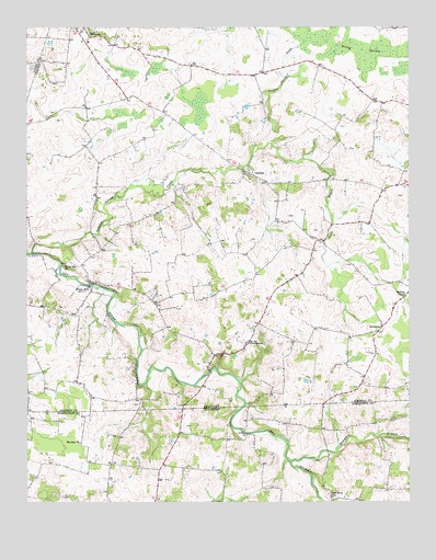
Prices Mill, KY USGS Topographic Map
Click on map above to begin viewing in our Map Viewer.

This topographic map contains these locations and features:
Feature Name Type Latitude Longitude GNIS ID View Map
Babb CemeteryCemeteryN36.6336°W86.7444°1644157View Map
Bethany ChurchChurchN36.6409°W86.7322°1277092View Map
Byram CemeteryCemeteryN36.6325°W86.6842°1644188View Map
Campbell CemeteryCemeteryN36.6464°W86.7286°1644190View Map
Clark CemeteryCemeteryN36.6317°W86.6689°1644203View Map
Cummings Farms AirfieldAirportN36.7275°W86.7284°2444089View Map
Doss CemeteryCemeteryN36.6450°W86.6978°1644232View Map
Duer CemeteryCemeteryN36.6406°W86.6772°1644239View Map
Duffy School (historical)SchoolN36.6339°W86.6997°1316480View Map
Milliken ChapelChurchN36.6787°W86.6258°498369View Map
Neely BranchStreamN36.7193°W86.6699°499226View Map
NeosheoPopulated PlaceN36.7120°W86.6786°499264View Map
Prices MillPopulated PlaceN36.6814°W86.7300°501328View Map
ProvidencePopulated PlaceN36.6662°W86.6775°501366View Map
Red River SchoolSchoolN36.6262°W86.6503°1299083View Map
Robey SwampSwampN36.7422°W86.6363°502079View Map
Rose CemeteryCemeteryN36.6281°W86.7083°1644414View Map
SchweizerPopulated PlaceN36.6709°W86.6339°503070View Map
Stringer CemeteryCemeteryN36.6359°W86.6467°1644438View Map
Sulphur Spring CreekStreamN36.6906°W86.7483°504760View Map
Summers BranchStreamN36.6353°W86.6639°1271835View Map
Welcome FieldAirportN36.7110°W86.6345°517382View Map
West CemeteryCemeteryN36.6478°W86.6792°1644458View Map
White Hill ChurchChurchN36.6873°W86.7375°506585View Map

Note: Coordinates in the location and feature list above are referenced to NAD83 datum.


Copyright (C) 2008-2024 Ryan Niemi / Sunset Dynamics ... All Rights Reserved