TopoQuest Logo
Do you find TopoQuest useful?
Help keep TopoQuest running and adding new maps/features by donating!
Bitcoin:  19c7KJd3qBynnjoSw5npx9KScwjBe4ifkT
Litecoin:  LXs6TkuXGGXo1vDsWCkWVdjQX94eUKd6ui
Home View Maps Find Maps Find Places Resources & Links


Cameron, Pennsylvania Topographic Map

USGS Map Title: Cameron, PA
USGS Map MRC: 41078D2
DRG (GeoTIFF) Download: o41078d2.tif


Neighboring USGS Topographic Map Quads:


  Rich Valley, PA  
41078E3
 

  Emporium, PA  
41078E2
 

  Wharton, PA  
41078E1
 

  West Creek, PA  
41078D3
 

  Cameron, PA  
41078D2
 

  First Fork, PA  
41078D1
 

  Dents Run, PA  
41078C3
 

  Driftwood, PA  
41078C2
 

  Sinnemahoning, PA  
41078C1


Map MRC Location:

N42°
W79°
N42°
W78°
H8 H7 H6 H5 H4 H3 H2 H1
G8 G7 G6 G5 G4 G3 G2 G1
F8 F7 F6 F5 F4 F3 F2 F1
E8 E7 E6 E5 E4 E3 E2 E1
D8 D7 D6 D5 D4 D3 D2 D1
C8 C7 C6 C5 C4 C3 C2 C1
B8 B7 B6 B5 B4 B3 B2 B1
A8 A7 A6 A5 A4 A3 A2 A1
N41°
W79°
N41°
W78°

Cameron, PA USGS 1:24K Topographic Map Preview:
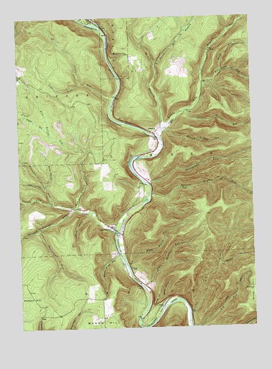
Cameron, PA USGS Topographic Map
Click on map above to begin viewing in our Map Viewer.

This topographic map contains these locations and features:
Feature Name Type Latitude Longitude GNIS ID View Map
Bauer HollowValleyN41.4998°W78.2082°1168813View Map
Bender RunStreamN41.4545°W78.2339°1198412View Map
Beny HollowValleyN41.3863°W78.1722°1198416View Map
Big RunStreamN41.3815°W78.1589°1198432View Map
CameronPopulated PlaceN41.4542°W78.1756°1198521View Map
Cameron CountyCivilN41.4368°W78.2038°1213663View Map
Canoe RunStreamN41.4665°W78.1981°1198538View Map
Canoe RunLocaleN41.4667°W78.1972°1212771View Map
Finley RunStreamN41.4251°W78.2322°1198730View Map
Grove HillSummitN41.3870°W78.1256°1198844View Map
Grove Hill CemeteryCemeteryN41.3906°W78.1259°1198845View Map
Hunts RunStreamN41.4517°W78.1753°1198920View Map
Huston HillSummitN41.3831°W78.2392°1198921View Map
John Mason RunStreamN41.3917°W78.1845°1198948View Map
Left Fork Canoe RunStreamN41.4740°W78.2156°1199024View Map
Mason Grove RunStreamN41.4048°W78.1970°1199120View Map
May Hollow RunStreamN41.4237°W78.2195°1199125View Map
McKinnon BranchStreamN41.4542°W78.1731°1199140View Map
Memorial SpringSpringN41.4834°W78.1986°1201823View Map
Miller HollowValleyN41.4334°W78.2357°1199166View Map
Mooley Hollow RunStreamN41.4553°W78.1700°1199185View Map
Parker HollowValleyN41.4207°W78.2123°1199277View Map
Pine Street CemeteryCemeteryN41.3986°W78.1901°1199311View Map
Portable RunStreamN41.4253°W78.2322°1199331View Map
Reed HollowValleyN41.4317°W78.2367°1199368View Map
Right Fork Big RunStreamN41.4003°W78.1428°1199382View Map
Rock RunStreamN41.4776°W78.1403°1199402View Map
Russell Hollow RunStreamN41.4626°W78.1583°1199425View Map
Sand Springs TrailTrailN41.4867°W78.2281°1206710View Map
Slyder Airport (historical)AirportN41.4792°W78.1622°1200822View Map
Snodgrass RunStreamN41.4151°W78.2395°1199556View Map
Square Timber RunStreamN41.4292°W78.1783°1199588View Map
Steam Mill BranchStreamN41.4815°W78.1745°1199607View Map
Sterling RunPopulated PlaceN41.4148°W78.1989°1199617View Map
Sterling RunStreamN41.4251°W78.2320°1199618View Map
Stillhouse RunStreamN41.4328°W78.1797°1199623View Map
Tannery Hollow RunStreamN41.4231°W78.2192°1199664View Map
Township of LumberCivilN41.4645°W78.1571°1216104View Map
Tunnel HillCapeN41.3870°W78.1770°1199703View Map
Wash Mason RunStreamN41.4009°W78.1928°1199748View Map
Wayside Memorial State Forest Picnic AreaAreaN41.4845°W78.1992°1212772View Map
Whitehead RunStreamN41.4737°W78.1503°1199787View Map
Wyle CemeteryCemeteryN41.3834°W78.1769°1199822View Map

Note: Coordinates in the location and feature list above are referenced to NAD83 datum.


Copyright (C) 2008-2024 Ryan Niemi / Sunset Dynamics ... All Rights Reserved