TopoQuest Logo
Do you find TopoQuest useful?
Help keep TopoQuest running and adding new maps/features by donating!
Bitcoin:  19c7KJd3qBynnjoSw5npx9KScwjBe4ifkT
Litecoin:  LXs6TkuXGGXo1vDsWCkWVdjQX94eUKd6ui
Home View Maps Find Maps Find Places Resources & Links


Driftwood, Pennsylvania Topographic Map

USGS Map Title: Driftwood, PA
USGS Map MRC: 41078C2
DRG (GeoTIFF) Download: o41078c2.tif


Neighboring USGS Topographic Map Quads:


  West Creek, PA  
41078D3
 

  Cameron, PA  
41078D2
 

  First Fork, PA  
41078D1
 

  Dents Run, PA  
41078C3
 

  Driftwood, PA  
41078C2
 

  Sinnemahoning, PA  
41078C1
 

  The Knobs, PA  
41078B3
 

  Devils Elbow, PA  
41078B2
 

  Pottersdale, PA  
41078B1


Map MRC Location:

N42°
W79°
N42°
W78°
H8 H7 H6 H5 H4 H3 H2 H1
G8 G7 G6 G5 G4 G3 G2 G1
F8 F7 F6 F5 F4 F3 F2 F1
E8 E7 E6 E5 E4 E3 E2 E1
D8 D7 D6 D5 D4 D3 D2 D1
C8 C7 C6 C5 C4 C3 C2 C1
B8 B7 B6 B5 B4 B3 B2 B1
A8 A7 A6 A5 A4 A3 A2 A1
N41°
W79°
N41°
W78°

Driftwood, PA USGS 1:24K Topographic Map Preview:
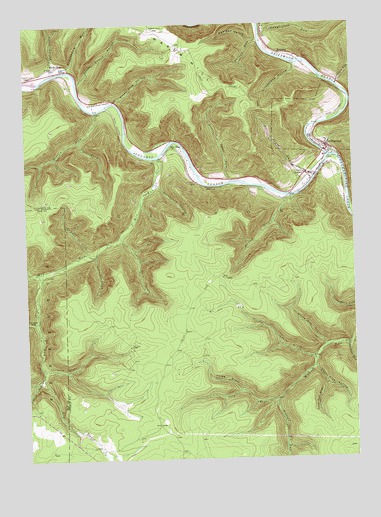
Driftwood, PA USGS Topographic Map
Click on map above to begin viewing in our Map Viewer.

This topographic map contains these locations and features:
Feature Name Type Latitude Longitude GNIS ID View Map
Archie Barr HollowValleyN41.3082°W78.2234°1168373View Map
Barrs RunStreamN41.3592°W78.2289°1212768View Map
Bearpen HollowValleyN41.3697°W78.1623°1168970View Map
Beaverdam RunStreamN41.3617°W78.2336°1192111View Map
Bennett Branch Sinnemahoning CreekStreamN41.3367°W78.1328°1169248View Map
Borough of DriftwoodCivilN41.3448°W78.1341°1215040View Map
Boyer RunStreamN41.3312°W78.1392°1170093View Map
Castle GardenPopulated PlaceN41.3315°W78.1403°1171319View Map
DriftwoodPopulated PlaceN41.3398°W78.1342°1192369View Map
Driftwood Branch Sinnemahoning CreekStreamN41.3367°W78.1331°1199858View Map
Dry RunStreamN41.3748°W78.1583°1173548View Map
Foley BranchStreamN41.2792°W78.1389°1212769View Map
Foley DraftValleyN41.2695°W78.1683°1174929View Map
Gore DraftValleyN41.2668°W78.1550°1175840View Map
Gravel LickStreamN41.3090°W78.2261°1192541View Map
Grindstone HollowValleyN41.3631°W78.1458°1176248View Map
Hicks HollowValleyN41.3629°W78.2390°1176984View Map
Hicks RunPopulated PlaceN41.3631°W78.2381°1203798View Map
Hicks Run CemeteryCemeteryN41.3606°W78.2489°1176986View Map
Horsehead HollowValleyN41.3287°W78.1989°1177456View Map
HuntleyPopulated PlaceN41.3673°W78.1525°1177631View Map
Johnson RunStreamN41.3573°W78.1297°1192696View Map
Johnson Run State Forest Natural AreaAreaN41.3584°W78.1278°1212766View Map
Laurel DraftValleyN41.2788°W78.1404°1178929View Map
Left Fork Miller RunStreamN41.3423°W78.2286°1179144View Map
Little Dent RunStreamN41.3298°W78.1706°1179527View Map
Little Fork DraftValleyN41.3131°W78.2132°1192802View Map
Lower Pine RunStreamN41.2828°W78.1264°1180029View Map
Mason HillSummitN41.3584°W78.1761°1199121View Map
Mason Hill CemeteryCemeteryN41.3733°W78.1988°1180526View Map
Miller RunStreamN41.3503°W78.2220°1181231View Map
Mix CemeteryCemeteryN41.3356°W78.1999°1181382View Map
Mix RunStreamN41.3367°W78.1978°1181385View Map
Mix RunPopulated PlaceN41.3395°W78.1925°1204195View Map
Nanny RunStreamN41.3251°W78.1492°1182157View Map
Nelson RunStreamN41.3706°W78.1589°1182243View Map
Paige RunStreamN41.2737°W78.2445°1183192View Map
Porcupine DraftValleyN41.2898°W78.2469°1193152View Map
Red RunStreamN41.3040°W78.2436°1184792View Map
Sanders DraftValleyN41.2759°W78.2425°1186935View Map
Stone Quarry HollowValleyN41.3591°W78.2286°1188731View Map
Stone Quarry RunStreamN41.3526°W78.2156°1212767View Map
Tanglefoot RunStreamN41.3717°W78.1578°1199663View Map
Township of GibsonCivilN41.3160°W78.1697°1216102View Map
Upper Pine DraftValleyN41.2710°W78.1360°1190247View Map
Upper Pine HollowValleyN41.2761°W78.1402°1190248View Map
Water Plug HollowValleyN41.3533°W78.2150°1190663View Map
White Oak DraftValleyN41.2826°W78.1360°1191301View Map

Note: Coordinates in the location and feature list above are referenced to NAD83 datum.


Copyright (C) 2008-2025 Ryan Niemi / Sunset Dynamics ... All Rights Reserved