TopoQuest Logo
Do you find TopoQuest useful?
Help keep TopoQuest running and adding new maps/features by donating!
Bitcoin:  19c7KJd3qBynnjoSw5npx9KScwjBe4ifkT
Litecoin:  LXs6TkuXGGXo1vDsWCkWVdjQX94eUKd6ui
Home View Maps Find Maps Find Places Resources & Links


Dentville, Mississippi Topographic Map

USGS Map Title: Dentville, MS
USGS Map MRC: 31090H5
DRG (GeoTIFF) Download: o31090h5.tif


Neighboring USGS Topographic Map Quads:


  Utica West, MS  
32090A6
 

  Utica East, MS  
32090A5
 

  Dabney Crossroads, MS  
32090A4
 

  Dentville NW, MS  
31090H6
 

  Dentville, MS  
31090H5
 

  Gallman, MS  
31090H4
 

  Barlow, MS  
31090G6
 

  Smyrna, MS  
31090G5
 

  Hazlehurst, MS  
31090G4


Map MRC Location:

N32°
W91°
N32°
W90°
H8 H7 H6 H5 H4 H3 H2 H1
G8 G7 G6 G5 G4 G3 G2 G1
F8 F7 F6 F5 F4 F3 F2 F1
E8 E7 E6 E5 E4 E3 E2 E1
D8 D7 D6 D5 D4 D3 D2 D1
C8 C7 C6 C5 C4 C3 C2 C1
B8 B7 B6 B5 B4 B3 B2 B1
A8 A7 A6 A5 A4 A3 A2 A1
N31°
W91°
N31°
W90°

Dentville, MS USGS 1:24K Topographic Map Preview:
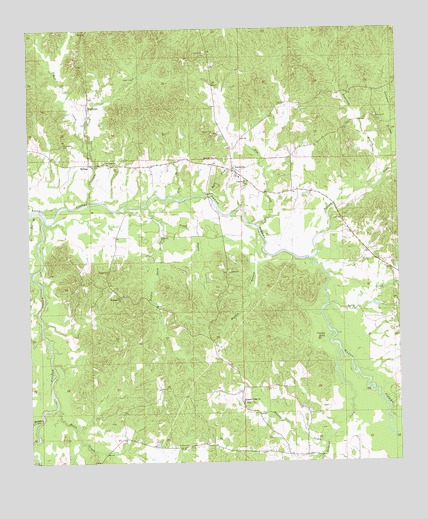
Dentville, MS USGS Topographic Map
Click on map above to begin viewing in our Map Viewer.

This topographic map contains these locations and features:
Feature Name Type Latitude Longitude GNIS ID View Map
Anderson BranchStreamN31.9532°W90.5104°666252View Map
Andrew Jackson Boy Scout Lake DamDamN31.8868°W90.6034°680929View Map
Bell BranchStreamN31.9471°W90.6245°666773View Map
Boggy BayouStreamN31.9449°W90.5798°667369View Map
Causey LakeLakeN31.9105°W90.5251°668171View Map
Choctaw CreekStreamN31.9499°W90.6045°668412View Map
DentvillePopulated PlaceN31.9599°W90.5554°669234View Map
Dentville Volunteer Fire DepartmentBuildingN31.9592°W90.5563°2667913View Map
Dry CreekStreamN31.9435°W90.5487°669417View Map
Fair View ChurchChurchN31.9618°W90.5990°669865View Map
Flower Hill CemeteryCemeteryN31.9668°W90.6131°670048View Map
Foster CreekStreamN31.9479°W90.6220°693254View Map
Green CemeteryCemeteryN31.9857°W90.5923°670652View Map
Halls CreekStreamN31.8907°W90.6168°670847View Map
Holcomb CreekStreamN31.9071°W90.5204°671278View Map
HoodtownPopulated PlaceN31.9779°W90.6048°691941View Map
Horsepen CreekStreamN31.8871°W90.6220°671475View Map
King BranchStreamN31.9513°W90.5751°672142View Map
Latimore BranchStreamN31.9582°W90.5032°672313View Map
Long CreekStreamN31.9199°W90.5240°672816View Map
Martin BranchStreamN31.9413°W90.5470°673172View Map
Mill CreekStreamN31.9632°W90.6034°673625View Map
Mount Hope CemeteryCemeteryN31.8796°W90.5762°674028View Map
Mount Washington Post Office (historical)Post OfficeN31.8760°W90.6154°712229View Map
Mount Zion CemeteryCemeteryN31.9618°W90.5656°708034View Map
New Mount Zion ChurchChurchN31.9624°W90.5648°674786View Map
Pine Bluff Baptist ChurchChurchN31.9552°W90.5507°675792View Map
Pine Bluff CemeteryCemeteryN31.9543°W90.5523°708043View Map
Pleasant Hill Baptist ChurchChurchN31.9229°W90.5940°676062View Map
Pleasant Hill CemeteryCemeteryN31.9229°W90.5940°708046View Map
Pleasant Ridge ChurchChurchN31.8924°W90.5532°676106View Map
Sugar CreekStreamN31.9524°W90.5632°678383View Map
Supervisor District 4CivilN31.9419°W90.6099°711831View Map
Turkey CreekStreamN31.9338°W90.5301°678949View Map
Whisky CreekStreamN31.8807°W90.5259°679564View Map
WillingPopulated PlaceN31.9610°W90.6043°692325View Map
Yellow Sand CreekStreamN31.9488°W90.5854°679949View Map

Note: Coordinates in the location and feature list above are referenced to NAD83 datum.


Copyright (C) 2008-2024 Ryan Niemi / Sunset Dynamics ... All Rights Reserved