TopoQuest Logo
Do you find TopoQuest useful?
Help keep TopoQuest running and adding new maps/features by donating!
Bitcoin:  19c7KJd3qBynnjoSw5npx9KScwjBe4ifkT
Litecoin:  LXs6TkuXGGXo1vDsWCkWVdjQX94eUKd6ui
Home View Maps Find Maps Find Places Resources & Links


Dentville NW, Mississippi Topographic Map

USGS Map Title: Dentville NW, MS
USGS Map MRC: 31090H6
DRG (GeoTIFF) Download: o31090h6.tif


Neighboring USGS Topographic Map Quads:


  Carlisle, MS  
32090A7
 

  Utica West, MS  
32090A6
 

  Utica East, MS  
32090A5
 

  Hermanville, MS  
31090H7
 

  Dentville NW, MS  
31090H6
 

  Dentville, MS  
31090H5
 

  McBride, MS  
31090G7
 

  Barlow, MS  
31090G6
 

  Smyrna, MS  
31090G5


Map MRC Location:

N32°
W91°
N32°
W90°
H8 H7 H6 H5 H4 H3 H2 H1
G8 G7 G6 G5 G4 G3 G2 G1
F8 F7 F6 F5 F4 F3 F2 F1
E8 E7 E6 E5 E4 E3 E2 E1
D8 D7 D6 D5 D4 D3 D2 D1
C8 C7 C6 C5 C4 C3 C2 C1
B8 B7 B6 B5 B4 B3 B2 B1
A8 A7 A6 A5 A4 A3 A2 A1
N31°
W91°
N31°
W90°

Dentville NW, MS USGS 1:24K Topographic Map Preview:
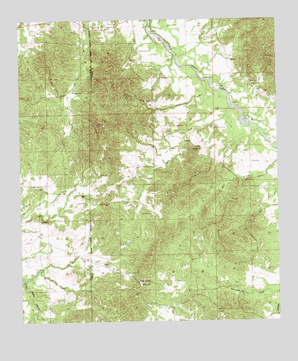
Dentville NW, MS USGS Topographic Map
Click on map above to begin viewing in our Map Viewer.

This topographic map contains these locations and features:
Feature Name Type Latitude Longitude GNIS ID View Map
Beech Grove CemeteryCemeteryN31.9135°W90.7487°666755View Map
Bethel CemeteryCemeteryN31.9402°W90.6376°666879View Map
Bethel CemeteryCemeteryN31.9418°W90.6368°666880View Map
Brushy ForkStreamN31.9629°W90.6465°667696View Map
Burtonton (historical)Populated PlaceN31.9932°W90.6959°686709View Map
Chapel Hill ChurchChurchN31.9729°W90.6370°668323View Map
China Grove Baptist Church (historical)ChurchN31.9963°W90.7159°708070View Map
ConnPopulated PlaceN31.8979°W90.7101°691783View Map
Glenwood School (historical)SchoolN31.9007°W90.7198°686766View Map
Grant CemeteryCemeteryN31.9560°W90.6704°670591View Map
Greenlee CemeteryCemeteryN31.9199°W90.6915°670702View Map
Griffins Store Post Office (historical)Post OfficeN31.9085°W90.7334°712230View Map
Howard CemeteryCemeteryN31.9702°W90.7232°671526View Map
Hulburt CemeteryCemeteryN31.9243°W90.7184°671572View Map
Hulburt CemeteryCemeteryN31.9268°W90.7204°671573View Map
Linden (historical)Populated PlaceN31.9002°W90.6890°686726View Map
Little Zion CemeteryCemeteryN31.9549°W90.6545°672717View Map
Little Zion ChurchChurchN31.9465°W90.6618°672720View Map
Meadows StoreLocaleN31.8915°W90.6932°673455View Map
Nelson CemeteryCemeteryN31.8910°W90.6915°674551View Map
Pisgah CemeteryCemeteryN31.9171°W90.7407°675930View Map
Pisgah School (historical)SchoolN31.9118°W90.7412°686805View Map
Saint Phillip ChurchChurchN31.9318°W90.7437°677251View Map
Scott School (historical)SchoolN31.9638°W90.7254°686820View Map
Shady Grove ChurchChurchN31.9238°W90.7070°677563View Map
Trimm CemeteryCemeteryN31.9360°W90.7070°678877View Map
Vaughn CemeteryCemeteryN31.9738°W90.6376°708272View Map
W C Devinney Lake DamDamN31.9402°W90.6901°680952View Map

Note: Coordinates in the location and feature list above are referenced to NAD83 datum.


Copyright (C) 2008-2025 Ryan Niemi / Sunset Dynamics ... All Rights Reserved