TopoQuest Logo
Do you find TopoQuest useful?
Help keep TopoQuest running and adding new maps/features by donating!
Bitcoin:  19c7KJd3qBynnjoSw5npx9KScwjBe4ifkT
Litecoin:  LXs6TkuXGGXo1vDsWCkWVdjQX94eUKd6ui
Home View Maps Find Maps Find Places Resources & Links


Des Arc NE, Missouri Topographic Map

USGS Map Title: Des Arc NE, MO
USGS Map MRC: 37090D5
DRG (GeoTIFF) Download: o37090d5.tif


Neighboring USGS Topographic Map Quads:


  Ironton, MO  
37090E6
 

  Lake Killarney, MO  
37090E5
 

  Rhodes Mountain, MO  
37090E4
 

  Glover, MO  
37090D6
 

  Des Arc NE, MO  
37090D5
 

  Rock Pile Mountain, MO  
37090D4
 

  Des Arc, MO  
37090C6
 

  Brunot, MO  
37090C5
 

  Coldwater, MO  
37090C4


Map MRC Location:

N38°
W91°
N38°
W90°
H8 H7 H6 H5 H4 H3 H2 H1
G8 G7 G6 G5 G4 G3 G2 G1
F8 F7 F6 F5 F4 F3 F2 F1
E8 E7 E6 E5 E4 E3 E2 E1
D8 D7 D6 D5 D4 D3 D2 D1
C8 C7 C6 C5 C4 C3 C2 C1
B8 B7 B6 B5 B4 B3 B2 B1
A8 A7 A6 A5 A4 A3 A2 A1
N37°
W91°
N37°
W90°

Des Arc NE, MO USGS 1:24K Topographic Map Preview:
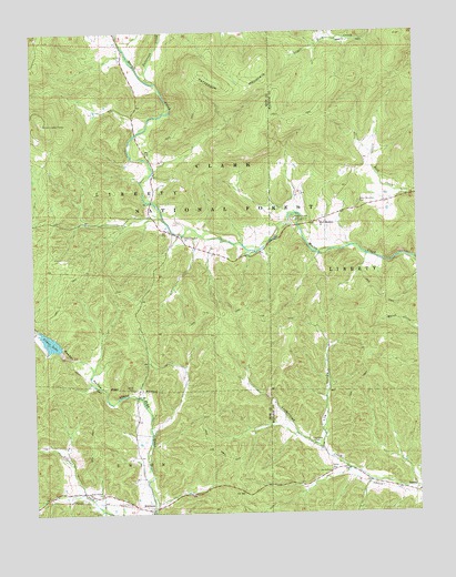
Des Arc NE, MO USGS Topographic Map
Click on map above to begin viewing in our Map Viewer.

This topographic map contains these locations and features:
Feature Name Type Latitude Longitude GNIS ID View Map
Black Mountain CemeteryCemeteryN37.4556°W90.5184°748884View Map
Black Mountain ChurchChurchN37.4506°W90.5315°748885View Map
Black Mountain SchoolSchoolN37.4495°W90.5301°748103View Map
Blue SchoolSchoolN37.4564°W90.5857°748101View Map
Collins CemeteryCemeteryN37.3778°W90.5943°749427View Map
Collins SchoolSchoolN37.3806°W90.6035°748102View Map
Crane LakeReservoirN37.4203°W90.6214°758271View Map
Crane Lake DamDamN37.4184°W90.6168°763669View Map
Crane Lake TrailTrailN37.4189°W90.6173°753933View Map
Crane Lookout TowerTowerN37.4764°W90.6207°755040View Map
Davis CemeteryCemeteryN37.3859°W90.5296°749575View Map
Free United ChurchChurchN37.3803°W90.6037°749987View Map
JewettPopulated PlaceN37.3803°W90.5015°750507View Map
Jewett SchoolSchoolN37.3806°W90.5015°748104View Map
Kelley CemeteryCemeteryN37.3862°W90.5290°750571View Map
Liberty United ChurchChurchN37.4470°W90.5765°750703View Map
Marble Creek CampgroundLocaleN37.4512°W90.5407°721855View Map
MinimumPopulated PlaceN37.3762°W90.5876°751119View Map
Orr Hollow CreekStreamN37.4511°W90.5822°2514795View Map
Patterson CreekStreamN37.4870°W90.5843°751510View Map
Patterson MountainSummitN37.4895°W90.5690°751511View Map
Reader HollowValleyN37.3989°W90.5890°751820View Map
Shoemaker CemeteryCemeteryN37.3937°W90.5348°752135View Map
Tilk HollowValleyN37.3920°W90.5318°755576View Map
Township of LibertyCivilN37.4216°W90.5059°766985View Map
White CemeteryCemeteryN37.4073°W90.5932°752846View Map
White HollowValleyN37.4062°W90.5898°736660View Map
Whitworth Mill (historical)LocaleN37.3806°W90.5746°736662View Map

Note: Coordinates in the location and feature list above are referenced to NAD83 datum.


Copyright (C) 2008-2025 Ryan Niemi / Sunset Dynamics ... All Rights Reserved