TopoQuest Logo
Do you find TopoQuest useful?
Help keep TopoQuest running and adding new maps/features by donating!
Bitcoin:  19c7KJd3qBynnjoSw5npx9KScwjBe4ifkT
Litecoin:  LXs6TkuXGGXo1vDsWCkWVdjQX94eUKd6ui
Home View Maps Find Maps Find Places Resources & Links


Des Arc West, Arkansas Topographic Map

USGS Map Title: Des Arc West, AR
USGS Map MRC: 34091H5
DRG (GeoTIFF) Download: o34091h5.tif


Neighboring USGS Topographic Map Quads:


  Walker, AR  
35091A6
 

  Jasmine, AR  
35091A5
 

  Gregory SW, AR  
35091A4
 

  Hickory Plains, AR  
34091H6
 

  Des Arc West, AR  
34091H5
 

  Des Arc East, AR  
34091H4
 

  Carlisle, AR  
34091G6
 

  Hazen, AR  
34091G5
 

  De Valls Bluff, AR  
34091G4


Map MRC Location:

N35°
W92°
N35°
W91°
H8 H7 H6 H5 H4 H3 H2 H1
G8 G7 G6 G5 G4 G3 G2 G1
F8 F7 F6 F5 F4 F3 F2 F1
E8 E7 E6 E5 E4 E3 E2 E1
D8 D7 D6 D5 D4 D3 D2 D1
C8 C7 C6 C5 C4 C3 C2 C1
B8 B7 B6 B5 B4 B3 B2 B1
A8 A7 A6 A5 A4 A3 A2 A1
N34°
W92°
N34°
W91°

Des Arc West, AR USGS 1:24K Topographic Map Preview:
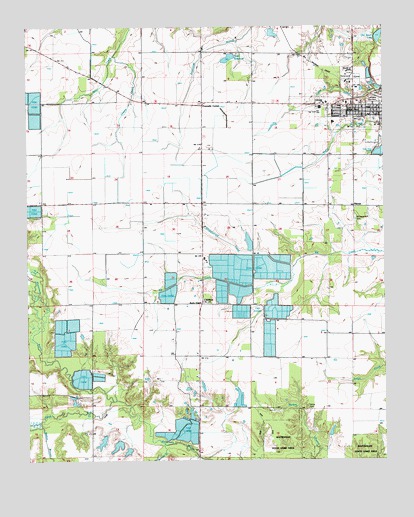
Des Arc West, AR USGS Topographic Map
Click on map above to begin viewing in our Map Viewer.

This topographic map contains these locations and features:
Feature Name Type Latitude Longitude GNIS ID View Map
Abbington Church (historical)ChurchN34.9784°W91.5771°59970View Map
Barnes CreekStreamN34.8795°W91.5771°76236View Map
Bob Norman Airstrip (historical)AirportN34.9752°W91.5265°2650727View Map
ChildersPopulated PlaceN34.9206°W91.5643°56958View Map
Church of ChristChurchN34.9870°W91.5110°83375View Map
City of Des ArcCivilN34.9767°W91.5064°2404222View Map
Des Arc Ambulance ServiceBuildingN34.9773°W91.5048°2119097View Map
Des Arc Elementary SchoolSchoolN34.9724°W91.5178°59989View Map
Faras RunStreamN34.8923°W91.5951°69547View Map
Fourmile CornerPopulated PlaceN34.9784°W91.5637°76964View Map
HarrysPopulated PlaceN34.9481°W91.5107°60001View Map
Lakeside CemeteryCemeteryN34.9787°W91.5037°50957View Map
Lakeside ChurchChurchN34.9779°W91.5212°83374View Map
Lasses CreekStreamN34.9920°W91.5946°50992View Map
Mellon BranchStreamN34.8851°W91.6204°51901View Map
Morris ChapelChurchN34.9220°W91.5649°83373View Map
Morris Chapel (historical)ChurchN34.9209°W91.5843°60028View Map
Oak Grove CemeteryCemeteryN34.9806°W91.5004°52889View Map
Oak Prairie Church (historical)ChurchN34.9206°W91.5635°83362View Map
Oak Prairie School (historical)SchoolN34.9204°W91.5660°60033View Map
Oak Prairie Volunteer Fire StationBuildingN34.9207°W91.5635°2116890View Map
Old River LakeLakeN34.9972°W91.5014°75057View Map
Philadelphia Church (historical)ChurchN34.9776°W91.5440°60038View Map
Tates ReservoirReservoirN34.9909°W91.5542°80323View Map
Tates Reservoir DamDamN34.9918°W91.5535°80322View Map
Taylor AirstripAirportN34.9867°W91.5481°2650726View Map
Township of White RiverCivilN34.9376°W91.5366°69012View Map
Whippoorwill CemeteryCemeteryN34.9445°W91.5101°56234View Map
Whippoorwill Church (historical)ChurchN34.9440°W91.5104°60064View Map
Whippoorwill CreekStreamN34.9306°W91.5321°56235View Map
White CemeteryCemeteryN34.8904°W91.5276°56246View Map

Note: Coordinates in the location and feature list above are referenced to NAD83 datum.


Copyright (C) 2008-2024 Ryan Niemi / Sunset Dynamics ... All Rights Reserved