TopoQuest Logo
Do you find TopoQuest useful?
Help keep TopoQuest running and adding new maps/features by donating!
Bitcoin:  19c7KJd3qBynnjoSw5npx9KScwjBe4ifkT
Litecoin:  LXs6TkuXGGXo1vDsWCkWVdjQX94eUKd6ui
Home View Maps Find Maps Find Places Resources & Links


Devils Nose, California Topographic Map

USGS Map Title: Devils Nose, CA
USGS Map MRC: 38120D4
DRG (GeoTIFF) Download: o38120d4.tif


Neighboring USGS Topographic Map Quads:


  Omo Ranch, CA  
38120E5
 

  Caldor, CA  
38120E4
 

  Peddler Hill, CA  
38120E3
 

  West Point, CA  
38120D5
 

  Devils Nose, CA  
38120D4
 

  Garnet Hill, CA  
38120D3
 

  Rail Road Flat, CA  
38120C5
 

  Fort Mountain, CA  
38120C4
 

  Dorrington, CA  
38120C3


Map MRC Location:

N39°
W121°
N39°
W120°
H8 H7 H6 H5 H4 H3 H2 H1
G8 G7 G6 G5 G4 G3 G2 G1
F8 F7 F6 F5 F4 F3 F2 F1
E8 E7 E6 E5 E4 E3 E2 E1
D8 D7 D6 D5 D4 D3 D2 D1
C8 C7 C6 C5 C4 C3 C2 C1
B8 B7 B6 B5 B4 B3 B2 B1
A8 A7 A6 A5 A4 A3 A2 A1
N38°
W121°
N38°
W120°

Devils Nose, CA USGS 1:24K Topographic Map Preview:
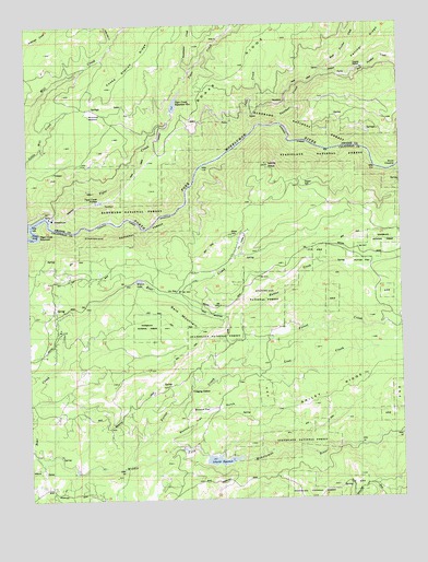
Devils Nose, CA USGS Topographic Map
Click on map above to begin viewing in our Map Viewer.

This topographic map contains these locations and features:
Feature Name Type Latitude Longitude GNIS ID View Map
Bald MountainSummitN38.4194°W120.4435°256460View Map
Boston FlatFlatN38.3977°W120.4452°257365View Map
Boston Flat GulchValleyN38.3927°W120.4599°257366View Map
Bruce CrossingCrossingN38.4616°W120.3777°1655849View Map
Cooks RanchLocaleN38.4424°W120.4296°1652929View Map
Deer CreekStreamN38.4707°W120.4263°259206View Map
Devils NoseSummitN38.4630°W120.4202°259324View Map
Doaks RidgeRidgeN38.4824°W120.4419°259414View Map
East Panther CreekStreamN38.4860°W120.4016°266681View Map
Forest CreekStreamN38.3846°W120.4691°260253View Map
Hunter CreekStreamN38.4135°W120.4280°261640View Map
Hunter FlatFlatN38.4360°W120.3891°261642View Map
KranLocaleN38.4066°W120.4605°1652933View Map
Lily GapGapN38.4299°W120.4502°262456View Map
Lily ValleyFlatN38.4419°W120.4296°262469View Map
Lion CreekStreamN38.4102°W120.4319°262499View Map
Little Tiger CreekStreamN38.4985°W120.4316°262739View Map
Long John CreekStreamN38.4957°W120.4719°262848View Map
McClainLocaleN38.4080°W120.4452°1652932View Map
Middle Fork 82-002 DamDamN38.3849°W120.4427°1663544View Map
Panther CreekStreamN38.4735°W120.4166°264471View Map
Panther PortalTunnelN38.4816°W120.3752°1655202View Map
PorterPopulated PlaceN38.3941°W120.4252°1656230View Map
Schaads ReservoirReservoirN38.3851°W120.4375°265902View Map
Sugar SpringSpringN38.4575°W120.4081°267856View Map
Sweetwater CreekStreamN38.4871°W120.4455°268025View Map
Tiger CreekStreamN38.4496°W120.4933°268274View Map
Tiger Creek ConduitCanalN38.4757°W120.4321°268275View Map
Tiger Creek ForbayReservoirN38.4535°W120.4771°268276View Map
Tiger Creek Forebay 97-126 DamDamN38.4532°W120.4777°1663683View Map
Tiger Creek Picnic AreaLocaleN38.4452°W120.4996°1733369View Map
Tiger Creek Regulation ReservoirReservoirN38.4791°W120.4512°268277View Map
Tiger Creek Regulator 97-104 DamDamN38.4766°W120.4527°1663660View Map
Tiger Creek ReservoirReservoirN38.4443°W120.4998°236349View Map
West Panther CreekStreamN38.4860°W120.4016°268930View Map
West Point Reg 1024-002 DamDamN38.4099°W120.3810°1664163View Map
Whitmore MeadowFlatN38.4760°W120.4783°269044View Map
Wilson LakeReservoirN38.4328°W120.4638°269207View Map

Note: Coordinates in the location and feature list above are referenced to NAD83 datum.


Copyright (C) 2008-2025 Ryan Niemi / Sunset Dynamics ... All Rights Reserved