TopoQuest Logo
Do you find TopoQuest useful?
Help keep TopoQuest running and adding new maps/features by donating!
Bitcoin:  19c7KJd3qBynnjoSw5npx9KScwjBe4ifkT
Litecoin:  LXs6TkuXGGXo1vDsWCkWVdjQX94eUKd6ui
Home View Maps Find Maps Find Places Resources & Links


Omo Ranch, California Topographic Map

USGS Map Title: Omo Ranch, CA
USGS Map MRC: 38120E5
DRG (GeoTIFF) Download: o38120e5.tif


Neighboring USGS Topographic Map Quads:


  Camino, CA  
38120F6
 

  Sly Park, CA  
38120F5
 

  Old Iron Mountain, CA  
38120F4
 

  Aukum, CA  
38120E6
 

  Omo Ranch, CA  
38120E5
 

  Caldor, CA  
38120E4
 

  Pine Grove, CA  
38120D6
 

  West Point, CA  
38120D5
 

  Devils Nose, CA  
38120D4


Map MRC Location:

N39°
W121°
N39°
W120°
H8 H7 H6 H5 H4 H3 H2 H1
G8 G7 G6 G5 G4 G3 G2 G1
F8 F7 F6 F5 F4 F3 F2 F1
E8 E7 E6 E5 E4 E3 E2 E1
D8 D7 D6 D5 D4 D3 D2 D1
C8 C7 C6 C5 C4 C3 C2 C1
B8 B7 B6 B5 B4 B3 B2 B1
A8 A7 A6 A5 A4 A3 A2 A1
N38°
W121°
N38°
W120°

Omo Ranch, CA USGS 1:24K Topographic Map Preview:
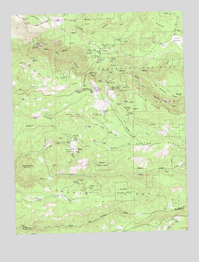
Omo Ranch, CA USGS Topographic Map
Click on map above to begin viewing in our Map Viewer.

This topographic map contains these locations and features:
Feature Name Type Latitude Longitude GNIS ID View Map
Andreason CemeteryCemeteryN38.5291°W120.5810°256245View Map
Andreason MillLocaleN38.5291°W120.5777°256246View Map
April Fool MineMineN38.5821°W120.5496°256301View Map
Arctic MineMineN38.6194°W120.5708°256334View Map
Bell MineMineN38.5491°W120.5738°256805View Map
Big MountainSummitN38.5766°W120.5052°256975View Map
Big ReservoirReservoirN38.5473°W120.5566°256991View Map
Black Oak MineMineN38.5907°W120.5691°257145View Map
BrownsvilleLocaleN38.5682°W120.5594°257519View Map
Caldor MineMineN38.5988°W120.5610°257822View Map
Cement HillSummitN38.5607°W120.6127°1658247View Map
Chic MineMineN38.5666°W120.5413°258259View Map
Christian MineMineN38.6060°W120.5560°258351View Map
Clear CreekStreamN38.6135°W120.5594°258428View Map
Coles StationLocaleN38.6210°W120.5921°258589View Map
Consolidated MineMineN38.5696°W120.5385°258650View Map
Cosumnes Copper MineMineN38.6069°W120.6063°258747View Map
Crystal MineMineN38.5913°W120.5546°258966View Map
Dark Canyon CreekStreamN38.5666°W120.5758°259058View Map
Deep Channel MineMineN38.5549°W120.5794°264316View Map
Dogtown CreekStreamN38.5919°W120.5544°259449View Map
Dorsey MineMineN38.5505°W120.5610°259499View Map
Drummond GulchValleyN38.5427°W120.5821°259537View Map
Drusy MineMineN38.5541°W120.5930°259539View Map
Eagle MineMineN38.5888°W120.5874°259666View Map
Farnham RidgeRidgeN38.5207°W120.5552°260055View Map
Glorianna MineMineN38.6032°W120.5669°260613View Map
Gold Note MineMineN38.5735°W120.5405°260655View Map
Henrys DiggingsLocaleN38.6032°W120.5569°261272View Map
Hidden Treasure MineMineN38.5596°W120.5716°261308View Map
Independence MineMineN38.5721°W120.5469°261700View Map
Indian CreekStreamN38.5310°W120.6016°261717View Map
Indian Diggings CemeteryCemeteryN38.5507°W120.5860°225873View Map
Indian Diggings Elementary SchoolSchoolN38.5811°W120.5776°225874View Map
Irish Slide MineMineN38.5982°W120.5519°261806View Map
Jones MineMineN38.5952°W120.5530°262004View Map
Last Chance MineMineN38.6088°W120.5471°262336View Map
Leoni Fire TankLocaleN38.5921°W120.5335°275008View Map
Leoni MeadowFlatN38.6085°W120.5052°262413View Map
Liddicoat SpringSpringN38.5377°W120.5360°275009View Map
Little Bill MineMineN38.5982°W120.5627°262541View Map
Little MountainSummitN38.5921°W120.5427°1658974View Map
Little ReservoirReservoirN38.5535°W120.5830°262699View Map
Loveless DredgingsLocaleN38.5663°W120.6085°262982View Map
Lucky Jack MineMineN38.5919°W120.5541°263064View Map
Marble QuarryMineN38.5466°W120.5802°263199View Map
Marble SpringsSpringN38.5475°W120.5798°263201View Map
Monitor MineMineN38.5738°W120.5421°263739View Map
O'Connor GulchValleyN38.5913°W120.5705°264266View Map
Old Chinese MineMineN38.6032°W120.5610°264317View Map
Old Empire MineMineN38.5971°W120.5641°264324View Map
Omo MineMineN38.5838°W120.5738°264353View Map
Omo RanchPopulated PlaceN38.5813°W120.5733°1659305View Map
Oregon GulchValleyN38.5338°W120.5119°264388View Map
Patterson MineMineN38.5269°W120.5710°264562View Map
Payne MineMineN38.6060°W120.5524°264576View Map
Peacock MineMineN38.5855°W120.5602°264589View Map
Pioneer Fire Protection District Station 31 WillowBuildingN38.6200°W120.6126°2623993View Map
Pioneer Fire Protection District Station 37 Omo RanchBuildingN38.5819°W120.5782°2624066View Map
Polar Bear MineMineN38.6016°W120.5694°264904View Map
Potosi MineMineN38.5824°W120.5530°265001View Map
Relief MineMineN38.5513°W120.5919°265372View Map
Richmond MineMineN38.5805°W120.5471°265412View Map
Round MountainSummitN38.5385°W120.6169°265605View Map
Slug GulchFlatN38.6005°W120.6130°266306View Map
Slug Gulch MineMineN38.5988°W120.6108°266309View Map
Sopiago CreekStreamN38.5891°W120.5630°267397View Map
Stillwagon MineMineN38.5855°W120.5558°267747View Map
Syracuse MineMineN38.5819°W120.5449°268044View Map
Telegraph MineMineN38.5463°W120.5824°268122View Map
Texas MineMineN38.5813°W120.5555°268168View Map
Tomcat MineMineN38.5999°W120.5621°268344View Map
Trinity MineMineN38.6035°W120.5635°268410View Map
Volcano MineMineN38.5674°W120.5649°268717View Map
Washington MineMineN38.5696°W120.5410°268797View Map
Webfoot MineMineN38.5669°W120.5827°268836View Map
Willow SchoolSchoolN38.6196°W120.6127°269182View Map
Yellow Aster MineMineN38.5666°W120.5391°269338View Map
Yellowjacket MineMineN38.5477°W120.5821°269359View Map

Note: Coordinates in the location and feature list above are referenced to NAD83 datum.


Copyright (C) 2008-2025 Ryan Niemi / Sunset Dynamics ... All Rights Reserved