TopoQuest Logo
Do you find TopoQuest useful?
Help keep TopoQuest running and adding new maps/features by donating!
Bitcoin:  19c7KJd3qBynnjoSw5npx9KScwjBe4ifkT
Litecoin:  LXs6TkuXGGXo1vDsWCkWVdjQX94eUKd6ui
Home View Maps Find Maps Find Places Resources & Links


Fort Mountain, California Topographic Map

USGS Map Title: Fort Mountain, CA
USGS Map MRC: 38120C4
DRG (GeoTIFF) Download: o38120c4.tif


Neighboring USGS Topographic Map Quads:


  West Point, CA  
38120D5
 

  Devils Nose, CA  
38120D4
 

  Garnet Hill, CA  
38120D3
 

  Rail Road Flat, CA  
38120C5
 

  Fort Mountain, CA  
38120C4
 

  Dorrington, CA  
38120C3
 

  Calaveritas, CA  
38120B5
 

  Murphys, CA  
38120B4
 

  Stanislaus, CA  
38120B3


Map MRC Location:

N39°
W121°
N39°
W120°
H8 H7 H6 H5 H4 H3 H2 H1
G8 G7 G6 G5 G4 G3 G2 G1
F8 F7 F6 F5 F4 F3 F2 F1
E8 E7 E6 E5 E4 E3 E2 E1
D8 D7 D6 D5 D4 D3 D2 D1
C8 C7 C6 C5 C4 C3 C2 C1
B8 B7 B6 B5 B4 B3 B2 B1
A8 A7 A6 A5 A4 A3 A2 A1
N38°
W121°
N38°
W120°

Fort Mountain, CA USGS 1:24K Topographic Map Preview:
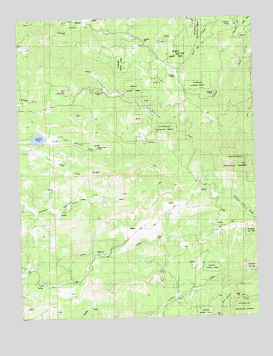
Fort Mountain, CA USGS Topographic Map
Click on map above to begin viewing in our Map Viewer.

This topographic map contains these locations and features:
Feature Name Type Latitude Longitude GNIS ID View Map
Bingham 82 DamDamN38.3255°W120.4944°1663542View Map
Black Wonder MineMineN38.3602°W120.4160°257166View Map
Central Calaveras Fire and Rescue Protection District Station 2BuildingN38.2633°W120.4802°2624501View Map
Creightons MeadowFlatN38.3719°W120.3899°258906View Map
Dutch CreekStreamN38.3530°W120.4191°259623View Map
Eagle Ridge Ranch AirportAirportN38.3239°W120.4739°1653846View Map
Esperanza ValleyValleyN38.2969°W120.4866°259962View Map
Father and Son MineMineN38.3210°W120.4594°260059View Map
Fine Gold MineMineN38.3438°W120.4566°260107View Map
Fort JonesPopulated PlaceN38.2574°W120.4196°1652923View Map
Fort MountainSummitN38.3430°W120.4735°260279View Map
FuchsPopulated PlaceN38.3474°W120.4560°1655204View Map
Gold King MineMineN38.3427°W120.3966°260650View Map
Hackerdam MineMineN38.3735°W120.3952°1675890View Map
HamsPopulated PlaceN38.3741°W120.4621°1675891View Map
Kaye CreekStreamN38.3325°W120.4247°2496979View Map
Mitchells MillLocaleN38.3652°W120.4330°263712View Map
Pine RidgeRidgeN38.3099°W120.4638°264776View Map
Rail Road Flat Census Designated PlaceCensusN38.3168°W120.4910°2409122View Map
Redhawk LakeReservoirN38.3252°W120.4902°257821View Map
Reid 1492 DamDamN38.2982°W120.4510°1664333View Map
Rim Rock RanchLocaleN38.3144°W120.4766°265426View Map
SandozPopulated PlaceN38.3480°W120.4305°1655203View Map
Swiss RanchLocaleN38.2752°W120.4588°268037View Map
Toutch MillLocaleN38.3063°W120.4058°1652922View Map

Note: Coordinates in the location and feature list above are referenced to NAD83 datum.


Copyright (C) 2008-2025 Ryan Niemi / Sunset Dynamics ... All Rights Reserved