TopoQuest Logo
Do you find TopoQuest useful?
Help keep TopoQuest running and adding new maps/features by donating!
Bitcoin:  19c7KJd3qBynnjoSw5npx9KScwjBe4ifkT
Litecoin:  LXs6TkuXGGXo1vDsWCkWVdjQX94eUKd6ui
Home View Maps Find Maps Find Places Resources & Links


Imnaha Creek, Oregon Topographic Map

USGS Map Title: Imnaha Creek, OR
USGS Map MRC: 42122F3
DRG (GeoTIFF) Download: o42122f3.tif


Neighboring USGS Topographic Map Quads:


  Prospect North, OR  
42122G4
 

  Red Blanket Mountain, OR  
42122G3
 

  Union Peak, OR  
42122G2
 

  Prospect South, OR  
42122F4
 

  Imnaha Creek, OR  
42122F3
 

  Devils Peak, OR  
42122F2
 

  Big Butte Springs, OR  
42122E4
 

  Rustler Peak, OR  
42122E3
 

  Pelican Butte, OR  
42122E2


Map MRC Location:

N43°
W123°
N43°
W122°
H8 H7 H6 H5 H4 H3 H2 H1
G8 G7 G6 G5 G4 G3 G2 G1
F8 F7 F6 F5 F4 F3 F2 F1
E8 E7 E6 E5 E4 E3 E2 E1
D8 D7 D6 D5 D4 D3 D2 D1
C8 C7 C6 C5 C4 C3 C2 C1
B8 B7 B6 B5 B4 B3 B2 B1
A8 A7 A6 A5 A4 A3 A2 A1
N42°
W123°
N42°
W122°

Imnaha Creek, OR USGS 1:24K Topographic Map Preview:
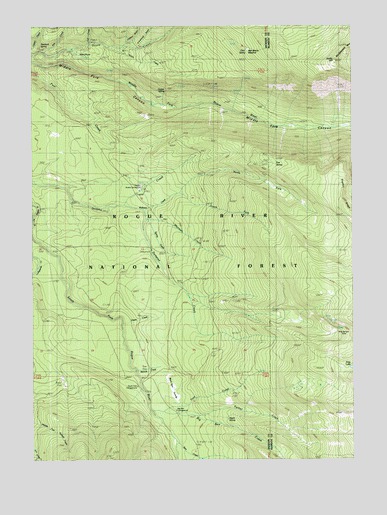
Imnaha Creek, OR USGS Topographic Map
Click on map above to begin viewing in our Map Viewer.

This topographic map contains these locations and features:
Feature Name Type Latitude Longitude GNIS ID View Map
Aspen SpringSpringN42.6366°W122.3002°1137331View Map
Bessie Rock TrailTrailN42.7310°W122.3186°1137957View Map
Big Ben Campground (historical)ParkN42.6374°W122.3220°1156865View Map
Big Ben CreekStreamN42.6390°W122.3292°1137969View Map
Black Bear SwampSwampN42.6455°W122.3216°1138172View Map
Fall CreekStreamN42.7449°W122.3523°1141980View Map
Fantail CreekStreamN42.6379°W122.3134°1142010View Map
Fantail SpringSpringN42.6500°W122.2882°1142011View Map
Fire CreekStreamN42.7421°W122.3698°1142124View Map
Fire SpringSpringN42.7100°W122.2811°1142125View Map
Foot CreekStreamN42.7379°W122.3748°1142292View Map
Frey CreekStreamN42.6390°W122.3256°1142480View Map
Frog LakeLakeN42.6513°W122.2517°1142499View Map
Geyser SpringSpringN42.7313°W122.3234°1142708View Map
Green CreekStreamN42.6643°W122.3403°1143028View Map
Halifax CreekStreamN42.7201°W122.2500°1143218View Map
Hemlock Lake TrailTrailN42.6315°W122.2795°1143482View Map
Hemlock SpringSpringN42.7445°W122.3725°1143483View Map
Imnaha Guard StationLocaleN42.7040°W122.3320°1144007View Map
Imnaha Recreation SiteLocaleN42.7026°W122.3345°1144005View Map
Kerby CreekStreamN42.7435°W122.3439°1144564View Map
Kerby HillSummitN42.7399°W122.2575°1144567View Map
King Spruce CampLocaleN42.6610°W122.2564°1144618View Map
King Spruce TrailTrailN42.6662°W122.2614°1144619View Map
Lodgepole CreekStreamN42.6860°W122.3714°1145321View Map
Lookout GulchValleyN42.7439°W122.3404°1145465View Map
Mudjekeewis MountainSummitN42.7462°W122.2506°1146620View Map
Mudjekeewis TrailTrailN42.7432°W122.2853°1146621View Map
Nichols Camp (historical)LocaleN42.6510°W122.3320°1146822View Map
Nichols CreekStreamN42.6501°W122.3353°1146823View Map
North Fork Wallowa CreekStreamN42.7018°W122.3206°1147018View Map
Otter SpringSpringN42.7433°W122.2918°1147295View Map
Rogue River National ForestForestN42.6773°W122.3163°1155110View Map
Sam CreekStreamN42.6307°W122.3203°1149011View Map
Seven Lakes TrailTrailN42.6546°W122.2817°1149250View Map
Snowbrush GulchValleyN42.7438°W122.3343°1149826View Map
South Fork Recreation SiteLocaleN42.6415°W122.3345°1156866View Map
South Fork Wallowa CreekStreamN42.7021°W122.3198°1150039View Map
Spring CreekStreamN42.6940°W122.3309°1150163View Map
Sumpter CreekStreamN42.6982°W122.3395°1150648View Map
Sumpter Creek Camp (historical)LocaleN42.6832°W122.3289°1156867View Map
Wallowa CreekStreamN42.6982°W122.3400°1151860View Map
Whitman CreekStreamN42.6940°W122.3311°1152277View Map

Note: Coordinates in the location and feature list above are referenced to NAD83 datum.


Copyright (C) 2008-2025 Ryan Niemi / Sunset Dynamics ... All Rights Reserved