TopoQuest Logo
Do you find TopoQuest useful?
Help keep TopoQuest running and adding new maps/features by donating!
Bitcoin:  19c7KJd3qBynnjoSw5npx9KScwjBe4ifkT
Litecoin:  LXs6TkuXGGXo1vDsWCkWVdjQX94eUKd6ui
Home View Maps Find Maps Find Places Resources & Links


Blocksburg, California Topographic Map

USGS Map Title: Blocksburg, CA
USGS Map MRC: 40123C6
DRG (GeoTIFF) Download: o40123c6.tif


Neighboring USGS Topographic Map Quads:


  Bridgeville, CA  
40123D7
 

  Larabee Valley, CA  
40123D6
 

  Dinsmore, CA  
40123D5
 

  Myers Flat, CA  
40123C7
 

  Blocksburg, CA  
40123C6
 

  Black Lassic, CA  
40123C5
 

  Miranda, CA  
40123B7
 

  Fort Seward, CA  
40123B6
 

  Alderpoint, CA  
40123B5


Map MRC Location:

N41°
W124°
N41°
W123°
H8 H7 H6 H5 H4 H3 H2 H1
G8 G7 G6 G5 G4 G3 G2 G1
F8 F7 F6 F5 F4 F3 F2 F1
E8 E7 E6 E5 E4 E3 E2 E1
D8 D7 D6 D5 D4 D3 D2 D1
C8 C7 C6 C5 C4 C3 C2 C1
B8 B7 B6 B5 B4 B3 B2 B1
A8 A7 A6 A5 A4 A3 A2 A1
N40°
W124°
N40°
W123°

Blocksburg, CA USGS 1:24K Topographic Map Preview:
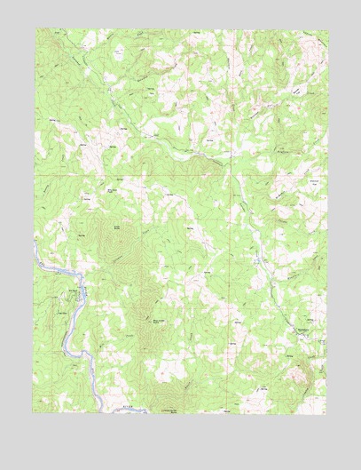
Blocksburg, CA USGS Topographic Map
Click on map above to begin viewing in our Map Viewer.

This topographic map contains these locations and features:
Feature Name Type Latitude Longitude GNIS ID View Map
Barn CreekStreamN40.3507°W123.6673°218677View Map
Basin CreekStreamN40.2513°W123.7031°218718View Map
Billy Goat PeakSummitN40.3221°W123.7209°1658061View Map
BlocksburgPopulated PlaceN40.2760°W123.6364°219454View Map
Blocksburg Post OfficePost OfficeN40.2760°W123.6378°2760020View Map
Blue Jacket ButteSummitN40.2796°W123.7006°219495View Map
Bosworth CreekStreamN40.3535°W123.7209°219671View Map
Boulder FlatFlatN40.3546°W123.6395°219694View Map
Boulder Flat CreekStreamN40.3340°W123.6642°266480View Map
Coleman CreekStreamN40.2940°W123.7303°221364View Map
Cooper CreekStreamN40.3085°W123.6586°266597View Map
Eel RockPopulated PlaceN40.2890°W123.7331°222998View Map
Frost CreekStreamN40.3729°W123.7434°223960View Map
Great ButteSummitN40.3104°W123.7178°1658662View Map
Hayfield CreekStreamN40.3324°W123.6631°266798View Map
Martin CreekStreamN40.3660°W123.7359°228171View Map
McMahon CreekStreamN40.3204°W123.6639°266991View Map
Mill CreekStreamN40.2682°W123.7259°228675View Map
Mountain CreekStreamN40.2943°W123.6509°267037View Map
Oak GlenPopulated PlaceN40.2824°W123.7411°1659265View Map
Payton RanchLocaleN40.3404°W123.7011°230430View Map
Perry RanchLocaleN40.3401°W123.7278°1665546View Map
Round Prairie RanchLocaleN40.3592°W123.7208°2629459View Map
Sherman FlatFlatN40.3251°W123.6317°232970View Map
Thurman CreekStreamN40.3340°W123.6698°255143View Map
Windbigler RanchLocaleN40.3696°W123.7314°1665556View Map

Note: Coordinates in the location and feature list above are referenced to NAD83 datum.


Copyright (C) 2008-2025 Ryan Niemi / Sunset Dynamics ... All Rights Reserved