TopoQuest Logo
Do you find TopoQuest useful?
Help keep TopoQuest running and adding new maps/features by donating!
Bitcoin:  19c7KJd3qBynnjoSw5npx9KScwjBe4ifkT
Litecoin:  LXs6TkuXGGXo1vDsWCkWVdjQX94eUKd6ui
Home View Maps Find Maps Find Places Resources & Links


Larabee Valley, California Topographic Map

USGS Map Title: Larabee Valley, CA
USGS Map MRC: 40123D6
DRG (GeoTIFF) Download: o40123d6.tif


Neighboring USGS Topographic Map Quads:


  Yager Junction, CA  
40123E7
 

  Showers Mountain, CA  
40123E6
 

  Blake Mountain, CA  
40123E5
 

  Bridgeville, CA  
40123D7
 

  Larabee Valley, CA  
40123D6
 

  Dinsmore, CA  
40123D5
 

  Myers Flat, CA  
40123C7
 

  Blocksburg, CA  
40123C6
 

  Black Lassic, CA  
40123C5


Map MRC Location:

N41°
W124°
N41°
W123°
H8 H7 H6 H5 H4 H3 H2 H1
G8 G7 G6 G5 G4 G3 G2 G1
F8 F7 F6 F5 F4 F3 F2 F1
E8 E7 E6 E5 E4 E3 E2 E1
D8 D7 D6 D5 D4 D3 D2 D1
C8 C7 C6 C5 C4 C3 C2 C1
B8 B7 B6 B5 B4 B3 B2 B1
A8 A7 A6 A5 A4 A3 A2 A1
N40°
W124°
N40°
W123°

Larabee Valley, CA USGS 1:24K Topographic Map Preview:
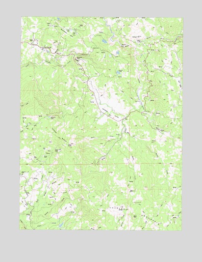
Larabee Valley, CA USGS Topographic Map
Click on map above to begin viewing in our Map Viewer.

This topographic map contains these locations and features:
Feature Name Type Latitude Longitude GNIS ID View Map
Alder FlatFlatN40.4954°W123.7303°218101View Map
Azbil FlatFlatN40.4224°W123.7317°218486View Map
BallySummitN40.4268°W123.7284°1657992View Map
Bliss RanchLocaleN40.4793°W123.7303°1665524View Map
Buck Mountain SchoolSchoolN40.4821°W123.7337°220001View Map
Buck RockPillarN40.3829°W123.6634°220011View Map
Burr CreekStreamN40.4688°W123.6614°220236View Map
Burr ValleyValleyN40.4649°W123.6325°220240View Map
Butte CreekStreamN40.4479°W123.6564°220290View Map
Cottrell RanchLocaleN40.4857°W123.7420°221666View Map
Crazy SpringSpringN40.4248°W123.7142°221813View Map
Davis CreekStreamN40.3915°W123.7370°222043View Map
Dry LakeSwampN40.4902°W123.7085°222652View Map
Fern PatchAreaN40.4171°W123.7406°223463View Map
Gunlock RanchLocaleN40.4949°W123.7042°224740View Map
Horse CreekStreamN40.4324°W123.6714°225596View Map
Indian CabinLocaleN40.4213°W123.7217°225854View Map
Kergerson LakeLakeN40.4410°W123.7289°226529View Map
Knack CreekStreamN40.3790°W123.7481°226646View Map
Larabee ButtesSummitN40.4307°W123.7225°1658940View Map
Larabee ValleyValleyN40.4415°W123.6714°226869View Map
Little Van Duzen RiverStreamN40.4821°W123.6628°266930View Map
McClellan MountainSummitN40.4938°W123.7195°228296View Map
McClellan RockSummitN40.4751°W123.7086°228298View Map
Middle Branch Mill CreekStreamN40.3935°W123.7367°228573View Map
Muddy CreekStreamN40.4735°W123.7264°229276View Map
Mule CreekStreamN40.4288°W123.6745°229301View Map
Potato PatchAreaN40.4179°W123.7334°230983View Map
Red RockPillarN40.3976°W123.6639°231371View Map
Snow Line RanchLocaleN40.3828°W123.7433°2629458View Map
Snowline Fox FarmLocaleN40.3829°W123.7434°234784View Map
Sweasey LakeLakeN40.4674°W123.6756°235881View Map
Swift CreekStreamN40.4293°W123.6736°235903View Map
Thompson CreekStreamN40.4185°W123.6250°268230View Map
Turtle LakeSwampN40.4922°W123.7126°236668View Map

Note: Coordinates in the location and feature list above are referenced to NAD83 datum.


Copyright (C) 2008-2025 Ryan Niemi / Sunset Dynamics ... All Rights Reserved