TopoQuest Logo
Do you find TopoQuest useful?
Help keep TopoQuest running and adding new maps/features by donating!
Bitcoin:  19c7KJd3qBynnjoSw5npx9KScwjBe4ifkT
Litecoin:  LXs6TkuXGGXo1vDsWCkWVdjQX94eUKd6ui
Home View Maps Find Maps Find Places Resources & Links


Hoagland, Indiana Topographic Map

USGS Map Title: Hoagland, IN
USGS Map MRC: 40084H8
DRG (GeoTIFF) Download: o40084h8.tif


Neighboring USGS Topographic Map Quads:


  Fort Wayne East, IN  
41085A1
 

  Maples, IN  
41084A8
 

  Woodburn South, IN  
41084A7
 

  Poe, IN  
40085H1
 

  Hoagland, IN  
40084H8
 

  Dixon, IN  
40084H7
 

  Preble, IN  
40085G1
 

  Decatur, IN  
40084G8
 

  Wren, OH  
40084G7


Map MRC Location:

N41°
W85°
N41°
W84°
H8 H7 H6 H5 H4 H3 H2 H1
G8 G7 G6 G5 G4 G3 G2 G1
F8 F7 F6 F5 F4 F3 F2 F1
E8 E7 E6 E5 E4 E3 E2 E1
D8 D7 D6 D5 D4 D3 D2 D1
C8 C7 C6 C5 C4 C3 C2 C1
B8 B7 B6 B5 B4 B3 B2 B1
A8 A7 A6 A5 A4 A3 A2 A1
N40°
W85°
N40°
W84°

Hoagland, IN USGS 1:24K Topographic Map Preview:
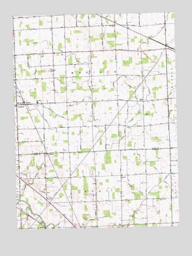
Hoagland, IN USGS Topographic Map
Click on map above to begin viewing in our Map Viewer.

This topographic map contains these locations and features:
Feature Name Type Latitude Longitude GNIS ID View Map
Adams County Sand and Gravel PitMineN40.8772°W84.9539°2634359View Map
Alpha CemeteryCemeteryN40.8761°W84.9196°430114View Map
Bell Peckham DitchCanalN40.9475°W84.8958°440966View Map
Berning DrainCanalN40.9612°W84.9425°430851View Map
Bobilya ParkParkN40.9409°W84.8994°431273View Map
Bohnke DitchCanalN40.9659°W84.8886°431302View Map
Bohnke Flauch DrainCanalN40.9617°W84.9191°431303View Map
Boston CornerPopulated PlaceN40.9484°W84.9002°431369View Map
Brown CemeteryCemeteryN40.9428°W84.8800°431606View Map
Brown DitchCanalN40.9464°W84.8827°431620View Map
Bulhman Schoder DitchCanalN40.9050°W84.9858°431784View Map
Consolidated SchoolSchoolN40.9492°W84.9822°432903View Map
Gerke DitchCanalN40.8898°W84.9027°435037View Map
Gressley DitchCanalN40.9489°W84.9483°435485View Map
HoaglandPopulated PlaceN40.9478°W84.9916°452451View Map
Hoagland Census Designated PlaceCensusN40.9520°W84.9955°2629863View Map
Hoagland Fire Department and Emergency Medical ServicesBuildingN40.9478°W84.9908°2626189View Map
Hoffman DitchCanalN40.9953°W84.9469°436277View Map
Hoffman Lepper DitchCanalN40.9798°W84.9664°436281View Map
Holbrock DitchCanalN40.8975°W84.9086°436306View Map
Marquardt ChurchChurchN40.9934°W84.9214°438640View Map
Massilon CemeteryCemeteryN40.9339°W84.9102°438704View Map
Ohler BranchStreamN40.9017°W84.8864°440522View Map
Pleasant Valley CemeteryCemeteryN40.8912°W84.8897°441323View Map
Renniger DitchCanalN40.9731°W84.9786°441897View Map
Saint Johns SchoolSchoolN40.9675°W84.9697°442615View Map
Saint Peter-Immanuel Lutheran SchoolSchoolN40.9045°W84.9183°442822View Map
Selking DitchCanalN40.8784°W84.9939°443208View Map
Township of MadisonCivilN40.9634°W84.9400°453587View Map
Township of RootCivilN40.8774°W84.9392°453812View Map
Valhalla AirportAirportN40.9998°W84.9950°449256View Map
Wagner Number One DitchCanalN40.9062°W84.8805°445353View Map
Weber DitchCanalN40.8881°W84.9383°445616View Map
Wietfield DitchCanalN40.9394°W84.9085°2612604View Map
WilliamsPopulated PlaceN40.9189°W84.9752°446056View Map

Note: Coordinates in the location and feature list above are referenced to NAD83 datum.


Copyright (C) 2008-2024 Ryan Niemi / Sunset Dynamics ... All Rights Reserved