TopoQuest Logo
Do you find TopoQuest useful?
Help keep TopoQuest running and adding new maps/features by donating!
Bitcoin:  19c7KJd3qBynnjoSw5npx9KScwjBe4ifkT
Litecoin:  LXs6TkuXGGXo1vDsWCkWVdjQX94eUKd6ui
Home View Maps Find Maps Find Places Resources & Links


Decatur, Indiana Topographic Map

USGS Map Title: Decatur, IN
USGS Map MRC: 40084G8
DRG (GeoTIFF) Download: o40084g8.tif


Neighboring USGS Topographic Map Quads:


  Poe, IN  
40085H1
 

  Hoagland, IN  
40084H8
 

  Dixon, IN  
40084H7
 

  Preble, IN  
40085G1
 

  Decatur, IN  
40084G8
 

  Wren, OH  
40084G7
 

  Linn Grove, IN  
40085F1
 

  Berne, IN  
40084F8
 

  Willshire, OH  
40084F7


Map MRC Location:

N41°
W85°
N41°
W84°
H8 H7 H6 H5 H4 H3 H2 H1
G8 G7 G6 G5 G4 G3 G2 G1
F8 F7 F6 F5 F4 F3 F2 F1
E8 E7 E6 E5 E4 E3 E2 E1
D8 D7 D6 D5 D4 D3 D2 D1
C8 C7 C6 C5 C4 C3 C2 C1
B8 B7 B6 B5 B4 B3 B2 B1
A8 A7 A6 A5 A4 A3 A2 A1
N40°
W85°
N40°
W84°

Decatur, IN USGS 1:24K Topographic Map Preview:
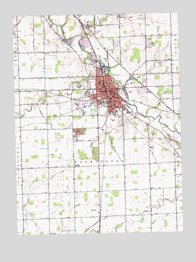
Decatur, IN USGS Topographic Map
Click on map above to begin viewing in our Map Viewer.

This topographic map contains these locations and features:
Feature Name Type Latitude Longitude GNIS ID View Map
Adams County Emergency Medical ServicesBuildingN40.8155°W84.9141°2719445View Map
Adams County HomeLocaleN40.7978°W84.8986°446653View Map
Adams County Sheriff's OfficeBuildingN40.8098°W84.9304°2758107View Map
Adams Memorial HospitalHospitalN40.8164°W84.9143°2660437View Map
Antioch ChurchChurchN40.8175°W84.9950°430216View Map
Ayers DitchCanalN40.8003°W84.8972°430364View Map
Blair DitchCanalN40.7609°W84.9883°431164View Map
Bluhm DitchCanalN40.7853°W84.9680°431265View Map
Borum RunStreamN40.8175°W84.9061°431359View Map
City of DecaturCivilN40.8301°W84.9280°2394480View Map
DecaturPopulated PlaceN40.8306°W84.9291°446543View Map
Decatur CemeteryCemeteryN40.8303°W84.9455°435468View Map
Decatur Fire DepartmentBuildingN40.8275°W84.9295°2625861View Map
Decatur Police DepartmentBuildingN40.8353°W84.9270°2758141View Map
Elm Tree CrossroadsPopulated PlaceN40.7884°W84.9561°434126View Map
Gage AirportAirportN40.8174°W84.9284°449142View Map
Hahnert DitchCanalN40.7734°W84.9597°435591View Map
Hanna City ParkParkN40.8389°W84.9408°435687View Map
Hendricks DitchCanalN40.7548°W84.9227°436020View Map
Hessler DitchCanalN40.7945°W84.9689°436071View Map
Holthouse DitchCanalN40.8214°W84.9925°436344View Map
Kohne Number One DitchCanalN40.8259°W84.9539°437423View Map
Kohne Number Two DitchCanalN40.8139°W84.9750°437424View Map
Koos DitchCanalN40.8434°W84.8947°437440View Map
Lincoln Amish School Number TwoSchoolN40.8273°W84.9272°437936View Map
McMillen ParkParkN40.8409°W84.9325°438920View Map
Miller DitchCanalN40.7995°W84.9266°439209View Map
MonmouthPopulated PlaceN40.8678°W84.9444°439330View Map
Mount Pleasant ChurchChurchN40.8537°W84.9761°439685View Map
Northwest Elementary SchoolSchoolN40.8356°W84.9355°440343View Map
Ohler DitchCanalN40.8737°W84.9014°440523View Map
Ruppert DitchCanalN40.7587°W84.8922°442394View Map
Saddle LakeReservoirN40.8576°W84.8981°442452View Map
Saddle Lake DamDamN40.8567°W84.8983°448677View Map
Saint Joseph CemeteryCemeteryN40.8346°W84.9509°442634View Map
Saint Josephs SchoolSchoolN40.8312°W84.9280°442651View Map
Saint Pauls ChurchChurchN40.7750°W84.8983°442782View Map
Southeast Elementary SchoolSchoolN40.8198°W84.9227°443875View Map
Straight BranchStreamN40.7598°W84.9319°444255View Map
Stratton ParkParkN40.8303°W84.9139°444263View Map
Township of WashingtonCivilN40.7901°W84.9373°453980View Map
Union ChapelChurchN40.8484°W84.8808°445091View Map
Union Chapel CemeteryCemeteryN40.8475°W84.8900°445094View Map
WADM-AM (Decatur)TowerN40.8198°W84.9172°448428View Map
WADM-FM (Decatur)TowerN40.8198°W84.9172°448996View Map
Yellow CreekStreamN40.8103°W84.8861°446378View Map

Note: Coordinates in the location and feature list above are referenced to NAD83 datum.


Copyright (C) 2008-2024 Ryan Niemi / Sunset Dynamics ... All Rights Reserved