TopoQuest Logo
Do you find TopoQuest useful?
Help keep TopoQuest running and adding new maps/features by donating!
Bitcoin:  19c7KJd3qBynnjoSw5npx9KScwjBe4ifkT
Litecoin:  LXs6TkuXGGXo1vDsWCkWVdjQX94eUKd6ui
Home View Maps Find Maps Find Places Resources & Links


Dongola, Missouri Topographic Map

USGS Map Title: Dongola, MO
USGS Map MRC: 37089B8
DRG (GeoTIFF) Download: o37089b8.tif


Neighboring USGS Topographic Map Quads:


  Glenallen, MO  
37090C1
 

  Marble Hill, MO  
37089C8
 

  Burfordville, MO  
37089C7
 

  Zalma, MO  
37090B1
 

  Dongola, MO  
37089B8
 

  Whitewater, MO  
37089B7
 

  Sturdivant, MO  
37090A1
 

  Advance, MO  
37089A8
 

  Bell City, MO  
37089A7


Map MRC Location:

N38°
W90°
N38°
W89°
H8 H7 H6 H5 H4 H3 H2 H1
G8 G7 G6 G5 G4 G3 G2 G1
F8 F7 F6 F5 F4 F3 F2 F1
E8 E7 E6 E5 E4 E3 E2 E1
D8 D7 D6 D5 D4 D3 D2 D1
C8 C7 C6 C5 C4 C3 C2 C1
B8 B7 B6 B5 B4 B3 B2 B1
A8 A7 A6 A5 A4 A3 A2 A1
N37°
W90°
N37°
W89°

Dongola, MO USGS 1:24K Topographic Map Preview:
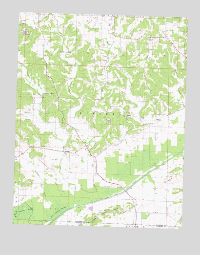
Dongola, MO USGS Topographic Map
Click on map above to begin viewing in our Map Viewer.

This topographic map contains these locations and features:
Feature Name Type Latitude Longitude GNIS ID View Map
Baker HillSummitN37.1589°W89.8776°713571View Map
Baker Hill SchoolSchoolN37.1445°W89.8870°748039View Map
Bootheel Planning RegionCivilN37.1253°W89.8754°754110View Map
Cane CreekStreamN37.1362°W89.9554°715342View Map
Castor River Diversion ChannelCanalN37.1453°W89.9204°715483View Map
Cato LeveeLeveeN37.1384°W89.9429°715501View Map
Dark Cypress SwampSwampN37.1311°W89.9950°716668View Map
DongolaPopulated PlaceN37.1681°W89.9598°716975View Map
Dongola School (historical)SchoolN37.1776°W89.9398°730534View Map
DrumPopulated PlaceN37.1887°W89.8937°740815View Map
Dry CreekStreamN37.1407°W89.9358°717089View Map
GlennonPopulated PlaceN37.1889°W89.9184°718516View Map
Goose Pond HillsRangeN37.1278°W89.9404°718605View Map
Goose Pond Hills SchoolSchoolN37.1309°W89.9384°748040View Map
Hawker CreekStreamN37.1331°W89.9626°719229View Map
Johnson SchoolSchoolN37.2001°W89.9679°748037View Map
Kellion CemeteryCemeteryN37.1584°W89.9768°720505View Map
Leopold Volunteer Fire Department Station 2BuildingN37.1897°W89.9188°2620400View Map
Little Valley ChurchChurchN37.2028°W89.9779°721347View Map
Malone CreekStreamN37.1626°W89.8929°721777View Map
Mansker CemeteryCemeteryN37.1909°W89.9893°721810View Map
Masters LakeReservoirN37.1876°W89.9307°764686View Map
Misters Lake DamDamN37.1867°W89.9318°764685View Map
New Sylvan ChurchChurchN37.2448°W89.9993°723320View Map
Null HillSummitN37.1876°W89.9657°723537View Map
Saint Anthony ChurchChurchN37.1906°W89.9187°730532View Map
Saint Anthony School (historical)SchoolN37.1878°W89.9176°730535View Map
SchlatitzPopulated PlaceN37.1709°W89.9876°735985View Map
Schlatitz SchoolSchoolN37.1673°W89.9859°748038View Map
Seiler SchoolSchoolN37.2417°W89.9668°748036View Map
Sylvan RidgeRidgeN37.2412°W89.9909°730533View Map
Sylvan Ridge School (historical)SchoolN37.2442°W89.9984°748035View Map
Township of LibertyCivilN37.1960°W89.9693°766323View Map
Whippoorwill DamDamN37.2367°W89.9951°764688View Map
Whippoorwill LakeReservoirN37.2383°W89.9952°764689View Map

Note: Coordinates in the location and feature list above are referenced to NAD83 datum.


Copyright (C) 2008-2025 Ryan Niemi / Sunset Dynamics ... All Rights Reserved