TopoQuest Logo
Do you find TopoQuest useful?
Help keep TopoQuest running and adding new maps/features by donating!
Bitcoin:  19c7KJd3qBynnjoSw5npx9KScwjBe4ifkT
Litecoin:  LXs6TkuXGGXo1vDsWCkWVdjQX94eUKd6ui
Home View Maps Find Maps Find Places Resources & Links


Glenallen, Missouri Topographic Map

USGS Map Title: Glenallen, MO
USGS Map MRC: 37090C1
DRG (GeoTIFF) Download: o37090c1.tif


Neighboring USGS Topographic Map Quads:


  Marquand, MO  
37090D2
 

  Hurricane, MO  
37090D1
 

  Scopus, MO  
37089D8
 

  Allbright, MO  
37090C2
 

  Glenallen, MO  
37090C1
 

  Marble Hill, MO  
37089C8
 

  Gipsy, MO  
37090B2
 

  Zalma, MO  
37090B1
 

  Dongola, MO  
37089B8


Map MRC Location:

N38°
W91°
N38°
W90°
H8 H7 H6 H5 H4 H3 H2 H1
G8 G7 G6 G5 G4 G3 G2 G1
F8 F7 F6 F5 F4 F3 F2 F1
E8 E7 E6 E5 E4 E3 E2 E1
D8 D7 D6 D5 D4 D3 D2 D1
C8 C7 C6 C5 C4 C3 C2 C1
B8 B7 B6 B5 B4 B3 B2 B1
A8 A7 A6 A5 A4 A3 A2 A1
N37°
W91°
N37°
W90°

Glenallen, MO USGS 1:24K Topographic Map Preview:
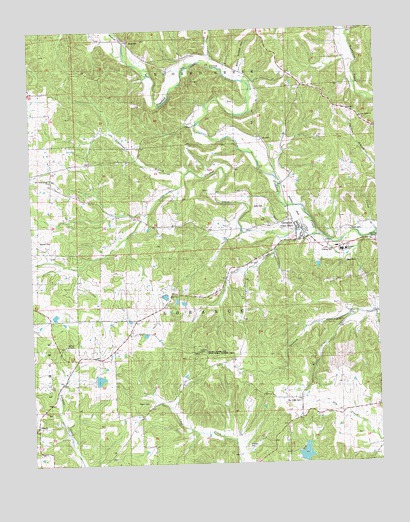
Glenallen, MO USGS Topographic Map
Click on map above to begin viewing in our Map Viewer.

This topographic map contains these locations and features:
Feature Name Type Latitude Longitude GNIS ID View Map
BessvillePopulated PlaceN37.3714°W90.0890°714006View Map
Black Snake HollowValleyN37.3617°W90.0484°738606View Map
Bollinger CountyCivilN37.3222°W90.0259°758463View Map
Deck CemeteryCemeteryN37.3237°W90.0445°743378View Map
Deck CemeteryCemeteryN37.3078°W90.0120°743379View Map
Dry Creek CemeteryCemeteryN37.2675°W90.0293°743382View Map
Dry Creek Church (historical)ChurchN37.2678°W90.0287°730526View Map
Dry Creek School (historical)SchoolN37.2689°W90.0245°717097View Map
Gimlet CreekStreamN37.3145°W90.0343°718464View Map
GlenallenPopulated PlaceN37.3178°W90.0279°718500View Map
Glenallen Fire Protection Association Station 1BuildingN37.3106°W90.0384°2621780View Map
Glenallen Fire Protection Association Station 3BuildingN37.2620°W90.0334°2621775View Map
GrassyPopulated PlaceN37.2609°W90.1237°718716View Map
Grassy Tower Site State Public Hunting AreaParkN37.2820°W90.0648°743380View Map
HuxiePopulated PlaceN37.2592°W90.0523°740387View Map
Huxie Post Office (historical)Post OfficeN37.2592°W90.0523°759782View Map
Indian CreekStreamN37.3653°W90.0590°750451View Map
Lake of the HillsReservoirN37.2529°W90.0274°763682View Map
Lake of the Hills DamDamN37.2501°W90.0284°763681View Map
Limbaugh BranchStreamN37.3331°W90.0698°754127View Map
Little Crooked CreekStreamN37.3153°W90.0207°721216View Map
Marquis DamDamN37.2751°W90.1034°764709View Map
Marquis LakeReservoirN37.2744°W90.1013°764710View Map
McGee ChurchChurchN37.2839°W90.1129°722108View Map
McKelvey SchoolSchoolN37.2914°W90.0857°731615View Map
Mouser CemeteryCemeteryN37.3148°W90.1223°743375View Map
Myers CemeteryCemeteryN37.3173°W90.0098°743376View Map
Myers CemeteryCemeteryN37.2678°W90.0840°743381View Map
New Salem ChurchChurchN37.3495°W90.0057°743374View Map
New Trace Creek ChurchChurchN37.3309°W90.1179°723321View Map
Number 632 DamDamN37.2951°W90.0934°764708View Map
Oak Grove ChurchChurchN37.2920°W90.1084°723580View Map
Opossum Creek SchoolSchoolN37.2901°W90.0245°723837View Map
Point Pleasant Church (historical)ChurchN37.2917°W90.0123°724692View Map
Prospect SchoolSchoolN37.3328°W90.0826°724956View Map
Reed DamDamN37.2967°W90.0701°764713View Map
Reed LakeReservoirN37.2963°W90.0706°764714View Map
Robey HollowValleyN37.2912°W90.0032°725410View Map
Shelton CemeteryCemeteryN37.2556°W90.0482°743383View Map
Shrum SchoolSchoolN37.3714°W90.0143°726421View Map
Town of Glen AllenCivilN37.3171°W90.0281°2396961View Map
Turkey BranchStreamN37.3162°W90.0020°727838View Map
Woodland SchoolSchoolN37.3112°W90.0126°743377View Map
Wright Lake DamDamN37.2967°W90.0718°764898View Map

Note: Coordinates in the location and feature list above are referenced to NAD83 datum.


Copyright (C) 2008-2024 Ryan Niemi / Sunset Dynamics ... All Rights Reserved