TopoQuest Logo
Do you find TopoQuest useful?
Help keep TopoQuest running and adding new maps/features by donating!
Bitcoin:  19c7KJd3qBynnjoSw5npx9KScwjBe4ifkT
Litecoin:  LXs6TkuXGGXo1vDsWCkWVdjQX94eUKd6ui
Home View Maps Find Maps Find Places Resources & Links


Burfordville, Missouri Topographic Map

USGS Map Title: Burfordville, MO
USGS Map MRC: 37089C7
DRG (GeoTIFF) Download: o37089c7.tif


Neighboring USGS Topographic Map Quads:


  Scopus, MO  
37089D8
 

  Millersville, MO  
37089D7
 

  Jackson, MO  
37089D6
 

  Marble Hill, MO  
37089C8
 

  Burfordville, MO  
37089C7
 

  Gordonville, MO  
37089C6
 

  Dongola, MO  
37089B8
 

  Whitewater, MO  
37089B7
 

  Chaffee, MO  
37089B6


Map MRC Location:

N38°
W90°
N38°
W89°
H8 H7 H6 H5 H4 H3 H2 H1
G8 G7 G6 G5 G4 G3 G2 G1
F8 F7 F6 F5 F4 F3 F2 F1
E8 E7 E6 E5 E4 E3 E2 E1
D8 D7 D6 D5 D4 D3 D2 D1
C8 C7 C6 C5 C4 C3 C2 C1
B8 B7 B6 B5 B4 B3 B2 B1
A8 A7 A6 A5 A4 A3 A2 A1
N37°
W90°
N37°
W89°

Burfordville, MO USGS 1:24K Topographic Map Preview:
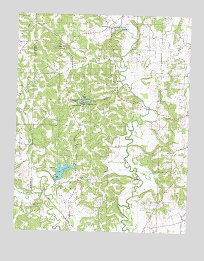
Burfordville, MO USGS Topographic Map
Click on map above to begin viewing in our Map Viewer.

This topographic map contains these locations and features:
Feature Name Type Latitude Longitude GNIS ID View Map
Allen CemeteryCemeteryN37.3425°W89.8476°743293View Map
Assembly of God ChurchChurchN37.2995°W89.8315°743290View Map
Barks ChapelChurchN37.2642°W89.8593°713652View Map
Bean BranchStreamN37.2598°W89.7526°713765View Map
Bethlehem ChurchChurchN37.2801°W89.8226°743286View Map
Bollinger Mill State ParkParkN37.3664°W89.8029°743297View Map
Borneman CemeteryCemeteryN37.2806°W89.7890°743291View Map
BurfordvillePopulated PlaceN37.3676°W89.8070°715068View Map
Burfordville Covered BridgeBridgeN37.3684°W89.8026°730547View Map
Byrd CreekStreamN37.3323°W89.7932°715165View Map
Cane CreekStreamN37.3523°W89.7632°715343View Map
Cedar Lake DamDamN37.3251°W89.8218°765045View Map
ClippardPopulated PlaceN37.2695°W89.8715°740311View Map
Clippard Post Office (historical)Post OfficeN37.3195°W89.8715°759781View Map
County Line ChurchChurchN37.3537°W89.8718°743295View Map
Crader CemeteryCemeteryN37.3281°W89.8712°743292View Map
CrumpPopulated PlaceN37.2787°W89.8293°731558View Map
Crump CemeteryCemeteryN37.2773°W89.8176°743285View Map
Cypress LakeReservoirN37.3254°W89.8262°738581View Map
Dillard CreekStreamN37.3414°W89.8004°716898View Map
Granny CreekStreamN37.2898°W89.8650°718696View Map
Gravel HillPopulated PlaceN37.3576°W89.8401°718736View Map
Gravel Hill CemeteryCemeteryN37.3689°W89.8584°743296View Map
Helderman CreekStreamN37.3514°W89.7645°719342View Map
Heldermann SchoolSchoolN37.3284°W89.8062°719343View Map
Hickory Grove School (historical)SchoolN37.3162°W89.8501°719470View Map
Hog CreekStreamN37.2806°W89.8559°719674View Map
Lake CedarReservoirN37.3252°W89.8233°765046View Map
Lake GirardeauReservoirN37.2849°W89.8406°758404View Map
Lake Girardeau DamDamN37.2801°W89.8434°763664View Map
Lake SweetgumReservoirN37.3228°W89.8276°738576View Map
Lessley CemeteryCemeteryN37.3531°W89.8720°743294View Map
Little Dogwood LakeReservoirN37.3251°W89.8305°738580View Map
Little Oak LakeReservoirN37.3236°W89.8241°738578View Map
Little Pine LakeReservoirN37.3239°W89.8254°738577View Map
Maple Grove School (historical)SchoolN37.2606°W89.7548°721825View Map
McGuire BranchStreamN37.3351°W89.7984°738582View Map
McGuire CemeteryCemeteryN37.3364°W89.8029°722122View Map
Millersville Rural Fire Protection District Station 3BuildingN37.3680°W89.8072°2620845View Map
Poplar Ridge SchoolSchoolN37.2953°W89.7607°724752View Map
Proffer CemeteryCemeteryN37.2809°W89.8276°743287View Map
Spivey CemeteryCemeteryN37.2964°W89.8387°743289View Map
Stoder CemeteryCemeteryN37.2862°W89.8459°743288View Map
Township of KinderCivilN37.3572°W89.8171°766399View Map
Township of LibertyCivilN37.2620°W89.8305°766400View Map
Whitewater Fire Protection District Station 2BuildingN37.3205°W89.8221°2620888View Map
Young CemeteryCemeteryN37.2964°W89.7615°754164View Map

Note: Coordinates in the location and feature list above are referenced to NAD83 datum.


Copyright (C) 2008-2024 Ryan Niemi / Sunset Dynamics ... All Rights Reserved