TopoQuest Logo
Do you find TopoQuest useful?
Help keep TopoQuest running and adding new maps/features by donating!
Bitcoin:  19c7KJd3qBynnjoSw5npx9KScwjBe4ifkT
Litecoin:  LXs6TkuXGGXo1vDsWCkWVdjQX94eUKd6ui
Home View Maps Find Maps Find Places Resources & Links


Canteen Canyon, New Mexico Topographic Map

USGS Map Title: Canteen Canyon, NM
USGS Map MRC: 33108A5
DRG (GeoTIFF) Download: o33108a5.tif


Neighboring USGS Topographic Map Quads:


  Rice Ranch, NM  
33108B6
 

  Shelley Peak, NM  
33108B5
 

  Diablo Range, NM  
33108B4
 

  Buckhorn, NM  
33108A6
 

  Canteen Canyon, NM  
33108A5
 

  Canyon Hill, NM  
33108A4
 

  Antelope Ridge, NM  
32108H6
 

  Cliff, NM  
32108H5
 

  Dorsey Ranch, NM  
32108H4


Map MRC Location:

N34°
W109°
N34°
W108°
H8 H7 H6 H5 H4 H3 H2 H1
G8 G7 G6 G5 G4 G3 G2 G1
F8 F7 F6 F5 F4 F3 F2 F1
E8 E7 E6 E5 E4 E3 E2 E1
D8 D7 D6 D5 D4 D3 D2 D1
C8 C7 C6 C5 C4 C3 C2 C1
B8 B7 B6 B5 B4 B3 B2 B1
A8 A7 A6 A5 A4 A3 A2 A1
N33°
W109°
N33°
W108°

Canteen Canyon, NM USGS 1:24K Topographic Map Preview:
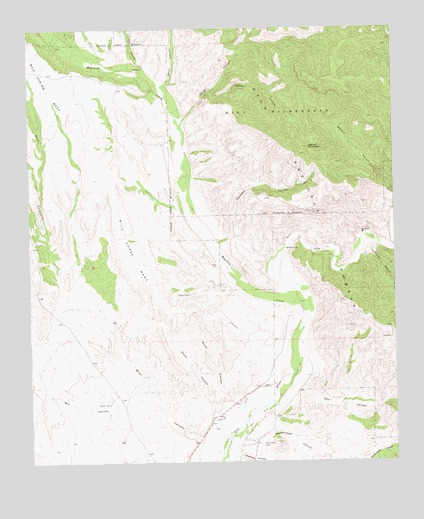
Canteen Canyon, NM USGS Topographic Map
Click on map above to begin viewing in our Map Viewer.

This topographic map contains these locations and features:
Feature Name Type Latitude Longitude GNIS ID View Map
Brock CanyonValleyN33.0601°W108.5001°904085View Map
Brushy CanyonValleyN33.0631°W108.5073°904110View Map
Canteen CanyonValleyN33.0620°W108.5609°904731View Map
Cedar Hill ProspectMineN33.0598°W108.5181°914872View Map
Cherry SpringSpringN33.0909°W108.5414°912742View Map
Clark Canyon DamDamN33.0284°W108.5706°924120View Map
Davis CanyonValleyN33.1062°W108.5784°905619View Map
Doyle CanyonValleyN33.0162°W108.5614°905848View Map
Fall CanyonValleyN33.1142°W108.5862°906225View Map
Guerrero CanyonValleyN33.0020°W108.5542°906776View Map
Indian CanyonValleyN33.1073°W108.5623°907191View Map
Juniper SpringSpringN33.0884°W108.5201°912747View Map
Maldonado CanyonValleyN33.0059°W108.5526°908373View Map
Maldonado CemeteryCemeteryN33.0050°W108.5462°908374View Map
Miller CanyonValleyN33.0142°W108.5503°908746View Map
Mogollon CreekStreamN33.0462°W108.5298°908822View Map
Nine Hundred Sixteen RanchLocaleN33.1131°W108.5876°909088View Map
Rough CanyonValleyN33.0973°W108.5728°910438View Map
Spar CanyonValleyN33.0220°W108.5326°911293View Map
Upper Gila Site Number 10 DamDamN33.0101°W108.5739°924040View Map
Upper Gila Site Number 11 DamDamN33.0067°W108.5956°924041View Map
Upper Gila Site Number Eight DamDamN33.0201°W108.5589°924038View Map
Upper Gila Site Number Nine DamDamN33.0184°W108.5639°924039View Map
Upper Gila Site Number Seven DamDamN33.0217°W108.5489°924037View Map
Upper Gila Site Number Six DamDamN33.0034°W108.5306°924036View Map
Victoria MineMineN33.0531°W108.5192°914893View Map
Watson MountainSummitN33.0903°W108.5295°912191View Map
Wild Horse MesaBenchN33.0659°W108.5926°912373View Map

Note: Coordinates in the location and feature list above are referenced to NAD83 datum.


Copyright (C) 2008-2025 Ryan Niemi / Sunset Dynamics ... All Rights Reserved