TopoQuest Logo
Do you find TopoQuest useful?
Help keep TopoQuest running and adding new maps/features by donating!
Bitcoin:  19c7KJd3qBynnjoSw5npx9KScwjBe4ifkT
Litecoin:  LXs6TkuXGGXo1vDsWCkWVdjQX94eUKd6ui
Home View Maps Find Maps Find Places Resources & Links


Dovre Peak, Oregon Topographic Map

USGS Map Title: Dovre Peak, OR
USGS Map MRC: 45123C5
DRG (GeoTIFF) Download: o45123c5.tif


Neighboring USGS Topographic Map Quads:


  The Peninsula, OR  
45123D6
 

  Trask, OR  
45123D5
 

  Gobblers Knob, OR  
45123D4
 

  Blaine, OR  
45123C6
 

  Dovre Peak, OR  
45123C5
 

  Trask Mountain, OR  
45123C4
 

  Niagara Creek, OR  
45123B6
 

  Springer Mountain, OR  
45123B5
 

  Stony Mountain, OR  
45123B4


Map MRC Location:

N46°
W124°
N46°
W123°
H8 H7 H6 H5 H4 H3 H2 H1
G8 G7 G6 G5 G4 G3 G2 G1
F8 F7 F6 F5 F4 F3 F2 F1
E8 E7 E6 E5 E4 E3 E2 E1
D8 D7 D6 D5 D4 D3 D2 D1
C8 C7 C6 C5 C4 C3 C2 C1
B8 B7 B6 B5 B4 B3 B2 B1
A8 A7 A6 A5 A4 A3 A2 A1
N45°
W124°
N45°
W123°

Dovre Peak, OR USGS 1:24K Topographic Map Preview:
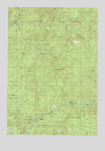
Dovre Peak, OR USGS Topographic Map
Click on map above to begin viewing in our Map Viewer.

This topographic map contains these locations and features:
Feature Name Type Latitude Longitude GNIS ID View Map
Alder Glen CampgroundLocaleN45.2662°W123.5807°1137087View Map
Bear CreekStreamN45.2707°W123.5721°1137664View Map
Boundary CreekStreamN45.3540°W123.5457°1163635View Map
Cabinet CreekStreamN45.2803°W123.5211°1135666View Map
Dovre PeakSummitN45.3136°W123.5087°1141218View Map
Elk Bend CampgroundParkN45.2829°W123.5401°1154409View Map
Elk CreekStreamN45.2821°W123.5437°1141748View Map
Headquarters Camp CreekStreamN45.2873°W123.6021°1135664View Map
Joes CreekStreamN45.2953°W123.5514°1135665View Map
Mesabi CreekStreamN45.3746°W123.5596°1132180View Map
Miller CreekStreamN45.3693°W123.5582°1154497View Map
Murphys Camp CreekStreamN45.3657°W123.5009°1958503View Map
Rock CreekStreamN45.3615°W123.5162°1148599View Map
Slick Rock CreekStreamN45.2543°W123.6218°1149684View Map
South CreekStreamN45.3596°W123.6165°1154500View Map
Steampot CreekStreamN45.3726°W123.5621°1150382View Map
Stretch CreekStreamN45.3512°W123.5401°1154499View Map
Summit CreekStreamN45.3596°W123.6165°1163636View Map
Thorn CreekStreamN45.2742°W123.5231°1154408View Map
Trask SummitGapN45.3284°W123.6051°1151403View Map
Tucca CreekStreamN45.3240°W123.5576°1151471View Map

Note: Coordinates in the location and feature list above are referenced to NAD83 datum.


Copyright (C) 2008-2025 Ryan Niemi / Sunset Dynamics ... All Rights Reserved