TopoQuest Logo
Do you find TopoQuest useful?
Help keep TopoQuest running and adding new maps/features by donating!
Bitcoin:  19c7KJd3qBynnjoSw5npx9KScwjBe4ifkT
Litecoin:  LXs6TkuXGGXo1vDsWCkWVdjQX94eUKd6ui
Home View Maps Find Maps Find Places Resources & Links


Springer Mountain, Oregon Topographic Map

USGS Map Title: Springer Mountain, OR
USGS Map MRC: 45123B5
DRG (GeoTIFF) Download: o45123b5.tif


Neighboring USGS Topographic Map Quads:


  Blaine, OR  
45123C6
 

  Dovre Peak, OR  
45123C5
 

  Trask Mountain, OR  
45123C4
 

  Niagara Creek, OR  
45123B6
 

  Springer Mountain, OR  
45123B5
 

  Stony Mountain, OR  
45123B4
 

  Midway, OR  
45123A6
 

  Grand Ronde, OR  
45123A5
 

  Sheridan, OR  
45123A4


Map MRC Location:

N46°
W124°
N46°
W123°
H8 H7 H6 H5 H4 H3 H2 H1
G8 G7 G6 G5 G4 G3 G2 G1
F8 F7 F6 F5 F4 F3 F2 F1
E8 E7 E6 E5 E4 E3 E2 E1
D8 D7 D6 D5 D4 D3 D2 D1
C8 C7 C6 C5 C4 C3 C2 C1
B8 B7 B6 B5 B4 B3 B2 B1
A8 A7 A6 A5 A4 A3 A2 A1
N45°
W124°
N45°
W123°

Springer Mountain, OR USGS 1:24K Topographic Map Preview:
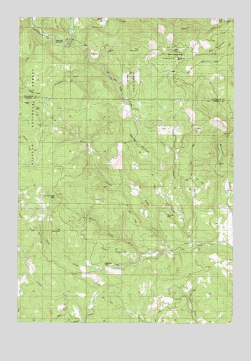
Springer Mountain, OR USGS Topographic Map
Click on map above to begin viewing in our Map Viewer.

This topographic map contains these locations and features:
Feature Name Type Latitude Longitude GNIS ID View Map
Bell MountainRidgeN45.2371°W123.5104°1137899View Map
Bible CreekStreamN45.2404°W123.5962°1137962View Map
Bible RanchLocaleN45.2140°W123.5554°1167160View Map
Big MountainSummitN45.1626°W123.5998°1138048View Map
Bogue CreekStreamN45.2471°W123.5804°1155087View Map
Burton CreekStreamN45.1518°W123.5534°1139020View Map
Burton RidgeRidgeN45.1537°W123.5718°1139022View Map
Camp CooperLocaleN45.2496°W123.5098°1139205View Map
Camp Cooper ReservoirReservoirN45.2492°W123.5059°1162743View Map
Canada CreekStreamN45.1543°W123.5390°1139294View Map
Cherry MountainSummitN45.1637°W123.6162°1139600View Map
Coast Creek ParkParkN45.1484°W123.5762°1139877View Map
Coast Creek ShelterLocaleN45.2132°W123.5318°1159338View Map
Coneridge SchoolSchoolN45.1732°W123.5390°1159339View Map
Darling MountainSummitN45.1690°W123.5415°1140638View Map
Gilbert CreekStreamN45.1568°W123.5248°1142725View Map
Kennedy CreekStreamN45.1804°W123.5637°1153334View Map
Mina CreekStreamN45.2465°W123.6193°1146299View Map
Muletail CreekStreamN45.2312°W123.5882°1146647View Map
Nenamusa (historical)Populated PlaceN45.2457°W123.5943°1162084View Map
Nenamusa FallsFallsN45.2429°W123.5971°1153331View Map
Nenamusa Post Office (historical)Post OfficeN45.2457°W123.5943°1165694View Map
Niagara PointSummitN45.2148°W123.6193°1146820View Map
Pumpkinseed MountainSummitN45.1765°W123.6046°1148045View Map
Rocky Bend Recreation SiteLocaleN45.2393°W123.6059°1148654View Map
Royce CreekStreamN45.2484°W123.5707°1153327View Map
Rye MountainSummitN45.2371°W123.5559°1148878View Map
Sheridan DivisionCivilN45.1587°W123.5133°1938118View Map
Springer CreekStreamN45.1776°W123.5540°1153333View Map
Springer MountainSummitN45.1959°W123.5568°1150200View Map
Testament CreekStreamN45.2454°W123.5959°1150987View Map
Thune MountainSummitN45.2462°W123.6034°1151207View Map
Wilson CreekStreamN45.1873°W123.5109°1153332View Map

Note: Coordinates in the location and feature list above are referenced to NAD83 datum.


Copyright (C) 2008-2024 Ryan Niemi / Sunset Dynamics ... All Rights Reserved