TopoQuest Logo
Do you find TopoQuest useful?
Help keep TopoQuest running and adding new maps/features by donating!
Bitcoin:  19c7KJd3qBynnjoSw5npx9KScwjBe4ifkT
Litecoin:  LXs6TkuXGGXo1vDsWCkWVdjQX94eUKd6ui
Home View Maps Find Maps Find Places Resources & Links


Blaine, Oregon Topographic Map

USGS Map Title: Blaine, OR
USGS Map MRC: 45123C6
DRG (GeoTIFF) Download: o45123c6.tif


Neighboring USGS Topographic Map Quads:


  Tillamook, OR  
45123D7
 

  The Peninsula, OR  
45123D6
 

  Trask, OR  
45123D5
 

  Beaver, OR  
45123C7
 

  Blaine, OR  
45123C6
 

  Dovre Peak, OR  
45123C5
 

  Hebo, OR  
45123B7
 

  Niagara Creek, OR  
45123B6
 

  Springer Mountain, OR  
45123B5


Map MRC Location:

N46°
W124°
N46°
W123°
H8 H7 H6 H5 H4 H3 H2 H1
G8 G7 G6 G5 G4 G3 G2 G1
F8 F7 F6 F5 F4 F3 F2 F1
E8 E7 E6 E5 E4 E3 E2 E1
D8 D7 D6 D5 D4 D3 D2 D1
C8 C7 C6 C5 C4 C3 C2 C1
B8 B7 B6 B5 B4 B3 B2 B1
A8 A7 A6 A5 A4 A3 A2 A1
N45°
W124°
N45°
W123°

Blaine, OR USGS 1:24K Topographic Map Preview:
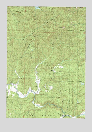
Blaine, OR USGS Topographic Map
Click on map above to begin viewing in our Map Viewer.

This topographic map contains these locations and features:
Feature Name Type Latitude Longitude GNIS ID View Map
Alder CreekStreamN45.2779°W123.7348°1137079View Map
Bays CreekStreamN45.2871°W123.7384°1161267View Map
Beaver PointSummitN45.3604°W123.7091°1134674View Map
BlainePopulated PlaceN45.2773°W123.7046°1138239View Map
Blaine CemeteryCemeteryN45.2824°W123.7112°1154404View Map
Blaine Post Office (historical)Post OfficeN45.2773°W123.7046°1164925View Map
Camelback BluffCliffN45.2901°W123.7482°1139184View Map
Clarence CreekStreamN45.2507°W123.6412°1139748View Map
Detrick RanchLocaleN45.3034°W123.6771°1140928View Map
East CreekStreamN45.2801°W123.7015°1141520View Map
Grindstone MountainSummitN45.3513°W123.6630°1143095View Map
Hardscrabble MountainSummitN45.3171°W123.7140°1143300View Map
Hatinger CreekStreamN45.2596°W123.6621°1163828View Map
High PeakSummitN45.3328°W123.7038°1143573View Map
Limestone CreekStreamN45.2640°W123.7040°1145026View Map
Moon CreekStreamN45.2784°W123.7062°1146414View Map
Moon Meadow DairyLocaleN45.2786°W123.7017°2663825View Map
Nestucca Grange HallLocaleN45.2744°W123.7230°1639208View Map
Nestucca Rural Fire Protection District Station 86 BlaineBuildingN45.2629°W123.6935°2577037View Map
Norris CreekStreamN45.2532°W123.6598°1156055View Map
Powder CreekStreamN45.2518°W123.6587°1147957View Map
Powder Creek TrailTrailN45.2526°W123.6857°1147958View Map
Skookum LakeReservoirN45.3736°W123.7040°1161516View Map
Skookum Lake DamDamN45.3732°W123.6979°1153998View Map
Square TopSummitN45.2979°W123.6349°1150219View Map
Wake CreekStreamN45.2562°W123.6573°1154406View Map

Note: Coordinates in the location and feature list above are referenced to NAD83 datum.


Copyright (C) 2008-2025 Ryan Niemi / Sunset Dynamics ... All Rights Reserved