TopoQuest Logo
Do you find TopoQuest useful?
Help keep TopoQuest running and adding new maps/features by donating!
Bitcoin:  19c7KJd3qBynnjoSw5npx9KScwjBe4ifkT
Litecoin:  LXs6TkuXGGXo1vDsWCkWVdjQX94eUKd6ui
Home View Maps Find Maps Find Places Resources & Links


Sebrell, Virginia Topographic Map

USGS Map Title: Sebrell, VA
USGS Map MRC: 36077G2
DRG (GeoTIFF) Download: o36077g2.tif


Neighboring USGS Topographic Map Quads:


  Sussex, VA  
36077H3
 

  Littleton, VA  
36077H2
 

  Manry, VA  
36077H1
 

  Yale, VA  
36077G3
 

  Sebrell, VA  
36077G2
 

  Vicksville, VA  
36077G1
 

  Drewryville, VA  
36077F3
 

  Capron, VA  
36077F2
 

  Courtland, VA  
36077F1


Map MRC Location:

N37°
W78°
N37°
W77°
H8 H7 H6 H5 H4 H3 H2 H1
G8 G7 G6 G5 G4 G3 G2 G1
F8 F7 F6 F5 F4 F3 F2 F1
E8 E7 E6 E5 E4 E3 E2 E1
D8 D7 D6 D5 D4 D3 D2 D1
C8 C7 C6 C5 C4 C3 C2 C1
B8 B7 B6 B5 B4 B3 B2 B1
A8 A7 A6 A5 A4 A3 A2 A1
N36°
W78°
N36°
W77°

Sebrell, VA USGS 1:24K Topographic Map Preview:
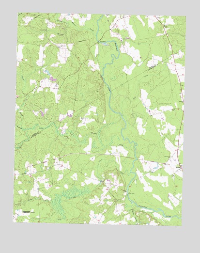
Sebrell, VA USGS Topographic Map
Click on map above to begin viewing in our Map Viewer.

This topographic map contains these locations and features:
Feature Name Type Latitude Longitude GNIS ID View Map
Applewhite Church (historical)ChurchN36.7638°W77.1750°1738968View Map
Bethel Star ChurchChurchN36.7785°W77.2441°1463215View Map
Blows Chapel (historical)ChurchN36.8426°W77.1991°1690181View Map
Buckhorn SwampStreamN36.7621°W77.1589°1464009View Map
Butts CemeteryCemeteryN36.8190°W77.1344°1464192View Map
Careys BridgeBridgeN36.7682°W77.1652°1464440View Map
Chub (historical)Populated PlaceN36.8640°W77.1755°1690188View Map
Cooper School (historical)SchoolN36.7846°W77.2205°1738978View Map
Coopers School (historical)SchoolN36.7749°W77.2211°1738979View Map
Crichton BridgeBridgeN36.7754°W77.1858°1465431View Map
Dividing BranchStreamN36.8690°W77.2127°1465829View Map
Felts BranchStreamN36.8149°W77.1711°1466527View Map
Hickory Hill CemeteryCemeteryN36.8549°W77.2183°1690206View Map
Hickory Hill ChurchChurchN36.8549°W77.2180°1467986View Map
Hickory Hill School (historical)SchoolN36.8549°W77.2175°1690207View Map
Hornet SwampStreamN36.7629°W77.2214°1468251View Map
Hunting Quarter Plantation (historical)LocaleN36.8538°W77.1900°1690213View Map
Hunting Quarter SwampStreamN36.8621°W77.1914°1468402View Map
Jones School (historical)SchoolN36.8240°W77.1261°1739003View Map
Little SwampStreamN36.8085°W77.2455°1469662View Map
Mill Neck ChurchChurchN36.8007°W77.2105°1470525View Map
Nicholson School (historical)SchoolN36.7724°W77.1794°1739011View Map
Parker RunStreamN36.8552°W77.1752°1472064View Map
Peters BridgeBridgeN36.8590°W77.1897°1472225View Map
Pleasant Grove ChurchChurchN36.8685°W77.1411°1472476View Map
Raccoon CreekStreamN36.7943°W77.1611°1472919View Map
Saint Johns ChurchChurchN36.7796°W77.1311°1473760View Map
Saint Marks ChurchChurchN36.8243°W77.1258°1473819View Map
SebrellPopulated PlaceN36.7838°W77.1275°1500047View Map
Sebrell-Reese CemeteryCemeteryN36.7907°W77.1344°1474136View Map
Spring CreekStreamN36.8015°W77.2405°1474986View Map
Three CreekStreamN36.7813°W77.1639°1475690View Map
Westbrook BridgeBridgeN36.7893°W77.1591°1476513View Map
Westbrooks Bridge (historical)BridgeN36.7893°W77.1594°1739040View Map

Note: Coordinates in the location and feature list above are referenced to NAD83 datum.


Copyright (C) 2008-2025 Ryan Niemi / Sunset Dynamics ... All Rights Reserved