TopoQuest Logo
Do you find TopoQuest useful?
Help keep TopoQuest running and adding new maps/features by donating!
Bitcoin:  19c7KJd3qBynnjoSw5npx9KScwjBe4ifkT
Litecoin:  LXs6TkuXGGXo1vDsWCkWVdjQX94eUKd6ui
Home View Maps Find Maps Find Places Resources & Links


Dry Creek, Colorado Topographic Map

USGS Map Title: Dry Creek, CO
USGS Map MRC: 38107H7
DRG (GeoTIFF) Download: o38107h7.tif


Neighboring USGS Topographic Map Quads:


  Grand Mesa, CO  
39107A8
 

  Leon Peak, CO  
39107A7
 

  Chalk Mountain, CO  
39107A6
 

  Cedaredge, CO  
38107H8
 

  Dry Creek, CO  
38107H7
 

  Gray Reservoir, CO  
38107H6
 

  Orchard City, CO  
38107G8
 

  Lazear, CO  
38107G7
 

  Hotchkiss, CO  
38107G6


Map MRC Location:

N39°
W108°
N39°
W107°
H8 H7 H6 H5 H4 H3 H2 H1
G8 G7 G6 G5 G4 G3 G2 G1
F8 F7 F6 F5 F4 F3 F2 F1
E8 E7 E6 E5 E4 E3 E2 E1
D8 D7 D6 D5 D4 D3 D2 D1
C8 C7 C6 C5 C4 C3 C2 C1
B8 B7 B6 B5 B4 B3 B2 B1
A8 A7 A6 A5 A4 A3 A2 A1
N38°
W108°
N38°
W107°

Dry Creek, CO USGS 1:24K Topographic Map Preview:
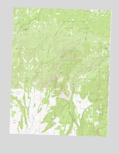
Dry Creek, CO USGS Topographic Map
Click on map above to begin viewing in our Map Viewer.

This topographic map contains these locations and features:
Feature Name Type Latitude Longitude GNIS ID View Map
Bennett MineMineN38.9111°W107.7612°186279View Map
Cactus ParkFlatN38.9150°W107.8651°186264View Map
Caesar CreekStreamN38.9983°W107.8409°175358View Map
Carl Smith DamDamN38.9616°W107.7523°199314View Map
Cow CreekStreamN38.9255°W107.7937°186287View Map
Cow Creek DitchCanalN38.9161°W107.7928°186272View Map
Currant Creek Number 2 DitchCanalN38.8994°W107.8234°186265View Map
Dever CreekStreamN38.8816°W107.7862°186275View Map
Dry CreekStreamN38.8850°W107.8465°186286View Map
Durkee RidgeRidgeN38.9755°W107.8012°186283View Map
Farmers MineMineN38.9108°W107.7639°186278View Map
Grassy GulchValleyN38.9146°W107.7985°196640View Map
Hells HoleBasinN38.9739°W107.7814°186284View Map
Hunt DamDamN38.8972°W107.7634°199216View Map
Hunt ReservoirReservoirN38.8975°W107.7627°186281View Map
Landerth MineMineN38.9366°W107.8142°186285View Map
Newman MineMineN38.8964°W107.7587°186282View Map
Overland CanalCanalN38.8933°W107.7967°186273View Map
Owens MineMineN38.9058°W107.7584°186280View Map
Patterson Number 1 DamDamN38.9633°W107.7506°199850View Map
Patterson ReservoirReservoirN38.9616°W107.7523°199315View Map
Patterson Reservoir Number 1ReservoirN38.9633°W107.7506°199851View Map
Seven X RanchLocaleN38.9014°W107.7806°186277View Map
Shindledecker DitchCanalN38.9311°W107.7701°186288View Map
Sooner DitchCanalN38.9750°W107.8642°186269View Map
Spaulding PeakSummitN38.9783°W107.8565°186268View Map
Stull DitchCanalN38.9016°W107.8073°186274View Map
Ward MineMineN38.9358°W107.8412°186266View Map
West Fork Currant CreekStreamN38.9144°W107.8451°186267View Map
Wilbanks MesaSummitN38.9653°W107.8673°203208View Map

Note: Coordinates in the location and feature list above are referenced to NAD83 datum.


Copyright (C) 2008-2025 Ryan Niemi / Sunset Dynamics ... All Rights Reserved