TopoQuest Logo
Do you find TopoQuest useful?
Help keep TopoQuest running and adding new maps/features by donating!
Bitcoin:  19c7KJd3qBynnjoSw5npx9KScwjBe4ifkT
Litecoin:  LXs6TkuXGGXo1vDsWCkWVdjQX94eUKd6ui
Home View Maps Find Maps Find Places Resources & Links


Dubois, Indiana Topographic Map

USGS Map Title: Dubois, IN
USGS Map MRC: 38086D7
DRG (GeoTIFF) Download: o38086d7.tif


Neighboring USGS Topographic Map Quads:


  Alfordsville, IN  
38086E8
 

  Rusk, IN  
38086E7
 

  Hillham, IN  
38086E6
 

  Jasper, IN  
38086D8
 

  Dubois, IN  
38086D7
 

  Cuzco, IN  
38086D6
 

  Huntingburg, IN  
38086C8
 

  Saint Anthony, IN  
38086C7
 

  Birdseye, IN  
38086C6


Map MRC Location:

N39°
W87°
N39°
W86°
H8 H7 H6 H5 H4 H3 H2 H1
G8 G7 G6 G5 G4 G3 G2 G1
F8 F7 F6 F5 F4 F3 F2 F1
E8 E7 E6 E5 E4 E3 E2 E1
D8 D7 D6 D5 D4 D3 D2 D1
C8 C7 C6 C5 C4 C3 C2 C1
B8 B7 B6 B5 B4 B3 B2 B1
A8 A7 A6 A5 A4 A3 A2 A1
N38°
W87°
N38°
W86°

Dubois, IN USGS 1:24K Topographic Map Preview:
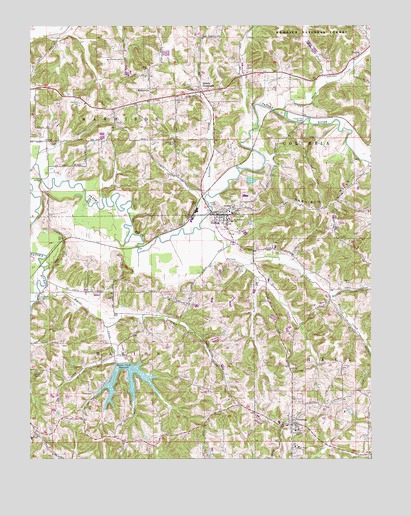
Dubois, IN USGS Topographic Map
Click on map above to begin viewing in our Map Viewer.

This topographic map contains these locations and features:
Feature Name Type Latitude Longitude GNIS ID View Map
Bailey CemeteryCemeteryN38.4259°W86.7575°430401View Map
Bailey CreekStreamN38.4220°W86.7653°450646View Map
Bauer CreekStreamN38.4309°W86.7969°430585View Map
Beaver CreekStreamN38.4231°W86.8714°430673View Map
Beaver Creek LakeReservoirN38.4019°W86.8398°430676View Map
Beaver Creek Lake DamDamN38.4026°W86.8431°447083View Map
Camp CarnesParkN38.4003°W86.8733°432014View Map
CelestinePopulated PlaceN38.3848°W86.7792°432294View Map
Celestine Community Club LakeReservoirN38.3851°W86.7567°447232View Map
Celestine Community Club Lake DamDamN38.3851°W86.7567°447233View Map
Celestine Elementary SchoolSchoolN38.3831°W86.7778°442515View Map
Celestine Volunteer Fire DepartmentBuildingN38.3838°W86.7737°2626122View Map
Coon Seitz BridgeBridgeN38.4214°W86.8722°432937View Map
CrystalPopulated PlaceN38.4920°W86.7539°450824View Map
Crystal Station BridgeBridgeN38.4720°W86.7755°433231View Map
Davis CreekStreamN38.4759°W86.7861°450833View Map
DuboisPopulated PlaceN38.4453°W86.8044°433736View Map
Dubois Census Designated PlaceCensusN38.4458°W86.7978°2629882View Map
Dubois Community Club LakeReservoirN38.4552°W86.7941°447252View Map
Dubois Community Club Lake DamDamN38.4562°W86.7956°451742View Map
Dubois CrossroadsPopulated PlaceN38.4812°W86.8119°433738View Map
Dubois Volunteer Fire DepartmentBuildingN38.4468°W86.8058°2625803View Map
Ewing CemeteryCemeteryN38.4484°W86.8072°434274View Map
Harbison CemeteryCemeteryN38.4775°W86.8572°435721View Map
Harbison HillsRangeN38.4484°W86.7647°435722View Map
Hardin CemeteryCemeteryN38.4512°W86.8025°435727View Map
John Seitz BridgeBridgeN38.4559°W86.8711°437021View Map
KellervillePopulated PlaceN38.4817°W86.8317°437213View Map
Ludlow Post Office (historical)Post OfficeN38.4859°W86.7967°453033View Map
Mount Zion CemeteryCemeteryN38.4825°W86.8164°439730View Map
Northeast Dubois High SchoolSchoolN38.4459°W86.8014°446620View Map
Pinnick CreekStreamN38.4220°W86.7655°451338View Map
Polson CreekStreamN38.4414°W86.8122°441416View Map
Saint Johns ChurchChurchN38.4814°W86.8133°442587View Map
Saint Peters ChurchChurchN38.4478°W86.8008°442810View Map
Saint Raphaels ChurchChurchN38.4437°W86.8011°442830View Map
Sugar CreekStreamN38.4834°W86.7664°451519View Map
Teder CreekStreamN38.4131°W86.8475°444617View Map
Township of HarbisonCivilN38.4769°W86.8633°453373View Map
Township of MarionCivilN38.3977°W86.8395°453605View Map

Note: Coordinates in the location and feature list above are referenced to NAD83 datum.


Copyright (C) 2008-2025 Ryan Niemi / Sunset Dynamics ... All Rights Reserved