TopoQuest Logo
Do you find TopoQuest useful?
Help keep TopoQuest running and adding new maps/features by donating!
Bitcoin:  19c7KJd3qBynnjoSw5npx9KScwjBe4ifkT
Litecoin:  LXs6TkuXGGXo1vDsWCkWVdjQX94eUKd6ui
Home View Maps Find Maps Find Places Resources & Links


Alfordsville, Indiana Topographic Map

USGS Map Title: Alfordsville, IN
USGS Map MRC: 38086E8
DRG (GeoTIFF) Download: o38086e8.tif


Neighboring USGS Topographic Map Quads:


  Montgomery, IN  
38087F1
 

  Loogootee, IN  
38086F8
 

  Shoals, IN  
38086F7
 

  Glendale, IN  
38087E1
 

  Alfordsville, IN  
38086E8
 

  Rusk, IN  
38086E7
 

  Otwell, IN  
38087D1
 

  Jasper, IN  
38086D8
 

  Dubois, IN  
38086D7


Map MRC Location:

N39°
W87°
N39°
W86°
H8 H7 H6 H5 H4 H3 H2 H1
G8 G7 G6 G5 G4 G3 G2 G1
F8 F7 F6 F5 F4 F3 F2 F1
E8 E7 E6 E5 E4 E3 E2 E1
D8 D7 D6 D5 D4 D3 D2 D1
C8 C7 C6 C5 C4 C3 C2 C1
B8 B7 B6 B5 B4 B3 B2 B1
A8 A7 A6 A5 A4 A3 A2 A1
N38°
W87°
N38°
W86°

Alfordsville, IN USGS 1:24K Topographic Map Preview:
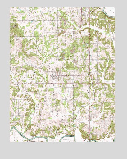
Alfordsville, IN USGS Topographic Map
Click on map above to begin viewing in our Map Viewer.

This topographic map contains these locations and features:
Feature Name Type Latitude Longitude GNIS ID View Map
AlfordsvillePopulated PlaceN38.5606°W86.9483°430072View Map
Alfordsville CemeteryCemeteryN38.5687°W86.9447°430073View Map
Assembly of God ChurchChurchN38.5317°W86.9608°430318View Map
Baver LakeReservoirN38.5144°W86.9228°447753View Map
Baver Lake DamDamN38.5151°W86.9250°447754View Map
East Fork Sugar CreekStreamN38.5795°W86.9583°433901View Map
Friends CreekStreamN38.6239°W86.8886°434851View Map
Hopper HillSummitN38.5445°W86.9064°436472View Map
Inman ChurchChurchN38.5370°W86.8897°436819View Map
Knob HillSummitN38.5798°W86.9772°437403View Map
Knott HillSummitN38.5670°W86.9811°437411View Map
Mount Zion ChurchChurchN38.5495°W86.8875°439743View Map
Old Union ChurchChurchN38.5489°W86.9558°440616View Map
Slate CreekStreamN38.5034°W86.9553°443592View Map
Sugar CreekStreamN38.5087°W86.9875°444314View Map
Town of AlfordsvilleCivilN38.5605°W86.9482°2397424View Map
Township of ReeveCivilN38.5585°W86.9786°453785View Map
Township of RutherfordCivilN38.5573°W86.8823°453818View Map
Truelove ChurchChurchN38.5773°W86.9003°444930View Map
Turkey BranchStreamN38.5006°W86.8972°444958View Map
West Fork Sugar CreekStreamN38.5326°W86.9681°445760View Map
WhitfieldPopulated PlaceN38.6187°W86.9128°445985View Map

Note: Coordinates in the location and feature list above are referenced to NAD83 datum.


Copyright (C) 2008-2024 Ryan Niemi / Sunset Dynamics ... All Rights Reserved