TopoQuest Logo
Do you find TopoQuest useful?
Help keep TopoQuest running and adding new maps/features by donating!
Bitcoin:  19c7KJd3qBynnjoSw5npx9KScwjBe4ifkT
Litecoin:  LXs6TkuXGGXo1vDsWCkWVdjQX94eUKd6ui
Home View Maps Find Maps Find Places Resources & Links


Montpelier, Kentucky Topographic Map

USGS Map Title: Montpelier, KY
USGS Map MRC: 37085A2
DRG (GeoTIFF) Download: o37085a2.tif


Neighboring USGS Topographic Map Quads:


  Cane Valley, KY  
37085B3
 

  Knifley, KY  
37085B2
 

  Dunnville, KY  
37085B1
 

  Columbia, KY  
37085A3
 

  Montpelier, KY  
37085A2
 

  Russell Springs, KY  
37085A1
 

  Amandaville, KY  
36085H3
 

  Creelsboro, KY  
36085H2
 

  Jamestown, KY  
36085H1


Map MRC Location:

N38°
W86°
N38°
W85°
H8 H7 H6 H5 H4 H3 H2 H1
G8 G7 G6 G5 G4 G3 G2 G1
F8 F7 F6 F5 F4 F3 F2 F1
E8 E7 E6 E5 E4 E3 E2 E1
D8 D7 D6 D5 D4 D3 D2 D1
C8 C7 C6 C5 C4 C3 C2 C1
B8 B7 B6 B5 B4 B3 B2 B1
A8 A7 A6 A5 A4 A3 A2 A1
N37°
W86°
N37°
W85°

Montpelier, KY USGS 1:24K Topographic Map Preview:
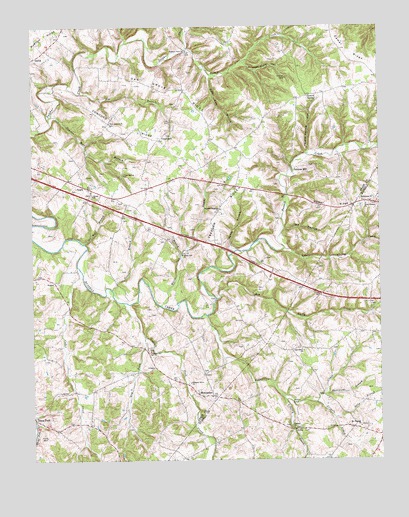
Montpelier, KY USGS Topographic Map
Click on map above to begin viewing in our Map Viewer.

This topographic map contains these locations and features:
Feature Name Type Latitude Longitude GNIS ID View Map
Bethel RidgeRidgeN37.0731°W85.1430°486999View Map
Bethlehem ChurchChurchN37.0751°W85.1311°487017View Map
Big BranchStreamN37.1059°W85.2321°487094View Map
Big Clifty CreekStreamN37.0467°W85.1841°487155View Map
Burton RidgeRidgeN37.1217°W85.2452°488481View Map
Butler CreekStreamN37.1192°W85.1944°488511View Map
Cabin Fork CreekStreamN37.0456°W85.2175°488568View Map
Camel RidgeRidgeN37.1170°W85.1350°488661View Map
Cedar CreekStreamN37.0559°W85.2338°489178View Map
Clear Spring ChurchChurchN37.0826°W85.2169°489647View Map
Concord (historical)Populated PlaceN37.0976°W85.2221°2743193View Map
Concord RidgeRidgeN37.0962°W85.2150°489942View Map
CraycraftPopulated PlaceN37.0940°W85.2027°507775View Map
Cripple CreekStreamN37.0165°W85.1480°490345View Map
Dry ForkStreamN37.0353°W85.2097°491184View Map
Dry HollowValleyN37.0664°W85.1594°491221View Map
Faith Temple ChurchChurchN37.0737°W85.1294°491939View Map
Freedom RidgeRidgeN37.0740°W85.1800°492506View Map
Freedom Separater ChurchChurchN37.0726°W85.1825°492511View Map
Gentrys MillPopulated PlaceN37.0848°W85.1536°508079View Map
Goose BranchStreamN37.0495°W85.2216°492988View Map
Hurricane BranchStreamN37.0195°W85.1447°494802View Map
JoppaPopulated PlaceN37.0517°W85.2422°508357View Map
Liberty ChurchChurchN37.0092°W85.1566°496367View Map
Liberty CreekStreamN37.0187°W85.1608°496382View Map
Little Clifty CreekStreamN37.0609°W85.1594°496676View Map
MontpelierPopulated PlaceN37.0190°W85.1855°508630View Map
Mount Pleasant ChurchChurchN37.0095°W85.1322°498836View Map
Muddy BranchStreamN37.0603°W85.1775°499022View Map
New Concord ChurchChurchN37.0976°W85.2219°499307View Map
Oak Grove (historical)Populated PlaceN37.1072°W85.1954°2743397View Map
Oak Grove ChurchChurchN37.0320°W85.1538°499677View Map
Oak Grove RidgeRidgeN37.1067°W85.1983°499694View Map
Oil Well BranchStreamN37.0628°W85.2316°499788View Map
OzarkPopulated PlaceN37.0792°W85.2313°508769View Map
Pleasant Grove Church (historical)ChurchN37.0223°W85.1936°500816View Map
Pleasant Hill ChurchChurchN37.0317°W85.2077°500857View Map
Pleasant View ChurchChurchN37.1184°W85.1941°500946View Map
Powder Mill BranchStreamN37.1001°W85.2425°501228View Map
Reynolds CreekStreamN37.0417°W85.1875°501747View Map
Rock Lick BranchStreamN37.1112°W85.1861°502128View Map
Selby BranchStreamN37.0120°W85.1416°503157View Map
Shiloh ChurchChurchN37.0767°W85.2280°503376View Map
Tavern SpringSpringN37.1043°W85.1474°504982View Map
Tavern Spring HollowValleyN37.0891°W85.1501°504983View Map
Taylor BranchStreamN37.0595°W85.1966°504987View Map
Wesley CemeteryCemeteryN37.0078°W85.2461°506393View Map
White Oak ChurchChurchN37.0595°W85.1958°506603View Map
White Oak CreekStreamN37.0448°W85.2041°506610View Map
Wildcat Cave HollowValleyN37.1140°W85.1731°506730View Map

Note: Coordinates in the location and feature list above are referenced to NAD83 datum.


Copyright (C) 2008-2024 Ryan Niemi / Sunset Dynamics ... All Rights Reserved