TopoQuest Logo
Do you find TopoQuest useful?
Help keep TopoQuest running and adding new maps/features by donating!
Bitcoin:  19c7KJd3qBynnjoSw5npx9KScwjBe4ifkT
Litecoin:  LXs6TkuXGGXo1vDsWCkWVdjQX94eUKd6ui
Home View Maps Find Maps Find Places Resources & Links


Dyer, Tennessee Topographic Map

USGS Map Title: Dyer, TN
USGS Map MRC: 36088A8
DRG (GeoTIFF) Download: o36088a8.tif


Neighboring USGS Topographic Map Quads:


  Kenton, TN  
36089B1
 

  Rutherford, TN  
36088B8
 

  Greenfield, TN  
36088B7
 

  Yorkville, TN  
36089A1
 

  Dyer, TN  
36088A8
 

  Bradford, TN  
36088A7
 

  Brazil, TN  
35089H1
 

  Trenton, TN  
35088H8
 

  Milan, TN  
35088H7


Map MRC Location:

N37°
W89°
N37°
W88°
H8 H7 H6 H5 H4 H3 H2 H1
G8 G7 G6 G5 G4 G3 G2 G1
F8 F7 F6 F5 F4 F3 F2 F1
E8 E7 E6 E5 E4 E3 E2 E1
D8 D7 D6 D5 D4 D3 D2 D1
C8 C7 C6 C5 C4 C3 C2 C1
B8 B7 B6 B5 B4 B3 B2 B1
A8 A7 A6 A5 A4 A3 A2 A1
N36°
W89°
N36°
W88°

Dyer, TN USGS 1:24K Topographic Map Preview:
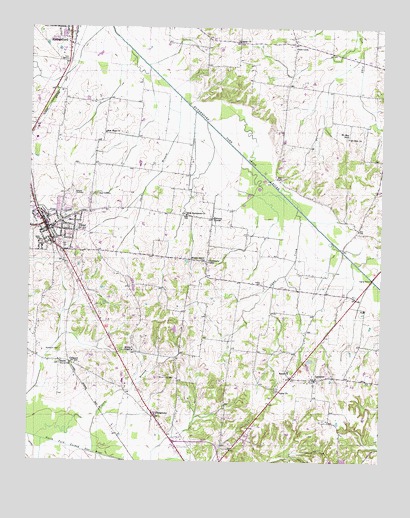
Dyer, TN USGS Topographic Map
Click on map above to begin viewing in our Map Viewer.

This topographic map contains these locations and features:
Feature Name Type Latitude Longitude GNIS ID View Map
Barrons CornerPopulated PlaceN36.0701°W88.9353°1276388View Map
Beech Grove CemeteryCemeteryN36.0281°W88.9887°1322045View Map
Beech Grove ChurchChurchN36.0284°W88.9887°1305062View Map
Beech Grove School (historical)SchoolN36.0284°W88.9881°1322047View Map
Bobbitt CemeteryCemeteryN36.0776°W88.9851°1305331View Map
Bucksnort CemeteryCemeteryN36.0320°W88.9889°1305500View Map
Camp CreekStreamN36.0728°W88.9051°1279382View Map
Cedar Grove School (historical)SchoolN36.1084°W88.9026°1322070View Map
Central View School (historical)SchoolN36.1153°W88.8790°1322072View Map
City of DyerCivilN36.0711°W88.9924°2403524View Map
Commissioner District 18CivilN36.1085°W88.9058°2464408View Map
Commissioner District 19CivilN36.0613°W88.9935°2464415View Map
District 11 (historical)CivilN36.0334°W88.8917°1310239View Map
District 23 (historical)CivilN36.1209°W88.8876°1310207View Map
District 7 (historical)CivilN36.0015°W88.9334°1310240View Map
DyerPopulated PlaceN36.0667°W88.9940°1283253View Map
Dyer CemeteryCemeteryN36.0620°W88.9876°1283258View Map
Dyer Church of ChristChurchN36.0634°W88.9931°1322089View Map
Dyer City HallBuildingN36.0662°W88.9934°1322090View Map
Dyer Cumberland Presbyterian ChurchChurchN36.0684°W88.9912°1648125View Map
Dyer Division (historical)CensusN36.0670°W88.9937°1648698View Map
Dyer Elementary SchoolSchoolN36.0687°W88.9884°1322091View Map
Dyer High SchoolSchoolN36.0698°W88.9884°1322092View Map
Dyer Police DepartmentBuildingN36.0586°W88.9863°2765727View Map
Dyer Post OfficePost OfficeN36.0673°W88.9945°1651848View Map
Dyer Rosenwald SchoolSchoolN36.0706°W88.9937°1322094View Map
Dyer Volunteer Fire DepartmentBuildingN36.0702°W88.9958°2653737View Map
Fairview Baptist ChurchChurchN36.0712°W88.9934°1648099View Map
First Baptist Church of DyerChurchN36.0662°W88.9959°1322100View Map
First Cumberland Presbyterian ChurchChurchN36.0717°W88.9976°1648100View Map
First Methodist Church of DyerChurchN36.0681°W88.9945°1648126View Map
First Presbyterian Church of DyerChurchN36.0681°W88.9917°1648127View Map
GeorgetownPopulated PlaceN36.0128°W88.9551°1285310View Map
Gibson County Fire Department Station 7 Tyson StoreBuildingN36.1239°W88.9071°2654102View Map
Gibson County High SchoolSchoolN36.0237°W88.9665°1322107View Map
Gibson County Sheriff's DepartmentBuildingN36.0641°W88.9925°2765832View Map
Good LuckPopulated PlaceN36.1203°W88.9070°1285627View Map
Griers ChapelChurchN36.0317°W88.9631°1286259View Map
Griers Chapel CemeteryCemeteryN36.0317°W88.9617°1322115View Map
GrizzardPopulated PlaceN36.0284°W88.9856°1315165View Map
Keas CemeteryCemeteryN36.0770°W88.9759°1289920View Map
Keeley CemeteryCemeteryN36.0512°W88.9176°1289950View Map
LaneviewPopulated PlaceN36.0237°W88.8987°1290614View Map
Laneview Baptist ChurchChurchN36.0231°W88.8992°1322139View Map
Laneview School (historical)SchoolN36.0237°W88.8984°1322141View Map
Mount Sinai CemeteryCemeteryN36.0240°W88.9537°1294791View Map
Mount Sinai Church (historical)ChurchN36.0245°W88.9531°1322170View Map
Mount Zion CemeteryCemeteryN36.0937°W88.8878°1322171View Map
Mount Zion ChurchChurchN36.0934°W88.8873°1294902View Map
Mount Zion SchoolSchoolN36.0942°W88.8873°1294926View Map
New Bethlehem CemeteryCemeteryN36.0714°W88.9448°1322178View Map
New Bethlehem ChurchChurchN36.0709°W88.9445°1295444View Map
New Hope Baptist ChurchChurchN36.0948°W88.9734°1295550View Map
Owen BranchStreamN36.1051°W88.9470°1296559View Map
Pleasant Grove Cumberland Presbyterian Church (historical)ChurchN36.0776°W88.9859°1322197View Map
Poplar GrovePopulated PlaceN36.0578°W88.9370°1647628View Map
Poplar Grove CemeteryCemeteryN36.0576°W88.9389°1322200View Map
Poplar Grove ChurchChurchN36.0581°W88.9381°1298198View Map
Poplar Grove School (historical)SchoolN36.0576°W88.9367°1322201View Map
Rogers BranchStreamN36.0026°W88.9770°1299979View Map
Salem CemeteryCemeteryN36.0267°W88.9076°1322212View Map
Salem CemeteryCemeteryN36.1217°W88.9267°1322213View Map
Salem ChurchChurchN36.0262°W88.9076°1300560View Map
Salem ChurchChurchN36.1212°W88.9265°1300562View Map
Union CemeteryCemeteryN36.0203°W88.9123°1322230View Map
Union ChurchChurchN36.0203°W88.9115°1304229View Map

Note: Coordinates in the location and feature list above are referenced to NAD83 datum.


Copyright (C) 2008-2025 Ryan Niemi / Sunset Dynamics ... All Rights Reserved