TopoQuest Logo
Do you find TopoQuest useful?
Help keep TopoQuest running and adding new maps/features by donating!
Bitcoin:  19c7KJd3qBynnjoSw5npx9KScwjBe4ifkT
Litecoin:  LXs6TkuXGGXo1vDsWCkWVdjQX94eUKd6ui
Home View Maps Find Maps Find Places Resources & Links


Brazil, Tennessee Topographic Map

USGS Map Title: Brazil, TN
USGS Map MRC: 35089H1
DRG (GeoTIFF) Download: o35089h1.tif


Neighboring USGS Topographic Map Quads:


  Tatumville, TN  
36089A2
 

  Yorkville, TN  
36089A1
 

  Dyer, TN  
36088A8
 

  Friendship, TN  
35089H2
 

  Brazil, TN  
35089H1
 

  Trenton, TN  
35088H8
 

  Maury City, TN  
35089G2
 

  Alamo, TN  
35089G1
 

  Humboldt, TN  
35088G8


Map MRC Location:

N36°
W90°
N36°
W89°
H8 H7 H6 H5 H4 H3 H2 H1
G8 G7 G6 G5 G4 G3 G2 G1
F8 F7 F6 F5 F4 F3 F2 F1
E8 E7 E6 E5 E4 E3 E2 E1
D8 D7 D6 D5 D4 D3 D2 D1
C8 C7 C6 C5 C4 C3 C2 C1
B8 B7 B6 B5 B4 B3 B2 B1
A8 A7 A6 A5 A4 A3 A2 A1
N35°
W90°
N35°
W89°

Brazil, TN USGS 1:24K Topographic Map Preview:
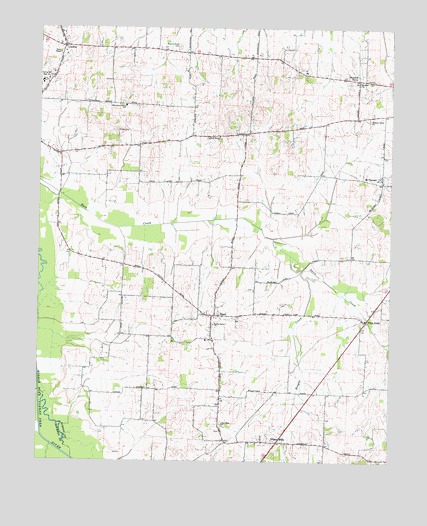
Brazil, TN USGS Topographic Map
Click on map above to begin viewing in our Map Viewer.

This topographic map contains these locations and features:
Feature Name Type Latitude Longitude GNIS ID View Map
Bethany ChurchChurchN35.9848°W89.0117°1305114View Map
Bowers Chapel (historical)ChurchN35.8937°W89.0603°1322058View Map
Bowers Chapel CemeteryCemeteryN35.8926°W89.0606°1322059View Map
BrazilPopulated PlaceN35.9176°W89.0626°1305403View Map
Brazil High School (historical)SchoolN35.9101°W89.0653°1322065View Map
Brazil Methodist ChurchChurchN35.9167°W89.0626°1322066View Map
Brazil-Gibson Wells Division (historical)CensusN35.9326°W89.0709°1648696View Map
CentralLocaleN35.9948°W89.1165°1280158View Map
Commissioner District 8CivilN35.9109°W89.0368°2464672View Map
Davis CreekStreamN35.9331°W89.0328°1282177View Map
District 16 (historical)CivilN35.9834°W89.0195°1310237View Map
District 25 (historical)CivilN35.9084°W89.0126°1310209View Map
District 5 (historical)CivilN35.9167°W89.0848°1310195View Map
District 6 (historical)CivilN35.9931°W89.1181°1310196View Map
Doris ChapelChurchN35.9928°W89.1181°1306385View Map
Frog JumpPopulated PlaceN35.9156°W89.0084°1284964View Map
Gibson County Fire Department Station 1 SpringhillBuildingN35.9941°W89.1165°2654254View Map
Gibson County Fire Department Station 3 BrazilBuildingN35.9155°W89.0630°2654253View Map
Gibson WellsPopulated PlaceN35.8806°W89.0395°1315112View Map
Gibson Wells Methodist ChurchChurchN35.8806°W89.0470°1322112View Map
Hickory GrovePopulated PlaceN35.9853°W89.0128°1315229View Map
Hickory Grove ChurchChurchN35.9734°W89.0078°1287591View Map
Hickory Grove School (historical)SchoolN35.9734°W89.0087°1322121View Map
Milligan School (historical)SchoolN35.9690°W89.0523°1322157View Map
Mount OrangePopulated PlaceN35.9567°W89.0034°1315554View Map
Mount Orange School (historical)SchoolN35.9556°W89.0028°1322165View Map
New Hope ChurchChurchN35.8856°W89.0592°1295540View Map
Olive Branch CemeteryCemeteryN35.9678°W89.0609°1322189View Map
Olive Branch ChurchChurchN35.9690°W89.0617°1296407View Map
Persimmon Grove Church (historical)ChurchN35.9848°W89.1001°1322194View Map
Persimmon Grove SchoolSchoolN35.9778°W89.0951°1297229View Map
Poplar Grove ChurchChurchN35.9145°W89.0628°1298196View Map
Reagan CreekStreamN35.9331°W89.0328°1299019View Map
Sale School (historical)SchoolN35.9720°W89.0256°1322211View Map
Spring HillPopulated PlaceN35.9840°W89.1223°1312587View Map
Spring Hill Baptist ChurchChurchN35.9851°W89.1223°1322222View Map
Spring Hill CemeteryCemeteryN35.9870°W89.1209°1322223View Map
Spring Hill Elementary SchoolSchoolN35.9837°W89.1242°1322224View Map
Spring Hill High SchoolSchoolN35.9851°W89.1240°1271112View Map
W H Bowers LakeReservoirN35.9078°W89.0808°1302204View Map
W H Bowers Lake DamDamN35.9067°W89.0801°1302205View Map
Walnut Grove CemeteryCemeteryN35.9948°W89.0765°1273719View Map
Walnut Grove School (historical)SchoolN35.9928°W89.0756°1322238View Map
Wards Grove ChurchChurchN35.9098°W89.0770°1322240View Map
Wards Grove School (historical)SchoolN35.9095°W89.0770°1322241View Map
Wellsview School (historical)SchoolN35.8942°W89.0284°1322243View Map
Wilson CemeteryCemeteryN35.9706°W89.0981°1648554View Map

Note: Coordinates in the location and feature list above are referenced to NAD83 datum.


Copyright (C) 2008-2024 Ryan Niemi / Sunset Dynamics ... All Rights Reserved