TopoQuest Logo
Do you find TopoQuest useful?
Help keep TopoQuest running and adding new maps/features by donating!
Bitcoin:  19c7KJd3qBynnjoSw5npx9KScwjBe4ifkT
Litecoin:  LXs6TkuXGGXo1vDsWCkWVdjQX94eUKd6ui
Home View Maps Find Maps Find Places Resources & Links


Rutherford, Tennessee Topographic Map

USGS Map Title: Rutherford, TN
USGS Map MRC: 36088B8
DRG (GeoTIFF) Download: o36088b8.tif


Neighboring USGS Topographic Map Quads:


  Rives, TN  
36089C1
 

  Gardner, TN  
36088C8
 

  Martin, TN  
36088C7
 

  Kenton, TN  
36089B1
 

  Rutherford, TN  
36088B8
 

  Greenfield, TN  
36088B7
 

  Yorkville, TN  
36089A1
 

  Dyer, TN  
36088A8
 

  Bradford, TN  
36088A7


Map MRC Location:

N37°
W89°
N37°
W88°
H8 H7 H6 H5 H4 H3 H2 H1
G8 G7 G6 G5 G4 G3 G2 G1
F8 F7 F6 F5 F4 F3 F2 F1
E8 E7 E6 E5 E4 E3 E2 E1
D8 D7 D6 D5 D4 D3 D2 D1
C8 C7 C6 C5 C4 C3 C2 C1
B8 B7 B6 B5 B4 B3 B2 B1
A8 A7 A6 A5 A4 A3 A2 A1
N36°
W89°
N36°
W88°

Rutherford, TN USGS 1:24K Topographic Map Preview:
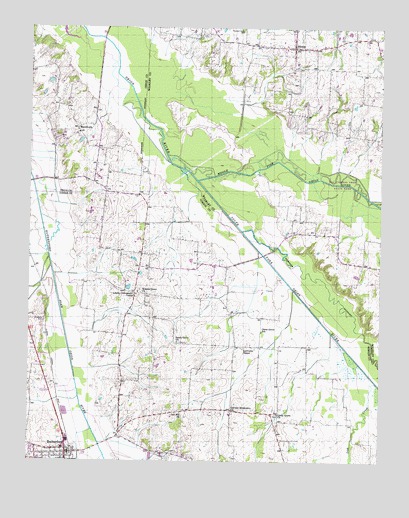
Rutherford, TN USGS Topographic Map
Click on map above to begin viewing in our Map Viewer.

This topographic map contains these locations and features:
Feature Name Type Latitude Longitude GNIS ID View Map
Baier FarmsLocaleN36.1594°W88.9219°2674577View Map
Beech Grove CemeteryCemeteryN36.1592°W88.9464°1322046View Map
Beech Grove ChurchChurchN36.1592°W88.9467°1276837View Map
Beech Grove School (historical)SchoolN36.1592°W88.9476°1322048View Map
Big Cypress Tree State ParkParkN36.2001°W88.8890°1322264View Map
Calvary Missionary ChurchChurchN36.1395°W88.9278°1305614View Map
China GrovePopulated PlaceN36.1390°W88.9140°1647625View Map
China Grove CemeteryCemeteryN36.1384°W88.9114°1322075View Map
China Grove ChurchChurchN36.1387°W88.9112°1305903View Map
China Grove Division (historical)CensusN36.1353°W88.9242°1648697View Map
China Grove SchoolSchoolN36.1626°W88.9170°1280485View Map
China Grove School (historical)SchoolN36.1387°W88.9123°1322076View Map
Connell CemeteryCemeteryN36.2320°W88.8764°1322287View Map
Cummings CreekStreamN36.1434°W88.9817°1281853View Map
District 19 (historical)CivilN36.1584°W88.9176°1310204View Map
Edmundson CreekStreamN36.1815°W88.9923°1283537View Map
Gibson County Fire Department Station 9 Rutherford RescueBuildingN36.1419°W88.9915°2654101View Map
Keathy CemeteryCemeteryN36.1653°W88.9948°1289921View Map
Lawrence ChapelChurchN36.1581°W88.9231°1290782View Map
Lick CreekStreamN36.1478°W88.8762°1291218View Map
Lonoke Community CenterLocaleN36.1731°W88.9617°1292028View Map
Lonoke School (historical)SchoolN36.1731°W88.9620°1322145View Map
MacedoniaPopulated PlaceN36.2212°W88.9831°1315453View Map
Macedonia Baptist ChurchChurchN36.2203°W88.9834°1320473View Map
Macedonia CemeteryCemeteryN36.2187°W88.9895°1326720View Map
Middle Fork Obion RiverStreamN36.2059°W88.9403°1269799View Map
Oak Hill ChurchChurchN36.1392°W88.9456°1296146View Map
Pleasant Grove CemeteryCemeteryN36.2487°W88.9239°1297804View Map
RutherfordPopulated PlaceN36.1276°W88.9859°1300352View Map
Rutherford CemeteryCemeteryN36.1259°W88.9989°1322203View Map
Rutherford City HallBuildingN36.1276°W88.9853°1322204View Map
Rutherford Elementary SchoolSchoolN36.1292°W88.9876°1322205View Map
Rutherford Fire DepartmentBuildingN36.1277°W88.9881°2654284View Map
Rutherford First Baptist ChurchChurchN36.1270°W88.9878°1322206View Map
Rutherford Post OfficePost OfficeN36.1273°W88.9857°1651871View Map
SidoniaPopulated PlaceN36.2440°W88.9059°1270248View Map
Sidonia Baptist ChurchChurchN36.2442°W88.9092°1322447View Map
Sidonia School (historical)SchoolN36.2442°W88.9090°1322448View Map
Sidonia Volunteer Fire DepartmentBuildingN36.2435°W88.9063°2653730View Map
South Fork Obion RiverStreamN36.2059°W88.9403°1270879View Map
Store BranchStreamN36.1745°W88.9059°1647629View Map
Town of RutherfordCivilN36.1257°W88.9925°2407260View Map
Walnut GrovePopulated PlaceN36.1734°W88.9623°1647630View Map
Walnut Grove CemeteryCemeteryN36.1742°W88.9606°1322236View Map
Walnut Grove ChurchChurchN36.1740°W88.9609°1304356View Map

Note: Coordinates in the location and feature list above are referenced to NAD83 datum.


Copyright (C) 2008-2025 Ryan Niemi / Sunset Dynamics ... All Rights Reserved