TopoQuest Logo
Do you find TopoQuest useful?
Help keep TopoQuest running and adding new maps/features by donating!
Bitcoin:  19c7KJd3qBynnjoSw5npx9KScwjBe4ifkT
Litecoin:  LXs6TkuXGGXo1vDsWCkWVdjQX94eUKd6ui
Home View Maps Find Maps Find Places Resources & Links


Yorkville, Tennessee Topographic Map

USGS Map Title: Yorkville, TN
USGS Map MRC: 36089A1
DRG (GeoTIFF) Download: o36089a1.tif


Neighboring USGS Topographic Map Quads:


  Trimble, TN  
36089B2
 

  Kenton, TN  
36089B1
 

  Rutherford, TN  
36088B8
 

  Tatumville, TN  
36089A2
 

  Yorkville, TN  
36089A1
 

  Dyer, TN  
36088A8
 

  Friendship, TN  
35089H2
 

  Brazil, TN  
35089H1
 

  Trenton, TN  
35088H8


Map MRC Location:

N37°
W90°
N37°
W89°
H8 H7 H6 H5 H4 H3 H2 H1
G8 G7 G6 G5 G4 G3 G2 G1
F8 F7 F6 F5 F4 F3 F2 F1
E8 E7 E6 E5 E4 E3 E2 E1
D8 D7 D6 D5 D4 D3 D2 D1
C8 C7 C6 C5 C4 C3 C2 C1
B8 B7 B6 B5 B4 B3 B2 B1
A8 A7 A6 A5 A4 A3 A2 A1
N36°
W90°
N36°
W89°

Yorkville, TN USGS 1:24K Topographic Map Preview:
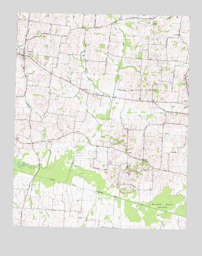
Yorkville, TN USGS Topographic Map
Click on map above to begin viewing in our Map Viewer.

This topographic map contains these locations and features:
Feature Name Type Latitude Longitude GNIS ID View Map
Bells ChapelChurchN36.1165°W89.0676°1305095View Map
Bells Chapel CemeteryCemeteryN36.1165°W89.0687°1322050View Map
Bells Chapel School (historical)SchoolN36.1167°W89.0695°1322051View Map
Bethel Baptist ChurchChurchN36.0867°W89.1176°1322052View Map
Bethel CemeteryCemeteryN36.0870°W89.1173°1277113View Map
Buzzard Roost BottomBasinN36.0151°W89.0167°1279228View Map
City of YorkvilleCivilN36.0968°W89.1185°2405071View Map
Clear Creek CemeteryCemeteryN36.0401°W89.0301°1322077View Map
Clear Creek ChurchChurchN36.0403°W89.0303°1305956View Map
Commissioner District 16CivilN36.1089°W89.0939°2464394View Map
Cow CreekStreamN36.0634°W89.0581°1306149View Map
Cowan CemeteryCemeteryN36.0976°W89.0748°1281455View Map
CurriePopulated PlaceN36.0431°W89.0428°1306242View Map
District 21 (historical)CivilN36.0584°W89.0042°1310205View Map
District 8 (historical)CivilN36.0792°W89.1001°1310197View Map
Dry CreekStreamN36.0728°W89.0551°1282919View Map
Duck Hill Church (historical)ChurchN36.0340°W89.0417°1322088View Map
Dyer Industrial ParkLocaleN36.0853°W89.0017°1322093View Map
Flowers CemeteryCemeteryN36.1195°W89.0262°1284513View Map
Flowers Chapel (historical)ChurchN36.1206°W89.0265°1322104View Map
Good Hope CemeteryCemeteryN36.0478°W89.0440°1322114View Map
Good Hope ChurchChurchN36.0481°W89.0442°1285622View Map
Hogue CemeteryCemeteryN36.0495°W89.0981°1288020View Map
Holly Spring CemeteryCemeteryN36.0331°W89.0415°1288111View Map
Hooten (historical)Populated PlaceN36.0487°W89.1120°1312580View Map
HopewellPopulated PlaceN36.0812°W89.0784°1288286View Map
Hopewell Methodist Episcopal Church SouthChurchN36.0784°W89.0795°1322126View Map
Hopewell School (historical)SchoolN36.0790°W89.0792°1322127View Map
Midway ChurchChurchN36.0559°W89.0801°1293739View Map
Mount Carmel Cumberland Presbyterian Church (historical)ChurchN36.0478°W89.0440°1322162View Map
Mount Olive CemeteryCemeteryN36.0809°W89.0278°1322163View Map
Mount Olive ChurchChurchN36.0809°W89.0262°1294708View Map
Mud CreekStreamN36.0262°W89.0890°1295005View Map
NewellPopulated PlaceN36.1173°W89.0687°1312584View Map
Old Bethlehem ChurchChurchN36.1134°W89.0070°1296277View Map
Riverside (historical)Populated PlaceN36.0390°W89.1065°1312586View Map
Sand CreekStreamN36.0659°W89.0317°1300660View Map
Union Academy (historical)SchoolN36.0437°W89.0445°1322229View Map
YorkvillePopulated PlaceN36.0995°W89.1190°1304709View Map
Yorkville CemeteryCemeteryN36.0981°W89.1209°1322250View Map
Yorkville CemeteryCemeteryN36.1009°W89.1231°1322251View Map
Yorkville Church of ChristChurchN36.0990°W89.1192°1320966View Map
Yorkville Cumberland Presbyterian ChurchChurchN36.1003°W89.1228°1322253View Map
Yorkville Division (historical)CensusN36.1120°W89.1151°1648706View Map
Yorkville Elementary SchoolSchoolN36.0923°W89.1198°1322252View Map
Yorkville Fire DepartmentBuildingN36.0985°W89.1189°2654175View Map
Yorkville High School (historical)SchoolN36.0926°W89.1198°1322254View Map
Yorkville Post OfficePost OfficeN36.1000°W89.1210°1651876View Map

Note: Coordinates in the location and feature list above are referenced to NAD83 datum.


Copyright (C) 2008-2024 Ryan Niemi / Sunset Dynamics ... All Rights Reserved