TopoQuest Logo
Do you find TopoQuest useful?
Help keep TopoQuest running and adding new maps/features by donating!
Bitcoin:  19c7KJd3qBynnjoSw5npx9KScwjBe4ifkT
Litecoin:  LXs6TkuXGGXo1vDsWCkWVdjQX94eUKd6ui
Home View Maps Find Maps Find Places Resources & Links


Kenton, Tennessee Topographic Map

USGS Map Title: Kenton, TN
USGS Map MRC: 36089B1
DRG (GeoTIFF) Download: o36089b1.tif


Neighboring USGS Topographic Map Quads:


  Obion, TN  
36089C2
 

  Rives, TN  
36089C1
 

  Gardner, TN  
36088C8
 

  Trimble, TN  
36089B2
 

  Kenton, TN  
36089B1
 

  Rutherford, TN  
36088B8
 

  Tatumville, TN  
36089A2
 

  Yorkville, TN  
36089A1
 

  Dyer, TN  
36088A8


Map MRC Location:

N37°
W90°
N37°
W89°
H8 H7 H6 H5 H4 H3 H2 H1
G8 G7 G6 G5 G4 G3 G2 G1
F8 F7 F6 F5 F4 F3 F2 F1
E8 E7 E6 E5 E4 E3 E2 E1
D8 D7 D6 D5 D4 D3 D2 D1
C8 C7 C6 C5 C4 C3 C2 C1
B8 B7 B6 B5 B4 B3 B2 B1
A8 A7 A6 A5 A4 A3 A2 A1
N36°
W90°
N36°
W89°

Kenton, TN USGS 1:24K Topographic Map Preview:
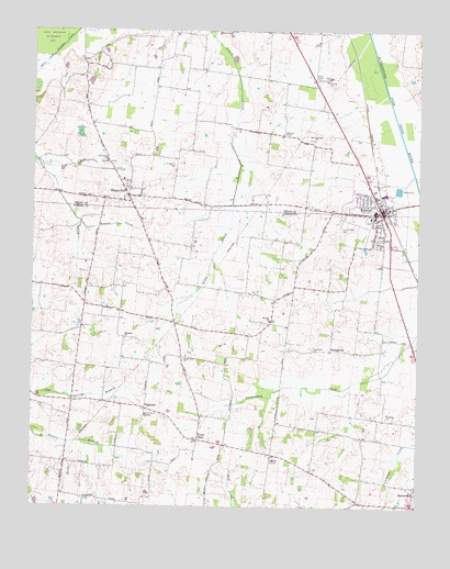
Kenton, TN USGS Topographic Map
Click on map above to begin viewing in our Map Viewer.

This topographic map contains these locations and features:
Feature Name Type Latitude Longitude GNIS ID View Map
Bamboo CreekStreamN36.1995°W89.1090°1276255View Map
Bear CreekStreamN36.2148°W89.1220°1276583View Map
Bethpage CemeteryCemeteryN36.1684°W89.0951°1322054View Map
Bethpage ChurchChurchN36.1692°W89.0945°1305182View Map
Boyett School (historical)SchoolN36.1315°W89.0270°1322060View Map
Christian ChapelPopulated PlaceN36.2228°W89.0442°1326714View Map
Christian ChapelChurchN36.2234°W89.0440°1280522View Map
District 10 (historical)CivilN36.1834°W89.0334°1310199View Map
District 24 (historical)CivilN36.1501°W89.1167°1310208View Map
District 9 (historical)CivilN36.1417°W89.0167°1310198View Map
FairviewPopulated PlaceN36.1731°W89.0790°1645134View Map
Fairview School (historical)SchoolN36.1709°W89.1090°1322099View Map
First Baptist Church of KentonChurchN36.2020°W89.0126°1322101View Map
Gibson County Fire Department Station 5 China GroveBuildingN36.1425°W89.0731°2654252View Map
Hollomon CemeteryCemeteryN36.2145°W89.0787°1288078View Map
KentonPopulated PlaceN36.2023°W89.0123°1290092View Map
Kenton City HallBuildingN36.2037°W89.0131°1320466View Map
Kenton City ParkParkN36.2006°W89.0162°1322135View Map
Kenton Elementary SchoolSchoolN36.2023°W89.0145°1320467View Map
Kenton Fire DepartmentBuildingN36.2032°W89.0129°2653864View Map
Kenton High SchoolSchoolN36.2028°W89.0145°1320468View Map
Kenton Police DepartmentBuildingN36.2032°W89.0129°2766028View Map
Kenton Post OfficePost OfficeN36.2046°W89.0118°1651475View Map
Kenton-Mason Hall Division (historical)CensusN36.2176°W89.0415°1648897View Map
Laneview ChurchChurchN36.1667°W89.0340°1290615View Map
Mason HallPopulated PlaceN36.2067°W89.0937°1292888View Map
Mason Hall School (historical)SchoolN36.2087°W89.0937°1320474View Map
Morella ChurchChurchN36.1740°W89.0478°1294342View Map
Morella School (historical)SchoolN36.1734°W89.0484°1322160View Map
New Concord ChurchChurchN36.2217°W89.0340°1295465View Map
New Salem ChurchChurchN36.2156°W89.1012°1295639View Map
North Union CemeteryCemeteryN36.1653°W89.0737°1322182View Map
North Union ChurchChurchN36.1648°W89.0753°1295948View Map
Northern ChurchChurchN36.1487°W89.0095°1295959View Map
Possum PondLakeN36.1731°W89.1096°1312585View Map
Rutherford Division (historical)CensusN36.1512°W89.0042°1648703View Map
Salem CemeteryCemeteryN36.2153°W89.1026°1326727View Map
StringtownPopulated PlaceN36.1667°W89.0284°1314350View Map
Sunny Side CemeteryCemeteryN36.1984°W89.0253°1303939View Map
TilghmanPopulated PlaceN36.1509°W89.0876°1314406View Map
Tilghmans School (historical)SchoolN36.1490°W89.0881°1322228View Map
Town of KentonCivilN36.2022°W89.0155°2405938View Map
Tyson StorePopulated PlaceN36.1428°W89.0703°1304214View Map
Tysonville (historical)Populated PlaceN36.1556°W89.0728°1312588View Map
Union Grove CemeteryCemeteryN36.2498°W89.0617°1326735View Map
Union Grove ChurchChurchN36.2498°W89.0609°1326773View Map

Note: Coordinates in the location and feature list above are referenced to NAD83 datum.


Copyright (C) 2008-2024 Ryan Niemi / Sunset Dynamics ... All Rights Reserved