TopoQuest Logo
Do you find TopoQuest useful?
Help keep TopoQuest running and adding new maps/features by donating!
Bitcoin:  19c7KJd3qBynnjoSw5npx9KScwjBe4ifkT
Litecoin:  LXs6TkuXGGXo1vDsWCkWVdjQX94eUKd6ui
Home View Maps Find Maps Find Places Resources & Links


S P Mountain, Arizona Topographic Map

USGS Map Title: S P Mountain, AZ
USGS Map MRC: 35111E6
DRG (GeoTIFF) Download: o35111e6.tif


Neighboring USGS Topographic Map Quads:


  Lockwood Canyon, AZ  
35111F7
 

  Additional Hill, AZ  
35111F6
 

  Campbell Francis Wash, AZ  
35111F5
 

  Chapel Mountain, AZ  
35111E7
 

  S P Mountain, AZ  
35111E6
 

  East of S P Mountain, AZ  
35111E5
 

  Kendrick Peak, AZ  
35111D7
 

  White Horse Hills, AZ  
35111D6
 

  O'Leary Peak, AZ  
35111D5


Map MRC Location:

N36°
W112°
N36°
W111°
H8 H7 H6 H5 H4 H3 H2 H1
G8 G7 G6 G5 G4 G3 G2 G1
F8 F7 F6 F5 F4 F3 F2 F1
E8 E7 E6 E5 E4 E3 E2 E1
D8 D7 D6 D5 D4 D3 D2 D1
C8 C7 C6 C5 C4 C3 C2 C1
B8 B7 B6 B5 B4 B3 B2 B1
A8 A7 A6 A5 A4 A3 A2 A1
N35°
W112°
N35°
W111°

S P Mountain, AZ USGS 1:24K Topographic Map Preview:
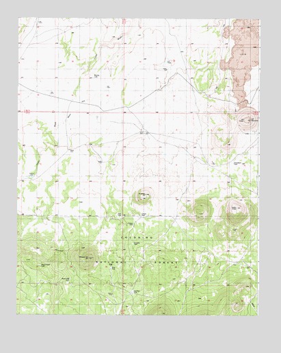
S P Mountain, AZ USGS Topographic Map
Click on map above to begin viewing in our Map Viewer.

This topographic map contains these locations and features:
Feature Name Type Latitude Longitude GNIS ID View Map
Antelope HillSummitN35.5506°W111.6829°25669View Map
Aso Ranch (historical)LocaleN35.5664°W111.6602°25818View Map
Aso TankReservoirN35.5650°W111.6598°41178View Map
Beasley DitchCanalN35.5867°W111.7218°26141View Map
Beasley LakeLakeN35.5999°W111.7114°26143View Map
Ceneca TankReservoirN35.5382°W111.6901°40562View Map
Cinesa TankReservoirN35.5417°W111.6863°37711View Map
Colton CraterCraterN35.5450°W111.6368°27829View Map
Deer TankReservoirN35.5422°W111.6957°28402View Map
Gonzales TankReservoirN35.5300°W111.6899°29411View Map
Heckethorn TankReservoirN35.5641°W111.6386°29846View Map
Klostermeyer LakeLakeN35.5207°W111.7380°30797View Map
Missouri Bill HillSummitN35.5236°W111.7124°31933View Map
Missouri Bill TankReservoirN35.5149°W111.7222°31934View Map
Mud Hen TankReservoirN35.5098°W111.6900°32091View Map
Rock TankReservoirN35.5197°W111.7011°33744View Map
S P CraterCraterN35.5822°W111.6318°33907View Map
S P MountainSummitN35.5822°W111.6293°33909View Map
S P TankReservoirN35.6065°W111.6732°33911View Map
Victory LakeLakeN35.5575°W111.7429°35782View Map

Note: Coordinates in the location and feature list above are referenced to NAD83 datum.


Copyright (C) 2008-2025 Ryan Niemi / Sunset Dynamics ... All Rights Reserved